Finding Dark Ships Via Satellite

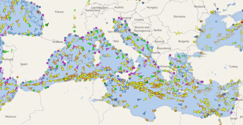
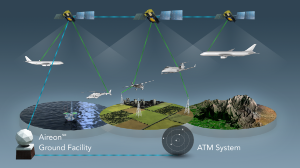
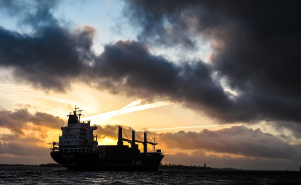
It would seem that for as long as there have been ships on the ocean, there’s been smuggling. The International Maritime Organisation requires ships to have AIS, the automatic identification system which is akin to a transponder on an airplane. However, if you don’t want to be found, you often turn off your AIS. So how do governments and insurance companies track so-called dark ships? Using satellite technology. A recent post in Global Investigative Journal tells the story of how lower-cost satellites are helping track these dark ships.

Optical tracking is the obvious method, but satellites that can image ships can be expensive and have problems with things like clouds. Radar is another option, but — again — an expensive option if you aren’t a big military agency with money to spend. A company called HawkEye 360 uses smallsats to monitor ship’s RF emissions, which is much less expensive and resource-intensive than traditional methods. Although the data may still require correlation with other methods like optical sensing, it is still cost-effective compared to simply scanning the ocean for ships.

Continue reading “Finding Dark Ships Via Satellite”

Tracking Boats And Ships In Real Time At The Same Time

Software-defined radio came on the hacker scene in a big way less than a decade ago thanks to the discovery that a small USB-based TV tuner dongle could be used for receiving all kinds of radio transmissions. Two popular projects from that era are tracking nearby airplanes and boats in real time. Of course, these projects rely on different frequencies and protocols, but if you live in a major port city like [Ian] then his project that combines both into a single user interface might be of interest.

This project uses an RTL-SDR dongle for the marine traffic portion of the project, but steps up to a FlightAware Pro dongle for receiving telemetry from airplanes. Two separate antennas are needed for this, and all of the information is gathered and handled by a pair of Raspberry Pis. The Pis communicate with various marine and air traffic databases as well as handles the custom user interface that knits both sets of information together. This interface was custom-built from a previous project of his and was repurposed slightly to fit the needs of this one.

This is a great project that goes into a lot of interesting detail about how the web traffic moves and how the UI works, so even if you’re not into software-defined radio it might be worth a look. However, it’s also worth noting that it hasn’t been easier to set up a system like this thanks to the abundance and low price of RTL-SDR dongles and the software tools that make setting them up a breeze.

Just How Can You Lose Something The Size Of A Cargo Ship?

I’m writing from a cozy farmhouse just outside of Oxford, UK where we are slowly emerging from a particularly intense Atlantic storm. Some areas have widespread flooding, while fallen tree branches and damaged roofs are countrywide. Our neighbours in the Irish Republic are first in the path of these storms, and receive an especially strong pasting.

In the news following the storm is a merchant ship that was washed up by this storm on the coast of County Cork. The MV Alta  is a nearly 2300t and 77m (just over 253 ft) freighter that had been abandoned in 2018 south of Bermuda after a mechanical failure had rendered it incapable of navigation. Its crew had been rescued by the US Coast Guard, and since then — apart from a brief sighting in mid-Atlantic by a Royal Navy polar research vessel — it had passed unseen as a drifting ghost ship before appearing on the Irish coast.

In a very literal sense it had dropped off the radar, but the question for us is how? With the huge array of technological advances in both navigation aids and global sensing available at the end of the 21st century’s second decade, should that even be possible? It’s worth taking a while as land-lubbers to look at how ships are tracked, to try to make sense of the seeming invisibility of something that is after all pretty large and difficult to hide.

Continue reading “Just How Can You Lose Something The Size Of A Cargo Ship?”

Traffic Updates On The Seven Seas: Open Source Chart Plotter Using A Raspberry Pi

As the Raspberry Pi in its various forms continues to flow into the wild by the thousands, it’s interesting to see its user base expand outside beyond the hacker communities. One group of people who’ve also started taking a liking to it is sailing enthusiasts. [James Conger] is one such sailor, and he built his own AIS enabled chart plotter for a fraction of the price of comparable commercial units.

AIS transponders in the Mediterranean. VesselFinder

Automatic Identification System (AIS) is a GPS tracking system that uses transponders to transmit a ship’s position data to other ships or receiver stations in an area. This is used for collision avoidance and by authorities (and hobbyists) to keep an eye on shipping traffic, and allow for stricken vessels to be found easily. [James]’ DIY chart plotter overlays the received AIS data over marine charts on a nice big display. A Raspberry Pi 3B+, AIS Receiver Hat, USB GPS dongle and a makes up the core of the system. The entire setup cost about $350. The Pi runs OpenCPN, an open source chart plotter and navigation software package that [John] says is rivals most commercial software. As most Pi users will know the SD card is often a weak link, so it’s probably worth having a backup SD card with all the software already installed just in case it fails during a voyage.

We’ve seen AIS receiver stations built using the RTL-SDR, as well as a number of projects around the AIS equivalent in aviation, ADS-B. Check out [John]’s video after the break. Continue reading “Traffic Updates On The Seven Seas: Open Source Chart Plotter Using A Raspberry Pi”

Aireon Hitchhikes On Iridium To Track Airplanes

SpaceX just concluded 2017 by launching 10 Iridium NEXT satellites. A footnote on the launch was the “hosted payload” on board each of the satellites: a small box of equipment from Aireon. They will track every aircraft around the world in real-time, something that has been technically possible but nobody claimed they could do it economically until now.

Challenge one: avoid adding cost to aircraft. Instead of using expensive satcom or adding dedicated gear, Aireon listen to ADS-B equipment already installed as part of international air traffic control modernization. But since ADS-B was designed for aircraft-to-aircraft and aircraft-to-ground, Aireon had some challenges to overcome. Like the fact ADS-B antenna is commonly mounted on the belly of an aircraft blocking direct path to satellite.

Challenge two: hear ADS-B everywhere and do it for less. Today we can track aircraft when they are flying over land, but out in the middle of the ocean, there are no receivers in range except possibly other aircraft. Aireon needed a lot of low-orbit satellites to ensure you are in range no matter where you are. Piggybacking on Iridium gives them coverage at a fraction of the cost of building their own satellites.

Continue reading “Aireon Hitchhikes On Iridium To Track Airplanes”

Low-cost Drift Buoy Plies The Atlantic For Nearly A Year

Put a message in a bottle and toss it in the ocean, and if you’re very lucky, years later you might get a response. Drop a floating Arduino-fied buoy into the ocean and if you’ve engineered it well, it may send data back to you for even longer.

At least that’s what [Wayne] has learned since his MDBuoyProject went live with the launching of a DIY drift buoy last year. The BOM for the buoy reads like a page from the Adafruit website: Arduino Trinket, an RTC, GPS module, Iridium satellite modem, sensors, and a solar panel. Everything lives in a clear plastic dry box along with a can of desiccant and a LiPo battery.

The solar panel has a view through the case lid, and the buoy is kept upright by a long PVC boom on the bottom of the case. Two versions have been built and launched so far; alas, the Pacific buoy was lost shortly after it was launched. But the Atlantic buoy picked up the Gulf Stream and has been drifting slowly toward Europe since last summer, sending back telemetry. A future version aims to incorporate an Automatic Identification System (AIS) receiver, presumably to report the signals of AIS transponders on nearby ships as they pass.

We like the attention to detail as well as the low cost of this build. It’s a project that’s well within reach of a STEM program, akin to the many high-altitude DIY balloon projects we’ve featured before.

Continue reading “Low-cost Drift Buoy Plies The Atlantic For Nearly A Year”

Tracking Ships Using Software-defined Radio (SDR)

tracking-ships-using-sdr

When we first started hearing about software-defined radio hacks (which often use USB dongles that ring it at under $20) we didn’t fully grasp the scope of that flexibility. But now we’ve seen several real-life examples that drive the concept home. For instance, did you know that SDR can be used to track ships? Ships large and small are required by may countries to use an Automatic Identification System (AIS) transponder. The protocol was originally developed to prevent collisions on large ships, but when the cost of the hardware became affordable the system was also brought to smaller vessels.

[Carl] wrote in to share his project (which is linked above). Just like the police scanner project from April this makes use of RTL-SDR in the form of a TV tuner dongle. He uses the SDRSharp software along with a Yagi-UDA. The captured data is then decoded and plotted on a map using ShipPlotter.