If you ever watch the original Star Trek, Captain Kirk and crew spend a lot of time mapping new parts of the galaxy. In fact, at least one episode centered on them taking images of some new part of space. It might not be new, but if you have a drone, you probably have accumulated a lot of frames of aerial imagery from around your house (or wherever you fly).
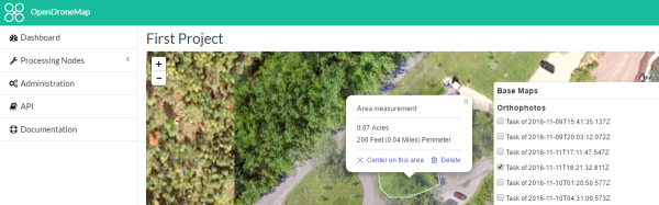
WebODM allows you to create georeferenced maps, point clouds and textured 3D models from your drone footage. The software is really an integration and workflow manager for Open Drone Map, which does most of the heavy lifting.