Satellite Provides Detailed Data On Antarctic Ice

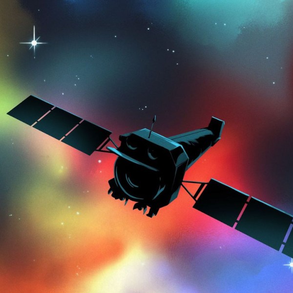
Ever since the first satellites started imaging the Earth, scientists have been using the data gathered to learn more about our planet and improve the lives of its inhabitants. From weather forecasting to improving crop yields, satellites have been put to work in a wide array of tasks. The data they gather can go beyond imaging as well. A new Chinese satellite known as Fengyun-3E is using some novel approaches to monitor Antarctic sea ice in order to help scientists better understand the changing climate at the poles.

While it is equipped with a number of other sensors, one of the more intriguing is a piece of equipment called WindRad which uses radar to measure wind at various locations and altitudes based on how the radar waves bounce off of the atmosphere at various places.  Scientists have also been able to use this sensor to monitor sea ice, and can use the data gathered to distinguish new sea ice from ice which is many years old, allowing them to better understand ice formation and loss at the poles. It’s also the first weather satellite to be placed in an early morning orbit, allowing it to use the long shadows cast by the sun on objects on Earth’s surface to gather more information than a satellite in other orbits might be able to.

With plenty of other imaging sensors on board and a polar orbit, it has other missions beyond monitoring sea ice. But the data that it gathers around Antarctica should give scientists more information to improve climate models and understand the behavior of sea ice at a deeper level. Weather data from satellites like these isn’t always confined to academia, though. Plenty of weather satellites broadcast their maps and data unencrypted on radio bands that anyone can access.

Polynesian Wayfinding Traditions Let Humans Roam The Pacific Ocean

Polynesian cultures have a remarkable navigational tradition. It stands as a testament to human ingenuity and an intimate understanding of nature. Where Western cultures developed maps and tools to plot courses around the world, the Polynesian tradition is more about using human senses and pattern-finding skills to figure out where one is, and where one might be going.

Today, we’ll delve into the unique techniques of Polynesian navigation, exploring how keen observation of the natural world enabled pioneers to roam far and wide across the breadth of the Pacific.

Continue reading “Polynesian Wayfinding Traditions Let Humans Roam The Pacific Ocean”

Keeping Watch Over The Oceans With Data Buoys

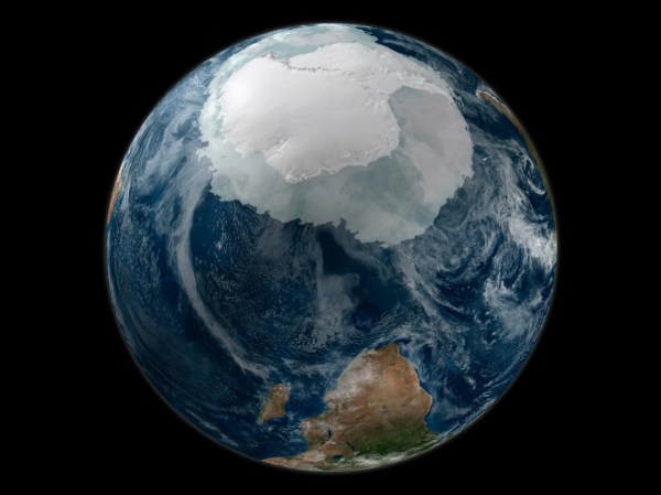
When viewed from just the right position in space, you’d be hard-pressed to think that our home planet is anything but a water world. And in all the ways that count, you’d be right; there’s almost nothing that goes on on dry land that isn’t influenced by the oceans. No matter how far you are away from an ocean, what’s going on there really matters.

But how do we know what’s going on out there? The oceans are trackless voids, after all, and are deeply inhospitable to land mammals such as us. They also have a well-deserved reputation for eating anything that ventures into them at the wrong time and without the proper degree of seafarer’s luck, and they also tend to be places where the resources that run our modern technological society are in short supply.

Gathering data about the oceans is neither cheap nor easy, but it’s critically important to everything from predicting what the weather will be next week to understanding the big picture of what’s going on with the climate. And that requires a fleet of data buoys, outnumbering the largest of the world’s navies and operating around the clock, keeping track of wind, weather, and currents for us.

Continue reading “Keeping Watch Over The Oceans With Data Buoys”

Dumping Spacecraft In The Middle Of Nowhere

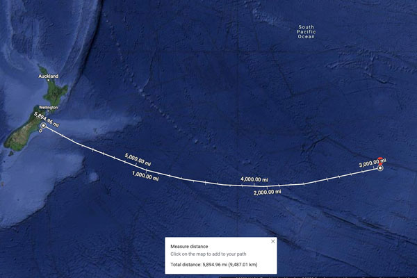
The BBC has an interesting article on Point Nemo, AKA the Oceanic Pole of Inaccessibility, AKA the spacecraft graveyard. This is the place in the ocean that is furthest from land, in the middle of the usually stormy South Pacific. It’s as far out there as you can get without leaving the planet: about 2,688 kilometers (1670 miles) from the nearest dry land. Even the ocean floor is 4 km (2.5 miles) down; the closest human life is the International Space Station (ISS) astronauts flying 415 km (260 miles) above it. It is not near any shipping lanes or transport routes. It is, to put it bluntly, the middle of goddam nowhere. So, it is a perfect place to dump derelict spacecraft.

Since 1971, over 160 spacecraft have met their end in these chilly waters, from the fiery public end of the Mir space station to the secret death of numerous secret spy satellites. The article in question focuses on the Soviet satellites, but plenty of other countries dump their end-of-life satellites there, including trash from the ISS. The Chinese Taingong-1 space station crashed nearby, although that was more by accident than design. The ISS is scheduled to join its trash in a few years: the current plan is that the massive space station will be de-orbited and crashed near Point Nemo in 2030.

Will there be anyone to see it? When the Mir space station was de-orbited, some entrepreneurial companies offered flights to the area to catch a glimpse, but the best view was from the island of Fiji. So, start planning your trip now…

Continue reading “Dumping Spacecraft In The Middle Of Nowhere”

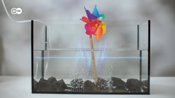
A pinwheel sits in an aquarium to simulate an offshore wind turbine. Bubbles come up from the "seabed" to encircle it to demonstrate a bubble curtain with an image of a sound waveform overlaid with the video to show the sound confined to the area within the bubble curtain.

Keeping The Noise Down Under The Sea

Since sound is the primary sense used by most ocean life, disruptions to the natural noise levels in the ocean from human activities can be particularly problematic for marine life. [DW Planet A] has a video describing some of the ways we can mitigate these disruptions to our friends under the sea.

Being noisy neighbors isn’t just a problem for whales but for everything down to the plankton at the base of the food web. Underwater construction like offshore wind installations get flak for being noisy, but technologies like bubble curtains can reduce noise output by up to 90% to the surrounding waters while still getting those nice low carbon energy benefits that prevent further ocean acidification and warming. Continue reading “Keeping The Noise Down Under The Sea”

Weird Electric Jet Skis Are Hitting The Waves

When it comes to reducing emissions from human sources, we’re at the point now where we need to take a broad-based approach. It’s not enough to simply make our cars more efficient, or start using cleaner power plants. We need to hit carbon zero, and thus everything has to change.

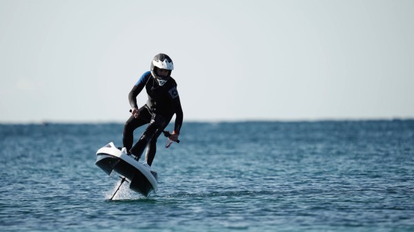
To that end, even recreational watercraft are going electric in this day and age. Several companies are developing motor-powered models that deliver all the fun without the emissions. But to do that, they’re taking to the air.

Continue reading “Weird Electric Jet Skis Are Hitting The Waves”

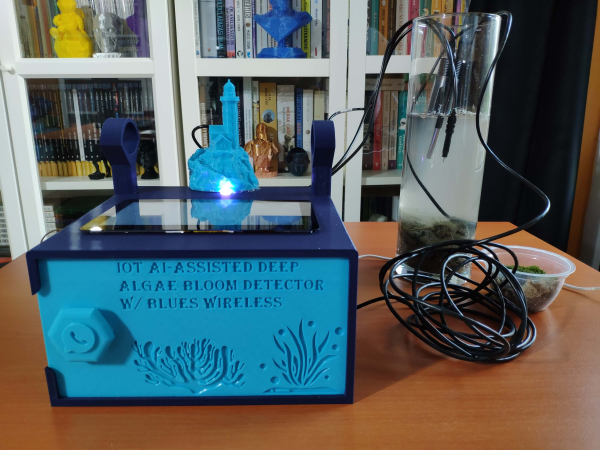
A blue enclosure with "IoT AI-assisted Deep Algae Bloom Detector w/Blues Wireless" written on the front. Two black cables run over a wooden desk to a cylinder with rocks on the bottom and filled with murky water. A bookshelf lurks in the background.

Detecting Algal Blooms With The Help Of AI

Harmful Algal Blooms (HABs) can have negative consequences for both marine life and human health, so it can be helpful to have early warning of when they’re on the way. Algal blooms deep below the surface can be especially difficult to detect, which is why [kutluhan_aktar] built an AI-assisted algal bloom detector.

After taking images of deep algal blooms with a boroscope, [kutluhan_aktar] trained a machine learning algorithm on them so a Raspberry Pi 4 could recognize future occurrences. For additional water quality information, the device also has an Arduino Nano connected to pH, TDS (total dissolved solids), and water temperature sensors which then are fed to the Pi via a serial connection. Once a potential bloom is spotted, the user can be notified via WhatsApp and appropriate measures taken.

If you’re looking for more environmental sensing hacks, check out the OpenCTD, this swarm of autonomous boats, or this drone buoy riding the Gulf Stream.