We take it for granted that you can look at your phone and tell exactly where you are. At least, as exact as the GPS satellites will allow. But throughout human history, there has been a tremendous desire to know where here is, exactly. Where does my farm end and yours start? Where is the border of my city or country? Suppose you have a flagpole directly in the center of town and a clock tower at the edge of town. You know where they are precisely on a map. You also know how tall they are. What you need is a theodolite, which is an instrument that measures angles very precisely.
Why?
Suppose you could measure the angle to the top of the flagpole from where you are standing. It is simple geometry to calculate how far away the flagpole is. You have a right triangle where you know two angles — 90 degrees and the measured angle — and you know one side, the height. Suppose the flagpole is 50 meters tall and the angle you measure is 40 degrees.
Since the total of the angles must equal 180, you know the other angle is 50 degrees (90+50+40=180). Using some ugly math, you can figure out the whole triangle from that. The part we are interested in is the base and the result is that it is 59.588 meters long. That’s how far you are from the flagpole.
Of course, that doesn’t give you a spot. It gives you a circle with the flagpole in the middle. Suppose you now measure the angle to the 100-meter clock tower. (This town has tall things.) You find it to be 30 degrees. Now you can draw a circle around the clock tower with a radius of 173.205 meters. Presumably, those circles will touch in two places. You are at one of those two places.
If you have some idea where you are anyway, you probably know which of the two points you are at. If not, you could sight a third thing. Of course, you have to be able to see the flagpole and other reference points. If you really want a stable reference, you can do the same trick with stars since you can look up exactly where they are over at a given time and their relative height.
In real life, over large distances, it is a bit trickier because the Earth is not flat — honest. So you can do even hairier math to compensate for that.
Measuring Angles
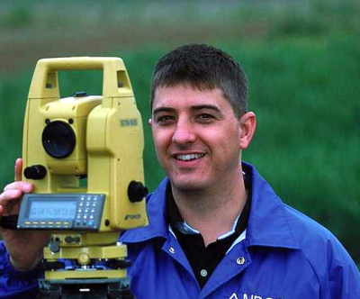
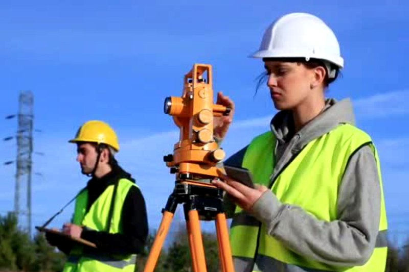
On ships, you often measure angles with a sextant. A theodolite is very similar but more suitable for making very precise measurements on the ground while a sextant measures the angle between two items, one of them usually the horizon. To the uninitiated, the device looks like a small telescope on a tripod. However, looking through the eyepiece will reveal a crosshair and some way to read the horizontal and vertical angles of the telescope. In the old days, this was probably just a pointer and scale but a modern device will have a digital readout.
Sometimes you hear these called transits. Actually, this is a special type of theodolite more properly known as a transit theodolite. The identifying feature is that the telescope is short enough to go full circle around the vertical axis. The idea is you could measure the angle one way, flip it around, and measure again. Averaging the results will reduce certain errors that have an opposite sign when you measure this way.
In addition to the telescope, there is a centering plate, levels, and a compass. (The centering plate is called a tribrach, which is an interesting instrument in its own right.) The idea is to be able to put the instrument in an exact place, level it, point it in a certain direction, sight and focus on a distant object, and then be able to read the azimuth and elevation to the target.
Grady at Practical Engineering will show you how surveyors use this instrument in the video below. He even gives you some homework to try if you want to get the topography of your backyard and don’t have a theodolite hanging around the garage.
History
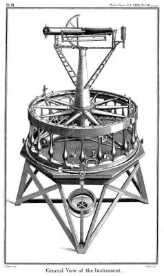
The theodolite seems like an obvious idea, but there were problems in calibrating the scales precisely. Jesse Ramsden solved this problem in 1787 and his instrument would go on to complete the first high-precision survey of all of Great Britain and Ireland.
Earlier instruments like the groma and dioptra only did part of what a theodolite can do. Early forerunners go back as far as the 1500s when several measuring devices that could go in both orientations appeared. However, incorporating everything — the telescope, the spirit levels, and a compass would wait until Jonathan Sisson’s 1725 instrument. But Ramsden made one with high precision due to his dividing engine to create precisely spaced markings. His dividing engine used a tangent screw mechanism that his improved screw-cutting lathe produced and could achieve one arcsecond (4.8 microradians) division. That is, a full circle would divide into almost 1.3 million parts.
For many years, the basic design didn’t change much. Sure, there were slight improvements and even adaptations for special purposes. For example, Edward Ritchie developed a theodolite for use on water that employed a pendulum to counteract wave movement. The U. S. Navy used these to survey harbors in the 1870s.
But it would be the 1920s when Heinrich Wild provided an optical path for the readings so that both angle measurements were visible through the instrument’s eyepiece. This was easier to use and less prone to dust and rain problems on external measuring scales.
In Use Today
Of course, surveyors use these instruments. But they also find use in tracking weather balloons and construction. These days a “total station” will measure everything electronically. They may also measure the distance to the target. Even in 1986, you could get a total station, and the video below shows a Wild Heerbrugg T2000 from the inside out.
Back in the day, theodolites were important for tracking rockets. Of course, these days, you can often use other means to find things like rocket altitude or exact locations.
Featured image from “Surveying & Mapping Technicians“, a video produced by the US Dept. of Labor.






Ah the memories… I used to help out my Dad every now and then for almost two decades. Me being the son (and him being the Boss) my job was to set up the Theodolite in the field so he could do the important stuff. Which means he got to smoke cigarettes while impatiently waiting for me to carry the darn thing and its tripod, the attached computer (Husky Hunter, anyone?) as well as the two shovels, the prisms (and /their/ tripods), the poles, the hammer, the wooden stakes used to mark whatever was important, the concrete boundary stones (which I had to dig the holes for as well), the wooden ram to set said stones firmly, the walkie talkie and everything else that was necessary. Since this was in real life my inventory was not as spacious as is the case with First Person Shooters, so this meant several trips to the van and back, never mind the weather, the terrain, or the distance. He was quite often offering a helping hand, but ultimately it always seemed to come down to “And now take that stuff and walk 300m in this direction, I´ll give you further instructions”. It was character building for sure.
I just remembered this one story where I had to look for a century old granite marker stone, which happened to be in a cementary. It was a nice warm afternoon, grannies were tending to the graves of their loved ones, and I just appeared out of the blue, dropped a clutter of aforementioned tools and shovels, talking on the radio. To their horror I begun to dig right in the middle of the graveyard, because those old marker stones are usually buried about 1m deep. Those looks! I found the stone, it was right on point where some land surveyor had deposited it more that 100 years before.
Another time I had to remove some cobblestones in front of an old manor in order to dig a hole. Some guy, face all red, yelled at me that he would call the police because I was destroying protected and undoubtedly historically important pavement. As a land surveyor you pretty much have carte blanche in most cases, so I told him to feel free to do so while I calmly continued to dig. Right at the moment the police showed up I found what I was looking for – a bright orange plastic marker that I personally had placed three years before. The fellas face went pale, I got a pat on the back from one of the policemen while the other one mocked the guy a bit.
In the US, private property is usually marked by an iron pipe or rod driven into the ground. This has the advantage of being discoverable with a metal detector, which often speeds things up.
Oddly near a telephone pole there a metal plate embedded into the ground.
A computer? Luxury! Back in my day we had a tape, a thermometer, a log book and we were happy!
Actually thank god for computers. Survey all day, plug the logger into the PC and it’d spit out the map to the plotter. You could survey a road almost as fast as you could walk it.
And with todays gear your Dad could do it all by himself if he were so inclined, leaving you plenty of time for Minecraft.
Character building? Yeah, I did that too.
Been called a character, all my adult life, as a result.
I’ve got two Russian-made theodolites, but I bought a GNSS RTK from Sparkfun, and my state provides a free correction network, so I can get 1.4cm accuracy with the RTK and my phone. I can use it for coastal cruising as long as I have phone data. The theodolites have joined my pile of other junk.
The more interesting question about surveying is what do you do when your monuments have moved? I understand tectonics is sliding the whole thing a few cms per year, so the lat/long of section corners are changing measurably.
I’m sure Cree can give a more detailed answer, but my understanding is:
(a) Where it is absolute latitude and longitude that matter, the physical markers are re-surveyed every few years w/r/t (eg) astronomical references to update their current position, which is how we know they are sliding due to plate tectonics in the first place; and
(b) many things like state boundaries are legally fixed to the position of the markers, /not/ absolute lat/long. So as the markers shift so does the state, or country. This is interesting because many apparently straight borders, like between the US and Canada, are in fact *not* actually straight due to surveying errors and drift. The actual markers set during the original survey of the border are what fix its location.
The coordinate systems are also set based on various markers, and they get adjusted from time to time as well.
Some references for more info:
https://www.usgs.gov/faqs/what-state-plane-coordinate-system-can-gps-provide-coordinates-these-values for coordinate system shifts
Border disputes and surveying:
https://www.texasstandard.org/stories/how-a-bad-survey-and-powerful-connections-added-1000-square-miles-to-texas-lands/
https://en.wikipedia.org/wiki/New_York_%E2%80%93_New_Jersey_Line_War
Thanks for the interesting reading.
There is a little bit more trigonometry into triangulation then in the “why?” section of this article. There is no “90 degree angle” between the base of the flag pole and the theodolite because the elevation of the theodolite is still unknown at that point. As far as I know, they first only use horizontal angles to calculate distances, and only then use the vertical angle to be able to calculate relative elevation between points. As far as I know, elevation is also less accurate because the vertical angles are very small.
Yeah, HAD have managed to not exactly get it wrong for once, but backwards. You don’t calculate the distance, you get out you trust tape (chain) and measure it. Any Englishman can tell you what a chain is, it’s the length of a cricket pitch (22 yards, ain’t imperial great). ~20 metres in civilised parts of the world.
They’ve also missed the bit about measured triangles are never 180 degrees, so you get to do the closing angle calcs to fudge the numbers.
Well, I was trying to get the basic idea across and that’s the same way you get people to understand stellar navigation even though the Earth is not flat. I did mention the real math is worse ;-)
Simplification is a useful tool to explain concepts, but you must always beware of going too far with simplifications.
Writing done how triangulation is actually done (or at least one way to do it) would have been just as easy.
1. Measure the distance between the flag pole and the church tower (You need a baseline with known length).
2. Measure angle between the base line and a third point (Radio tower?) both from the flag pole and the church tower.
3. Use simple trigonometry to calculate the distances from those angles and the length of the baseline.
The video below shows it more graphically. @02:22 there is a map with the first triangulation of France, and @03:23 a more detailed map.
https://www.youtube.com/watch?v=yTyX_EJQOIU
I stopped when one of the narrators replaced himself with a puppet though. I appreciated the earlier puns, but that was too much entertainment for me.
This can be further extended with error correction over multiple measurements or 3D, but these steps give a basic understanding of triangulation without oversimplification or falsehoods.
You could still pretend the earth isn’t spherical and then level yourself with gravity, if you can measure the angle to both the top and bottom of the pole. Or, uhh, without an extra reference or being able to see the bottoms, i guess next you could find the azimuthal angle between the pole and the tower to help out, if you assume you know the elevations and heights of both but not your own. But the bit about subtracting angles is a distraction I think; in the simple cases like that you use soh-cah-toa to pick the correct trig function for your knowns.
Hunters and golfers use rangefinders that measure their own angle w.r.t. gravity to get the horizontal component of the triangle from eye level to the indicated object, because of projectiles.
One does forget the pure optical units as time goes on. The first total station I experienced connected to an HP calculator and was, IIRC, HP manufactured. Been a long time (since uni, to tell the truth)
Last thirty years, I have used but a humble dumpy level and tape, my GPS unit that needs to sit undisturbed for a goodly time, or left precise location finding to the professionals.
HP 41 and Educalc selling a survey pack.
I did my surveying back in the 1970s when “distance meters” first came out and weighed about 50 pounds. Lugging those from the truck to the tripod was a bear. Centimeter accuracy is fine for property surveys, but we sometimes did construction surveys where the placement of bolts, for example, had to match pre-cut steel and sub-centimeter accuracy was needed. That took very careful traverses that had to check back into the starting point to just a millimeter or two. The boss usually came out and “ran the gun” for those surveys.
Few questions for the pros.
( my background- amateur celestial navigator here. with celestial nav I can get about 100yds with multiple averaged readings, over a few days, using the “fit slope” method. I am not sure, I do not measure celestial transits, but I would think with that you can do better. I don’t know of any amateurs doing that though. And info on celestial navigation for land surveying is very hard to find.)
1)Do you always have to start from a known location? as in, you are always measuring from a landmark, marker, etc? It isn’t de novo, like cel nav, right? Or GPS I guess but even that- there is error there as well.
2) How close are these things? 1 cm? 1m? On the local scale they came and measured my property from the marker and put in new markers, but I assume that was to the mm or so… from the marker.
3) Certainly there are circumstances in the woods etc that you can’t really just look for a mountain peak or something. Let alone two (or more) landmarks… what then?
Thanks, fun and great article.
100 yards is really good, well done!
It’s a YMMV thing, with differential GPS they might be accurate to 1 cm. Phone cell towers are used these days as well, triangulation off them alone is surprising good, well under 50 metres in many cases.
It’s really a case of continuous measurements. You locate points A & B, measure both ways between them, and then the same for point C. You round out the errors, and add in points D, E etc. You eventually get a mesh where all the points are within a tolerable error margin. And a few years later do it all again.
Then you throw in altitude for bonus fun.
Local surveys are pretty accurate as the distances are small, but it’s an error margin thing. Won’t be to the mm, but good enough to find things. It’s really only to check if anything has moved since last time, which includes subsidence or fences moved.
RTK really helps.
https://en.wikipedia.org/wiki/Real-time_kinematic_positioning
ok, please add check distance using paralaksa (eye) or tales solve
and make this same with theodolit and count error
I suggest taking a look at the Great Trignometrical Survey – one of the largest, most complex, longest scientific initiatives that ran from 1802 to 1871. Read up here https://en.wikipedia.org/wiki/Great_Trigonometrical_Survey