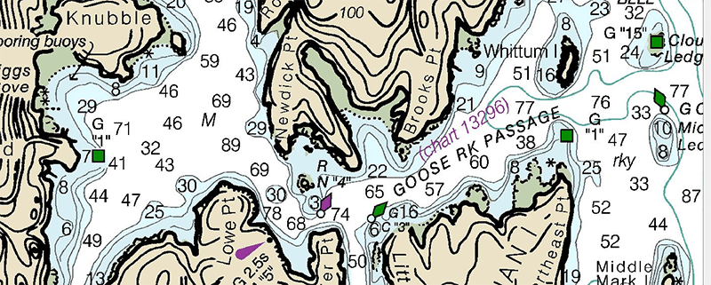
Road atlases are still published, but you wouldn’t know it if you have a smartphone and Google Maps. Most pilots who got their license a decade ago started on paper maps, but the iPad rules the cockpit today. On a single SD card, you can store maps for every square mile of the Earth’s surface. [Erland] figured it was high time for digital maps to go nautical and built a tablet-like device to display charts while sailing.
The Pi Chart is, of course, powered by a Raspberry Pi running a few dozen lines of JavaScript and HTML. Software wise, there’s not much to this build save for the new OpenGL-based rendering that allows for ultra smooth map rendering.
The hardware is where this build becomes useful, and for that, [Erland] is using a sunlight readable Pixel Qi display. A Li Ion battery provides about 10 hours of runtime, and a Bluetooth enabled GPS dongle tells the Pi exactly where the boat is.

The Raspberry Pi Zero contest is presented by Hackaday and Adafruit. Prizes include Raspberry Pi Zeros from Adafruit and gift cards to The Hackaday Store!
See All the Entries || Enter Your Project Now!


That’s cool, but it appears he is using vector maps. They’re nice for most uses, but raster maps have navigation details that vector maps lacks. This can mean the difference between safely navigating reefs versus scrapping bottom or worse.
Why does the interior graphics format have less detail?
*inferior :P
A lot of details can be rendered in vector maps. The main problem I could see with vector maps is the time to render it if you have a lot of details. The raspberry can lack the power to render it quickly.
So here’s an anecdote for that one. In the last Volvo Ocean Race, Team Vestas wiped out on a reef that they hadn’t accounted for, because they were zoomed out too far on their plotter. Exactly the same way that you see details disappear from, eg, google maps as you zoom out. Fitting content on a map is actually incredibly complicated, and most automated renderers opt to discard “small” details instead/
Nah, pretty much any vector chart will have way more features in it than a raster chart. I use cm97 and it’s got way more than the equivalent paper charts (which are an important backup). As another commenter mentioned, misusing them can lead to level of detail issues but that’s the same as using the wrong scale of a raster chart.
The issue is not the lack of data in the vector charts, it is in the software that does not display detail data when zoomed out. For software that does have the option to change this, it is often buried deeply in the configuration settings to the point you are not likely to find if you don’t already know where to go looking for it.
Thanks for your interest!
I’m actually using raster maps. The top picture in the blog article is not from my project.
This is not so much an active choice, rather that I could get a hold of raster charts of my area of interest.
where did he get the maps and considering that the bottom of most waterways are in a constant state of change how does he update them? if it is realtime does he have a sat phone or something for data? what am i missing
Any number of subscription services or governmental bodies. NOAA for example, host charts on their web page and update them weekly. Though I imagine major updates come less frequently.
Thanks for your interest!
The source of my raster maps is not entirely kosher, so I don’t want to talk too much about that ;-)
My area of interest is the Stockholm Archipelago, and while changes are made now and then to the nautical charts, shifting bottoms are not a problem.
Also, this chart plotter is more intended as a complement to paper charts, rather than a replacement.
Charts are notorious for being inaccurate. Many draw data from a century ago. You need to use your head and post a look out if the chart shows water at your boat’s draft.
Vector maps are much superior to raster, as you can choose which data types to show (even for each zoom level). The official maps are updated regularly. I haven’t followed, as I am out of that for some 10 years, but back then it was once a week you got the changes and had to update your (digital) charts manually – just as with the paper charts and updates. I believe it should be an automatic update by now, as soon as it gets published. Of course, you have to pay for such services. DIY systems do not (I am pretty sure) conform to official ECDIS standards, so the updating burden is on the user. And nobody will give you such information for free. So there is a bit of problem to get permission to sail with such a system without paper charts. Of course it doesn’t matter for the small fish.
NOAA provides the information for free (raster and vector), at least in the US. Formatting that data is a problem for the user. Most people would pay for that formatting, but this is Hackaday.
Most boaters that build their own chart plotters use OpenCPN on the software side. OpenCPN is a pretty solid open source project and it looks like a lot of people run it successfully on RasPi 2 and other SBCs.
Thanks for your comment!
I did run into OpenCPN, and I will have a closer look at it later on.
Initially, I want to build a minimalistic interface, and do not need a lot of features (Minimum Viable Product), so I’m focusing on the physical device rather than the software features. I can always update the software later.
Interesting for the display, but electronic nautical charts are not new, see OpenCPN : http://opencpn.org/ocpn/ . Further, OpenCPN has been ported to the Raspberry PI, see : http://www.agurney.com/raspberry-pi/pi-chart .
Thanks for your comment, Colin.
I agree that the concept is not new. I’m just a maker wanting to build one for myself in a steampunkish case.
See my answer to an earlier post about OpenCPN (tl;dr: I want minimal features now and am focusing on the hardware). Thanks for the link.
One part of the project which you might find interesting is a completely wireless GPS and compass dongle, running off solar cells and communicating via Bluetooth Low Energy. My back-of-the-envelope calculations show that the GPS stuff can be run at low enough power that a small solar cell and battery should be able to run it for a long time. I don’t know if there any devices like that available today.
Great to see a pixelQi display in use. I really thought these would become more popular than they have.
I thought the company had gone under… I only see out of stock or very limited quantities available.
Are they still being produced? I really wanted them to become mainstream.