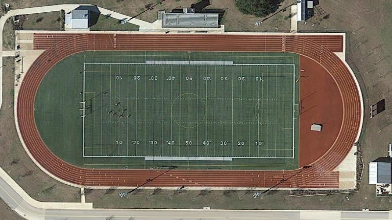
Google Maps is one of the modern wonders of the world. It is hard to remember how expensive it used to be to get high-quality aerial images. Of course, you don’t get to pick when they fly over a particular piece of the planet. If you are like [Dennis Baldwin] that’s not good enough. He’s been using his drone to document the construction of a high school stadium.
[Dennis] uses the open-source GDAL tools to create Google Map tiles from drone imagery. Even better, he’s documented the process in the video you can find below. Once you can make your own map tiles, you can control when you take the images — important if you are documenting construction like [Dennis] did.
[Dennis] knows there are more automated ways to do the mapping, but he wanted to understand the whole process. He also plans on redoing the workflow completely using Open Drone Map. If you want to see some very expensive (non-open source) mapping software at work, you might want to read about this mapping drone.


Drone users ought to fight the FUD by emphasizing they have sought permission to fly over given properties…. otherwise this is just highly documenting repeat trespass.
Did Google tresspass over your house along with Mapquest and Microsoft? Were you mad when they did that?
In licensed aircraft.
Airspace is not private, not sure what the official limit is, but stuff flying over your shit is not trespassing ;-)
So you’re using a commercial drone with a COA?
Somewhere there’s a limit otherwise one could easily violate someone’s privacy. Buzz windows, watch nude sunbathers, etc.
According to a drug case appeal in Florida it’s 500 feet, less if you’re on a runway approach. Which coincidentally is the flight ceiling of drones. So drone footage is currently an invasion of privacy. Until there’s a lawsuit to over turn or redefine it.
Why not OpenStreetMap
that same thing struck me…
OpenStreetMap doesn’t have an imagery layer yet does it?
Strictly speaking you could say openstreatmap is only the line database, but it has many associated projects that use that data. And with the editing tools you can use any WMS imagery server with openstreetmap data layered over it.
http://wiki.openstreetmap.org/wiki/OpenAerialMap is a WMS tile server for opensource imagery.
There’s the little matter of it being a high school, with that being said one justifiable reason to let others know is safety. The school or the construction company may want to do something similar and it’s good to know who’s in the airspace. Something to keep in mind as drones become more common.
You can find many DIY aerial imagery examples at the Public Lab’s mapknitter.org website. Usually covering small areas though. That website is based on the same GDAL utilities. Many of those maps come from before drones were affordable and were made with kite imagery (KAP) and balloong imaery (BAP) techniques. In fact some of them have been taken from mapknitter.org by Google itself, processed and ingested into their default imagery layer a few years back. This was mostly done as the type of quirk that Google likes to have in their services, where if you type in the right query or look at the right place on the map, you get to see something cool. In this case the quirk was the sub-centimeter level ground resolution imagery in small specific areas at a time when about 1m satellite imagery was the standard. This probably wouldn’t make sense today.