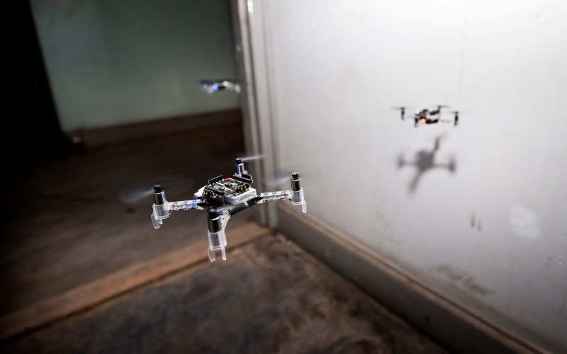
When it comes to robotic navigation, the usual approach is to go as technically advanced and “smart” as possible. Yet the most successful lifeforms that we know of follow a completely different approach. With limited senses and cognitive abilities, the success of invertebrates like ants and honeybees lie in cooperation in large numbers. A joint team of researchers from TU Delft, University of Liverpool and Radboud University of Nijmegen, decided to try this approach and experimented with a simple navigation technique to allow a swarm of tiny flying robots to explore an unknown environment.
The drones used were of-the-shelf Crazyflie 2.0 micro quadcopters with add-on boards. Sensors consisted of it’s onboard IMU, simple range finding sensors on a Multi-ranger deck for obstacle detection, and a down pointing optical flow sensor, on a Flow deck, to keep track of the distance travelled. To navigate, the drones used a “swarm gradient bug algorithm” (SGBA). Each drone in has different preferred direction of travel from takeoff. When an obstacle encountered, it follows the contour of the obstacle, and then continues in the preferred direction once the path is clear. When the battery drops to 60%, it returns to a wireless homing beacon. While this technique might not be the most efficient, it has the major advantage of being “lightweight” enough to implement on a cheap microcontroller, an STM32F4 in this case. The full research article is available for free, and is a treasure trove of information.
The main application researchers have in mind is for search and rescue. A swarm of drones can explore an unstable or dangerous area, and identify key areas to focus rescue efforts on. This can drastically reduce wasted time and risk to rescue workers. It is always cool to see complex problems being solved with simple solution, and we are keen to see where things go. Check out the video after the break.
We’ve covered Crazyflie hacks a number of times over the years, and this time will probably not be the last.
Thanks [Qes] for the tip!


There’s a 3d imaging technique that can build up a full map…I can only find the company matterport, however some university had some it a few years ago. Someone here will remind me. Anyway it’d be cool to try and combine the live video back from these to do that.
You can build 3d models from a set a images using photogrammetry . It take a bit of processing time though .
like the scanning orbs from the movie Prometheus
Photogrammetry, LiDAR, ultrasonics, OpenCV and other Simultaneous Location And Mapping (SLAM) methods do this. Sebastian Thrun has (had?) an open course on the topic
Probably an interesting video but the musical diarrhoea makes it pretty useless.
The letter ‘m’ on your keyboard might help with that.
Less is more is interesting approach – when I used to do industrial software I would try and make the code as simple as I could – much more reliable
this does open up some interesting uses
As a kid I had nightmares about over-sized wasps etc with evil intent.
Coming true now.
Those might become true. Slaughterbots is a fictional video warning against that https://www.youtube.com/watch?v=9CO6M2HsoIA and there is also the https://www.stopkillerrobots.org campaign.
On the other hand, 30g bot swarm autonomously searching for survivors in a cave or a ruin is pretty awesome thing. As always, the technology is not good or bad. The line is the intent of the operator.
The technology we need in response to potential slaughterbots is a system that detect a drone with cameras and fires high powered lasers at the senor to blind it. Get enough of those to blind a swarm of drones in seconds.
Or the programmer if autonomous.
Well one’s dying while the other’s thriving. Nature maintains a balance.
https://xkcd.com/2128/
Dang, you beat me to it XD