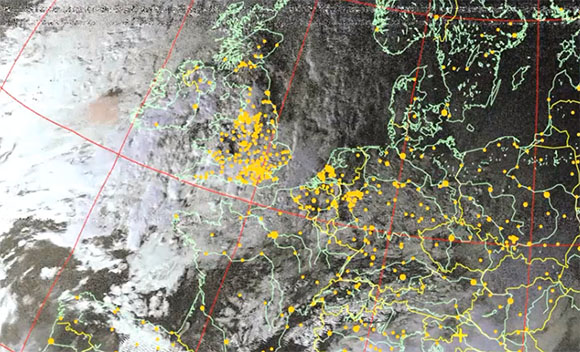
Several times a day, a NOAA weather satellite passes over your head, beaming down pictures of weather systems and cloud formations. These transmissions aren’t encrypted, and given the requisite hardware it’s possible for you to download these images from space as [Lovro] shows us in a tutorial video.
To get these near real-time satellite pictures, [Lovro] used one of those USB TV tuners we’ve grown so fond of. A somewhat specialized antenna is required to receive the right hand polarized transmissions from NOAA weather satellites, but with a few bits of wood and wire, [Lovro] made a helical antenna to listen in on the weather satellites transmitting around 137 MHz. After gathering a whole bunch of data from the satellites with SDRsharp, [Lovro] used an image decoder to turn an audio file into a picture taken from space just hours ago.
This isn’t the first time we’ve seen images from a NOAA weather satellite downloaded with a software defined radio; last year [hpux735] did just that with a somewhat inexpensive Softrock SDR. [Lovro]’s use of a USB TV tuner to receive the transmission from NOAA satellites is a lot easier on the pocketbook, though, with the largest expense being an investment in time to build a helical antenna.


Just WOW!
Same here ! WOW !
Earlier this year i got this picture from NOAA19 (APT 137Mhz) with a funcube dongle and a roof mounted discone antenna with the lowest frequency at the low end of the air band.
http://i194.photobucket.com/albums/z125/92jowi10/282303_410469078996127_1387566801_n_zps549fb903.jpg
That’s not too shabby at all. Only a few nulls here and there. Were you running a pre-amp?
No, no preamp, and this is the antenna prototype i was using. When the satellite was overhead it cut out a bit.
http://i194.photobucket.com/albums/z125/92jowi10/IMAG0480_zps1222aeb1.jpg
A discone antenna is not the best for this task where it is kept static and you want an high angle omnidirectional circularly polarized radiation pattern like the one given by turnstyle or better a quadrifilar helix antennas that for VHF are very cheap and easy to build.
QST August 1996 W3KH Quadrifilar Helix
Nice work! I’d love to see the preamp schematic.
Also, for anyone wanting to best our work, these dongles can (should?) easily handle the higher bandwidth and resolution 1700 MHz weather satellite signals. If I had more time, that’s what I’d be doing! :)
He linked to the schematic in the video description: http://electroschematics.com/wp-content/uploads/2009/04/fm-antenna-booster.jpg
Hi, I will also try to do this, I am working on rotor for dish to track satellite in the sky, and I will make preamp for this and entire new video for HRPT signal!
Schematic of this preamp is in description of video, and it is very very simple and cheap to make! ;)
At which point in the schematic do you have the shield? (between the halves)
Unfortunately, schematic does not show it, the box has 2 sections, the shield in middle has hole in center and in that hole is transistor… I will draw it now and put it in description!
There you go!
http://i48.tinypic.com/2m46fkz.jpg
Thanks! That’s the logical place to put it, but I wanted to be sure.
Thank you all, and thanks to hackaday.com for this article! I hope that everyone will find this useful!
Nice job, I was hoping to do something similar myself in the future.
BTW. I recognized those buildings, and just by case, happen to live in one behind that big red bric one from the begging of the video :D .
Does Lovro have any contact? I would like to meet him!
Here is my email! mrworf1701@gmail.com
I tried this a year ago, but soon realized i needed to custom build an antenna, which i never got around to.
I run a j-pole on my APT rig, and it does quite alright. A few more signal nulls on the final image, but it isn’t too bad at all.
‘Funny seeing this coming ’round again! I did all this about 30 years ago. Actually, no hardware “decoding” is needed. I used a very cheap little radio, sold by Radio Shack, for listening to aircraft talking to ground control, subsequently thrown in the trash by a bored user. Literally, a dumpster project. Helical antenna, circular polorization? Hogwash! I used an actual bent coat hanger whip antenna, and got very nice images, thank you very much. Hardware? A single cable connecting the radio earphone jack to the laptop audio input jack. That’s it! Pictures taken just hours ago? Totally incorrect! You are actually receiving the data milliseconds after it is gathered, there is (or, was) absolutely no data storage or buffering.
You see, the “scanning” is the cylindrical satellite spinning around, nothing more. The “cameras” are only sensing a single point of light, nothing more. First, the visible light sensor sweeps a “line”, then the infra-red sensor (for seeing clouds in the dark) comes around and sweeps its “line”, then a frame of housekeeping data is sent as a few very blocky characters. Then it all goes ’round again. The “raster” is simply the motion of the satellite passing over the earth. And that is ALL there is (or, at least, was) to a polar orbiting satellite, point light sensors in a rotating bird, modulating a 2400 Hz tone. These birds date back to an age of extreme simplicity. The “big” weather sats in geosynchronous orbit simply can not image what is happening at the poles. And so, the relatively crude “fill in” data for seeing the polar weather.
I have made fine images with only the most simple software synchronizing the start of a line to add to the image “ribbon” slowly scrolling up the laptop screen. The data were written to the display the instant received. The REAL HEAVY LIFTING is using the Keplarian numbers (orbital definition) and absolute time to determine the exact satellite position in real time. (As said above, the data are always coming in at real time). The BIG WORK is the 3D image processing math to overlay political boundary data correctly over the incoming data stream. And, yes, that was a bunch of fairly nasty code to write.
Just remember, really fine images can be assembled with an old aircraft radio, a bent coat hanger, and about ten lines of code. That’s really all you need. (Or, at least, it’s all that was needed back in simpler times.)
“Just remember, really fine images can be assembled with an old aircraft radio, a bent coat hanger, and about ten lines of code. That’s really all you need”
That’s basically how I put myself through meteorology school — APT and HFFAX weather charts off of my scanners. There was no Internet where I lived when I was in college (the best was Compuserve, a long-distance 14.4k phone call).
Only 30 years ago? I have a magazine from early 70’s with plans to a 137 Mhz satellite receiver made from parts and using osciloscope to display.
Interesting. Thanks for the background. . . this is a tempting MATLAB image processing project.
Is the geopolitical overlay (national borders, lat. long. etc) done in post processing?
– Robot
Yes… WxtoImg puts in the overlay, assuming you have current Kepler elements and the correct lat/long of your antenna.
First, I am 20 years old, and I didn’t existed 30 years ago, second, coat hanger wont help with insensitive tuner, third, we don’t have in Croatia radioshack, forth, no need to write any programs because very very good program is freeware with lots of options which you cannot achieve with few lines of code, fifth, I will soon be able to receive HRPT on 1,7 GHz with same 20$ tuner, home made stepper driver for dish antenna, and homemade waveguide.
And I could bet that my QFH antenna is hundred times better than your coat hanger, If coat hanger is that good as you claim, than it would be on satellite it self, but it isn’t!
If you want good antenna to receive faint signals, in this case RHCP, you will use QFH or turnstile antenna calculated for required frequency, thank you very much!
I don’t think Bob means to insult. But I don’t doubt for a second he could pick up APT from a wire hanger with a good receiver.
I had asked the question in a previous HaD post whether a good pre-amp and RHCP-biased antenna would be critical to a USB-dongle-based APT setup. I think you’ve answered that question in the affirmative; personally I’ve never had any luck due to the dongle’s insensitivity. I have trouble picking up local 2M stations on the dongle that are trivial for my hand scanners with “rubber ducks”.
On the other hand, I’ve had very good results with a modified Bearcat scanner ($35 on ebay) and a homemade J-Pole antenna ($20). You judge: http://www.appsremote.com/appsremote.com/wefax/noaa%20POES%202012/640/noaa-19-12261958-msa.jpg.640.jpg . My J-Pole is at ground-level with large buildings on the horizons. If I had your antenna (and excellent tower location), I could do much better. I’ve never had any luck getting the nulls out of a QFH.
I know that Bob doesn’t mean to insult, I just said a few facts, I know that I wouldn’t pick up signal with coat hanger even if satellite would be directly above because of insensitivity, that’s why I made preamp.. That preamp is just simple and awesome! :)
It depends on the reciever greatly.. I have a modded Baofeng UV-5R radio that can easily RX this satellite with just the whip antenna it came with…
Now the photos, lol are certainly not as clear as the one posted here on HaD and while a coat hanger certainly would RX APT its not going to be that clear.
A helical, cross yagi, or a QFH antenna would be your top choices to get a clean image.
Hey Bob,
I don’t doubt that you were able to achieve this 30 years ago but can you tell us what laptop was available in 1982/83? I was just out of high school then and had some cutting edge computer gear but I didn’t get my hand on a laptop until about 1992 and it was a beast at that (286).
Andrew
He could have been using an Osborne 1 or a TRS-80 model 100, they where both availiable. But then he really should write about how he created an audio input interface and did that type of signaling processing and graphics rendering on them. That sounds much more impressing than just recieving the satelite signal.
I dunno about laptop, but my first HFFAX and APT attempts were on an old Columbia Data Systems XT clone. Scanner audio was piped through a circuit hooked up to the serial port. No geopolitical markings on the direct APT images; if I needed those I would grab the preprocessed images off of HFFAX.
Waiting for somebody to do LRPT, either from a NOAA or a GOES bird, using an SDR. THAT will be quite an accomplishment.
Thanks for the information Lovro, never knew those particular satellite signals were available to get with such the simple hardware. Though, I am amazed at the capability of high freq modern electronics verses their costs.
I did this exact thing in August and September, while visiting home, with my brother. I can tell you from experience that with an EZCap brand tuner and a properly constructed (not even WELL constructed! ours was laughable) helical antenna, you need absolutely NO preamp. I guess I should have put together a video and some good documentation soz I could be on hackaday. X<
Bob is absolutely right: The image you see is composed of scan lines directly below the sat as is passes overhead. Compare when you begin receiving good image lines to where the sat is on your mapping software, and you will find its directly over the area currently being drawn.
Also, be aware that many of the NOAA sats are now out of service, and one scans but transmits no images (it is effectively dead, but the radio is still active).
You can find the guide to constructing a good helical in the ARRL handbook, chapter 30.6
For software I use:
HDSDR for radio reception
WXtoImg or APTDecoder for imaging (APTDecoder also handles sat tracking and maping)
Virtual Audio Cable to mitigate some audio issues with internal mixing. I can pump the software output directly to WXtoImg, which will think its getting audio from the mic jack. Essential for hushing the noise late at night.
http://www.unkebe.com/APT_Status_Report.htm
NOAA 15 137.620 (APT) on good. See Note 8.
NOAA 17 137.500 (APT) on No images. See Notes 7&8.
NOAA 18 137.9125 (APT) on good
NOAA 19 137.100 (APT) on good but see Note 6
Nearly any 2 meter ham radio (or scanner with a descriminator mod) can be used to do this.
I have a UHF/VHF satellite yagi antenna built out of coat hangers and a broom stick (I’m dead serious here) and it works just fine
NOAA 19 is at 137.1MHz and is damn easy to grab the APT downlink, that satellite also has a microwave link but tracking a dish is a bit more difficult and expensive.
This is so old its amazing… hopefully thought it’ll bring interest into satellites for people who were not aware of it…
You can talk to satellites, listen ti military satellites, etc,etc,etc the list just goes on..
The rtl-sdr does make this very easy for those who don’t know how to do hardware modifications… but its also cumbersome… its much easier to use a modded radio and record the satellite during its pass, then go back and decode it.
My post: http://diy-scib.org/blog/receiving-satelite-weather-images Thank you for inspiring me to finally put it all together.
lots of QFH designs for 137 MHz on my friend’s website (I agree, not the best kind of internet technology, but he’s not a computer guy, and the projects are really nice. )
http://rjclick.perso.sfr.fr/crbst_27.html
http://rjclick.perso.sfr.fr/crbst_31.html
http://rjclick.perso.sfr.fr
I’ve been working on this project for a little bit of time now. I’m trying to make a portable version for when I go camping up North (Canada). The goal is to have the recording and decoding on a Raspi running off of a battery, most likely just remote desktop from my phone to save on screen and input for the first version. Would anyone have any advice on the best lightweight SDR software to port to the raspi?
Here’s the 1st thread I found… http://www.raspberrypi.org/phpBB3/viewtopic.php?f=41&t=11542
Also this — http://www.eham.net/ehamforum/smf/index.php?topic=84327.0 — ignore the flame war towards the end, though…