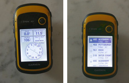
[Michael] posted up-to-date GPS data sets in the GPX format. These data sets are an alternative to paid updates. Since GPX is a published standard which uses an XML style formatting for location data [Michael’s] time was spent getting the original sets and finding a way to translate them for his Garmin EXTREX GPS.
The original data comes from — hang on, this is a mouthful — the US Federal Aviation Administration’s Facility Aeronautical Data Distribution System (FADDS). He had to apply for permission to download it and to use it in producing a custom GPS build. He grabbed the Airport waypoints and navaid sets, then studied accompanying files detailing the data structure before writing his own Visual Basic 2010 program to spit out the GPX files. He says he wanted to make them available in the spirit of the Open Hardware/Software movement. This may be most interesting for pilots (the kind that put Nooks on the dashboard, not the kind who watch the aircraft from the ground), but we’re sure there’s a myriad of uses for non-pilots alike.


lolwut? why bother with XML when you can simply parse GPGXX messages
Because many GPS receivers allow you to load GPX files to use as waypoints, etc. That’s the whole purpose of this work.
I used to have installed a couple of Linux apps ( i think in java ) that makes a lot of automated process/manipulation to and from GPX files to download to garmin GPS. Don’t know why to write another one!
GPSBabel?
http://www.gpsbabel.org
Great stuff thank you!! Works on my Garmin etrex 20.
This is awesome! I hate that all the aviation GPS vendors charge so much for database updates when the data is fundamentally owned by the public. Any chance of getting navaids and intersections, also?
I have some list for aviation data:
http://www.ourairports.com/data/
http://data.x-plane.org (GPL)
http://soaringweb.org/ (Airspace airspace)
@hpux735
I agree that the aviation date need be free but i know that some rumors that the us government have closet the data back in 2006/2007 by copyright clams form i think Australian but i am not surprise that the big chart makers are the real reason.
I would never use data from those sources to actually fly. I actually take the “not for navigation” stuff seriously.
Can you elaborate on the Australian conspiracy?
Wonderful! They charge a ton for these “public” data – I use an old set in my flight GPS but appreciate the updates.