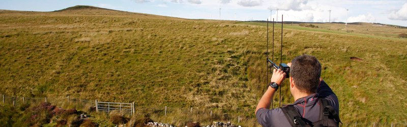
If you’re a first responder — say, searching for someone lost in the outback, or underneath an avalanche — and you’re looking for someone with a radio beacon, what’s the fastest way to find that beacon? Getting up high would be a good idea, and if you’re using radio direction finding, you’ll want to be able to cover a lot of ground quickly if only to make the triangulation a bit easier. High and fast — sounds like the perfect opportunity for a drone, right?
[Phil Handley]’s Bloodhound project is an autonomous drone that can scan a wide area, listening for emergency beacons while alerting the search and rescue personnel. His test bed tricopter uses DT750 brushless outrunners controlled by 18A Turnigy Plush ESCs and powered by a 2200mAh LiPo. A metal-gear servo works the yaw mechanism. He’s also got a Pixhawk Autopilot, a ArduPilot flight controller, a NavSpark GPS, a software defined radio dongle, and a Raspberry Pi. He made the air frame out of wooden dowels, following RCExplorer’s tricopter design.
The next challenge involves radio direction finding, essentially creating Bloodhound’s foxhunting skills. It needs to be able to autonomously track down a signal by taking readings from multiple angles. In addition to finding lost skiers, [Phil] also envisioned Bloodhound being used to track other beacons, of course—such as wildlife transponders or errant amateur rockets.


i don’t think a 2S 2000mAh battery is going to last long, a few minutes maybe ..
great project though, can’t wait to see his progress on the radio part. Any word on the antenna ?
2200 mAh, likely 3S or 4S. I used to run a tri about the same size and got 10 minutes. Make sure zero slop in yaw mechanism otherwise the servo won’t last. I used a big Savox MG and it was destroyed. Maybe poor FC firmware though.
A mechanical bloodhound would be a triumph of science and engineering.
Sentinel Panthers are much better, but they are mostly biological.
Be sure the drone has a beacon of its own,
so it can be found…
What about tracking Wifi and cellular. How best to find someone but by hunting for there phone signals.
convincing the phone to send out any wifi would be difficult if they aren’t already connected to something. That said cell announcements and bluetooth are more likely to work. the BLE beacon stuff would probably work pretty well.
You can do this with goTenna Mesh (and upcoming goTenna Pro) as well. Check out the results of our project with first responders and Colorado State University here: https://www.docdroid.net/OI4bLZQ/group-5-final-report-v1-2.pdf
Might be a good idea to add lights and noise makers to the drone. This could help lost skiers find you and/or the way back if they don’t have a radio on.
Great idea John and Phil. I don’t know what happened to my first post so I’m posting again. I was thinking for fox hunting you could use a a Yagi-Uda directional antenna (for peak vs null RDF), a GPS unit to build a baseline, then take magnetic compass readings (Hall effect) to build a right angle trig algorithm that gives you the angle to radio target and distance.
But I was thinking of something totally different like this:Bloodhound Autonomous Human Scent Tracking Drone https://goo.gl/7gXjMu
http://www.upl.co/uploads/peoplesniffer1503629914.jpg
http://www.upl.co/uploads/avalanchescenario1503631293.jpg
Anything the victim can do like make a hole above his head to the surface can only enhance the ammonia gas from his body fluids to exude out the hole faster. Then the People Sniffer Drone will detect an ammonia peak faster over that hole. Normally the drone would be detecting the ammonia gas leading up to the scene and any ammonia slowly exuding out of the packed snow. The drone would follow a strict circular search pattern and RTB (return to base) for battery replacement, then resume the search pattern. All humans and animals need to stand back away from the search area to reduce false positives.
When the beeper is very fast, the searcher marks that area with GPS coordinates or the drone can be triggered to drop something to mark the spot. Then first responders go out with probe sticks to verify someone is actually down there in the snow and not just the drone detected some deer or some other animal’s urine. Also the victim’s own urine would enhance the detection phase. However, not recommended doing it in sub freezing climate. But at 98.6° F [or 37 C] (body temp) it might not be a bad idea.
A methane and CO2 gas co-detector might be a value-added resource too for seeking human body odors and gases. Apparently these gas sensors are very cheap like below $2 (USD) a piece. The Arduino is the most expensive piece and it really isn’t that expensive. The other stuff can come from a hardware store and you can tear a laptop cooler pad apart for the tiny 5V muffin fan. Just need to work on an Arduino program to make all this work.
A $2 sensor doesn’t have near the sensitivity or repeatability required to find a person 20 feet away. The propellers are also going to drastically mess with your air sampling. You’ll sample air from above the quad, not below.
CaptMcAllister – Very good points. I considered that and that’s why I recommended adding a PVC pipe and muffin fan to increase the volume of sampling air. Also not sure what the PPM sensitivity of the MQ-series sensors are. So I recommend flying close to the deck at 50′ the way the US ARMY did with their UH-1 choppers. They too had to deal with the chopper’s downwash, but they never complained about that as the tube was slightly or completely vertical to the downwash. They too used a tube method (I think – similar to an airspeed pitot tube?). Not sure about the Arduino’s dealing with the sensors signal strength and how to amplify it. Doesn’t seem like a big challenge for our Arduino hackers here on HaD.
The only thing about the Hueys (UH-1) flying down on the deck like that to get Snoopy to detect properly was ground fire from the enemy. That’s why they flew in groups of 3 choppers. One lead doing recon at higher altitude, and one at the 6 doing rear defense.That allowed more loiter time for the Snoopy. In this case there is no such danger. The loiter time is only constrained by the drone battery. They used to false on bird’s nests. They were looking for ammonia AND camp fire condensates.
It’s worth an field experiment at least…
I do like the the OP’s ARDF idea though. JUST BRAINSTORMING HERE (non sequitur brain dump stuff next): You really don’t need several drones to do it. You can do your own multiple triangulation bearings by flying one drone to different points within the vicinity and storing signal and bearing data for later on-board computation by the Arduino. There are actual trigonometry algorithms to compute distance and bearing to a target. And you can convert those polar coordinates to rectangular (i..e Cartesian). However, you will also need a GPS shield I think? The radio could be a SDR hooked to a directional antenna (Yagi) for peaking (not nulling), and a connection to the the SDR’s AGC for carrier strength readings. I would think a HALL EFFECT magnetic compass with data output to Arduino would be needed to.
OR – you could take several signal strength readings at different waypoints around target area with an omni-directional aerial. and take GPS readings at each capture point. Then the drone could upload the data to you later via a USB port to compare readings for probable proximity to the fox hunt transmitter. Actually only humans need to stop and go to take RDF readings. A drone could just do all this at speed over miles of terrain and bring back the captured numbers within a few minutes. A human on foot would take several hours or more looking at paper maps and holding a Yagi antenna in hand.
Hours versus minutes:
http://www.jpole-antenna.com/wp-content/uploads/2017/02/Tape-Measure-Beam-Completed.jpg
Minutes version:
https://ai2-s2-public.s3.amazonaws.com/figures/2016-11-08/c57dad3e5861e8d0e64c118a12f017ac7bf86171/1-Figure1-1.png
Tether a sensor to hang below a drone to troll. While flying along so the drone downwash is behind the sensor, the sensor is moving through clean air (undisturbed by the drone).
I like your “out of the box” thinking CANOE! That is an excellent modification to the People Sniffer…
http://www.upl.co/uploads/tetheridea1503689417.jpg
Can we deploy multiple drones to perform triangulation of a signal?
I like.
Cheap, fast, each drone less accurate (cheaper) but multiple readings provide greater accuracy?
Could test a few setups and model expected performance to see if building a mini-fleet is worth while.
This is how I view the rotor down draft problem with a ammonia sniffer. The sniffer is kinda’ sorta’ higher than the rotors I think, and the rotors only help stir up the gases on the ground so that the probocis can get updrafts. I don’t know. What do you think (without being snide OK? :-D )?
http://www.upl.co/uploads/down-draft-problem1503680878.jpg
Here’s a OH-6A helo outfitted for Snoopy sniffer ops during VNW. It’s intake pipe is horizontal not vertical. So I don’t think the drone down drafts will impact the sniffer’s operations:
http://www.upl.co/uploads/oh6a-snoopy-sniffer1503684568.jpg
Good for large camps or long term occupation.
Here’s an idea that uses phased-array Doppler R.D.F. The display always points at the target transmitter as you circle it. You can visualize a triangulation pattern in your mind as you fly the drone. Three aerials hang vertically under the drone in an adcock bay array. The receiver just transmits RDF telemetry back to the remote display. The antenna never needs to move or turn (rotate or steer). You could hover and instantly have a bearing to target. As you move, the LED line keeps aiming toward the target. Lots of people use Doppler RDF as an effective tool for tracking transmitters.
http://www.upl.co/uploads/dopplerrdf1503690654.jpg
https://www.youtube.com/watch?v=XGMFhR7W4qk