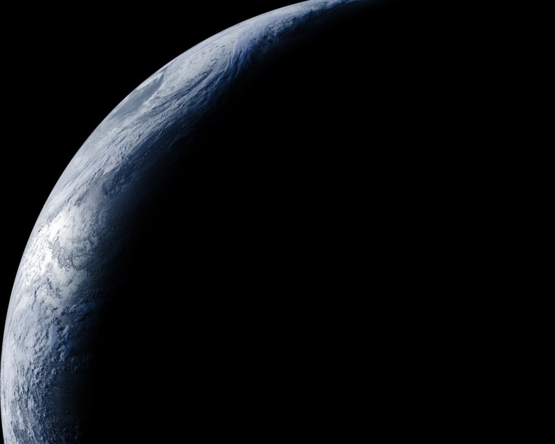
We’ve seen lots of hacks about capturing weather images from the satellites whizzing over our heads, but this nicely written how-to from [Eric Sorensen] takes a different approach. Rather than capturing images from polar satellites that pass overhead a few times a day, this article looks at capturing images from GOES-17, a geostationary satellite that looks down on the Pacific Ocean. The fact that it is a geostationary satellite means that it captures the same view all the time, so you can capture awesome time-lapse videos of the weather.
The fact that GOES-17 is a geostationary satellite means that it is a bit more involved. While polar satellites that orbit at an altitude of 800km or so can be received with a random piece of wire, the 35,800 km altitude of geostationary satellites means that you need a better antenna. That doesn’t have to be that expensive, though: [Eric] used a $100 parabolic antenna and a $100 Airspy Mini SDR receiver connected to an Ubuntu laptop running some open source software to receive and decode the 1.7GHz signal of the satellite.
The other trick is to figure out where to point the dish. Because it is a geostationary satellite, this part has to be done carefully, as the parabolic antenna has only a small receiving angle. [Eric] designed a 3D-printed mount that fits onto a tripod for his antenna.
Capturing satellite weather images is a fascinating thing to do, and this adds another level of interest, as the images show the full disc of the earth. Capture a series over time, and you can see storms spin around and across the ocean, and see just how complicated they are.
If you are looking for a simpler way to get started in receiving weather satellite images, check out this guide to converting an old TV antenna and USB receiver to capture images from polar satellites.


Difficult to point to a geostationary satellite? Dish TV? What? Maybe a little more challenge with a geosynchronous or molniya orbit but not a geostationary.
He did not say harder to point at it. Even I, as a non technically trained person, can see he means it needs a better antenna (as he said) because the signal will be weaker from a more distant satellite.
actually pinpointing a satellite in the sky is not easy especially when not mounted 100% rigidly. It takes a ton of fiddling and its even harder when its weak and you only get a few degrees of good signal, i have done my fair share of it
It was amazing doing this in high school, I believe it was 1.6 to 144 down converter on a 4 ft dish. It is still amazing, the pictures look great and the hardware is less bulky…
I had one of those downconverters too, when I was in college. Back in those days, GOES also relayed wefax maps as well.
Well the link in the article is dead so I’ma just leave my video that goes through the whole process here. https://www.youtube.com/watch?v=jGWFg7EDnyY
Well it’s nice but the picture seems to keep going dark and then light again, somebody ought to do something about that.
Who knew Earth had Macrovision? ;)
https://github.com/filipsPL/autowx2 maybe the auto social upload function will be implemented eventually
Kinda wonder how hard it would be to repurpose a DirecTV or Primestar dish versus buying a $100+ antenna…