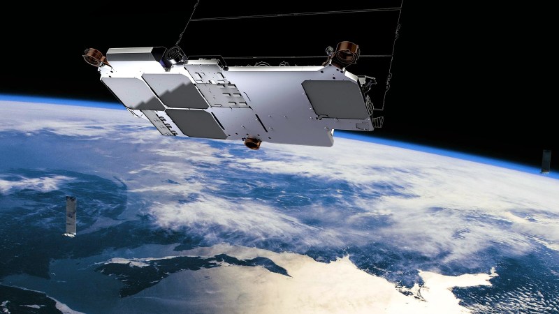
To find your position on the earth’s surface there are a variety of satellite-based navigation systems in orbit above us, and many receiver chipsets found in mobile phones and the like can use more than one of them. Should you not wish to be tied to a system produced by a national government though, there’s now an alternative. It comes not from an official source though, but as a side-effect of something else. Researchers at Ohio State University have used the Starlink satellite broadband constellation to derive positional fixing, achieving a claimed 8-metre accuracy.
The press release is light on information about the algorithm used, but since it mentions that it relies on having advance knowledge of the position and speed of each satellite we’re guessing that it measures the Doppler shift of each satellite’s signal during a pass to determine a relative position which can be refined by subsequent observations of other Starlink craft.
The most interesting takeaway is that while this technique leverages the Starlink network, it doesn’t have any connection to the service itself. Instead it’s an entirely passive use of the satellites, and though its accuracy is around an order of magnitude less than that achievable under GPS it delivers a position fix still useful enough to fit the purposes of plenty of users.
Earlier in the year there was some amusement when the British government bought a satellite broadband company under the reported impression it could plug the gap left by their withdrawal from the European Galileo project. Given this revelation, maybe they were onto something after all!
Thanks [Renze] for the tip.


8-metre accuracy is great and all… though it’s still worse than the original GPS. :/
The real question is, what possible application could make this useful?
Multi-GNSS (GPS, GLONASS, Galileo and BeiDou, …) already uses the information from multiple GNSS to increase location accuracy using Kalman filtering. The more satellites you can see the lower the error. So since Starlink still has way more satellites to deploy the 8 metre accuracy will only improve.
But the problem with using Starlink is the downlink frequencies are 10.7 – 12.7 GHz, 17.8 – 18.6 GHz, 18.8 – 19.3 GHz, 37.5 – 42.5 GHz which are very far away from the other GNSS satellites (search for “GNSS Frequencies and Signals”). You would need a totally separate system just to access the Starlink signals which at those frequencies would need to be outdoors and in direct line of sight.
Using a 10GHz downconverter you’ll have Starlink + GNSS 😍
Have you seen 10 ghz antennas vs gps antennas. Pretty big difference in size (for the gain needed)
Very true. A 10 Ghz antenna is one seventh the diameter, and just 2 percent the area, of a GPS antenna (for the same gain).
…which is completely irrelevant to the choice of downconverter frequency.
True, but that’s also an advantage, because with completely different frequency ranges, anything that jams the existing GNSS bands will miss Starlink, so it could end up being a backup for those cases.
That’s not how jamming works.
That is how jamming can work.
I guess the main thing is, that starLink is a LEO system where GNSS is mostly MEO.
Therfore the singal strenght is larger and the signals are less prone to interferences
the accuracy of 7,7m obtained in this paper is with a know altitude and a sensing time of 800 seconds. with this requirements the GPS could get much better results.
http://kassas.eng.uci.edu/papers/Kassas_The_first_carrier_phase_tracking_and_positioning_results_with_Starlink_LEO_satellite_Signals.pdf
waiting for the source to be able to test it!
I was going to make this point. But lets expand a bit.
1. It is locating a stationary receiver.
2. It takes 13minutes to calculate a single fix.
3. It will require an additional data source for the satellite positions. Currently downloaded from NORAD.
4. Good luck using this to navigate with.
5. Error is @30m for a 3D fix.
6. No mention of that the antenna requirements are for this.
The details are in the paper, but lazy news outlets never look at the detail.
GPD on my inexpensive Android phone can determine if I’m sitting in my living room or bedroom… I’ll think I’ll stick with that. 😏
>Should you not wish to be tied to a system produced by a national government though, there’s now an alternative.
Ties to a single private company.
What’s wrong with Galileo GNSS?
That’s my point. Galileo is intergovernmental (EU). I wouldn’t want to tie to a single private company over something (inter-)governmental for something like navigation.
Even better idea is one of those fancy jobs that can use multiple systems.
For sure, and bring a map and a sextant and a compas too.
>and bring a map and a sextant and a compas too.
Guess why orienteering is super popular in the Nordics and eastern Europe? (Hint: it’s the neighborhood)
Although a sextant would only be useful when combined with a nautical almanac, because you need the time and date to know where the celestial objects should be.
Yeah, and it’s a system the national government is using for its military, so they have a vested interest in keeping it operational. (With the trade-off, of course, that they reserve the right to degrade the accuracy of the civilian signals at any time — but AFAICT the “degraded” accuracy is still better than what you could get from Starlink.)
When Musk’s vanity project is so much space junk threatening to trigger Kessler Syndrome, GPS will still be trucking along.
Exactly.
Impressive
I had to install the Google GNSSLogger App to get a good precision:
https://play.google.com/store/apps/details?id=com.google.android.apps.location.gps.gnsslogger&hl=en&gl=US
With other apps it was not so precise.
While interesting, I wonder how much use it really is. For commercial GPS, the accuracy may be acceptable, but that market is already crowded by the current GPS offerings. Phones, etc already have a mature chipset to manage it, so moving to another system with less accuracy does not seem to be particularly useful.
The 2nd use is military use, the problem is precision . Military GPS can get to 30cm and while the article hints that greater accuracy can be achieved with more satellites, that is quite a step. DGPS can even achieve precision greater than that. I am not sure any military would like to be told that their cheap GPS was 30x less accurate than the opposition (I also assume 8m is the best case, and normally it will be worse)
The other problem is the frequency bands. GPS is in the MHz, while Starlink is in the GHz range. GHz frequencies get more attenuated by buildings etc. Not a problem to the receiver mounted on top of a building, but if you want to use a signal in a built up area, or even in a building, you may find you have limited or very poor signals. Again if GPS did not already exist, this maybe would not be a issue, but it does, so the question is again why bother?
I think the main potential use would be military. Unlike gps starlink is much harder to jam and attack. Being able to use it as a backup system, or as a additional source adds reliability. With regards to accuracy, keep in mind that this is the non-cooperative version. If this was ever a practical real world thing it will be cooperative, and probably much more accurate.
What do you mean harder to attack? The satellites are on a much lower orbit, even amateurs with a $1M budget could make a sizeable dent in the system…if they choose directed energy weapons, it would just be a matter of time until one can zap enough satellites to kill the system…
“GPS is in the MHz” if you mean 1228 and 1575 MHz. Most of us would call that “in the GHz”.
Barely in the GHz, which, I think, is the point.
Maybe for bad actors in battle. Using a signal that doesn’t have a selective availability option that could be switched on to increase errors, could have some value!
Thinking missiles that are a bit more accurate then non GPS guided ones or GPS that has induced errors making them miss a target completely.
The best thing Clinton did was turning off SA and I went right out and bought a GPS and still have it. Funny seeing it on an episode of SG1 with Daniel using it to detect traces of Naquada LOL.
I imagine missiles and drones for that matter have more than one way to finding their targets. Technology has come a long ways towards that goal.
There are a number of cases where localized jamming has left commercial ships and aircraft unable to use GPS. Making improvements to speed/motion limitations would be a huge help to navigation around those areas. Ships and aircraft are not likely to be operating near built up areas when this would be useful.
After the Kessler Syndrome cascade, we’ll be back to using GPS.
Pretty sure the company will fold or switch focus because of financial reasons well before that.
“Guess how many LEO constellations didn’t go bankrupt? Zero.” (Musk, March, 2020)
But they will see it through to revenue predictions, big hype, and a big huge IPO. The initial investors will make off like bandits, and the IPO suckers will be left holding the bag.
“The bag” being many thousands of satellites with an operational lifetime of just a few years, requiring regular replacement at the tune of a megabuck a pop, and beholden to SpaceX to lob them to orbit, at another megabuck a pop. And no way to generate sufficient revenue required to keep up even the replacement cost.
The only winners here are the cabal of initial investors, and maybe the launch provider.
About as “beholden” to SpaceX as we already are for other things. Why should Starlink rate a bigger mention?
It’s highly unlikely that a post-IPO Starlink will ever invest resources to try to launch on a different provider (if only because SpaceX is unlikely to divest), ensuring continuing launch revenue for SpaceX. Most other commercial payloads have an option to choose a different vehicle (though of course the bigger ones don’t, once they’ve committed to a payload integration plan).
I think the company will fold or switch focus, and then their unmaintained satellite swarm will trigger Kessler Syndrome.
StarLink = SpaceX, which is one of the top valued private companies on Earth and is dominating commercial space launch. For other providers to even come close will take at least a decade.
Are you forgetting StarLink satellites have an active avoidance systems which use military positioning and solar electric propulsion (krypton)? Besides, Kessler Syndrome is mainly a concern for satellites in orbits above 600-700 km. StarLink satellites are low enough that a “dead bird” without propulsion passively renters in months to a couple of years. Most much less.
Also; the 5 year lifetime is a feature, not a bug. Early retirement means the constellation is constantly being upgraded in speed, etc. and the satellites are MUCH cheaper to construct.
Yeah it should be one year even. Like upgrading your cell phone. They should also add ludicrous mode and self diving. They should also make vacuum rockets that they fly to capture the all the exhaust gases that all the regular flights put out. And I even have a name for it. Hyperbole.
Problem with the avoidance and “It just re-enters”. The scrap that is flying around and likely to cause more problems in the form of the Kessler Syndrome aren’t so much big chunks you can avoid, but small hard to detect fragments that hit with a force few projectiles on earth can match. These can last surprisingly long in orbit and no avoidance system has been able to avoid them. Like trying to dodge a bullet
And when such a fragment hits a satellite it does not just go “dead bird” and slowly re-enters as a single whole. It gets torn apart by the kinetic force applied. This result in a shot-gun like spray of fragments of which roughly half will gets sent into lower orbits and disintegrates, but the other half gets shot into higher-orbits where they might remain for quite a while and cause further trouble.
Qualcomm was doing something vaguely similar, commercially, with their OmniTracs system. Before 1990…
You still see those white radomes on many trucks.
It was primarily a a 2-way messaging system, but also provided positioning with a precision of a few hundred meters.
It used geo birds, in the Ku band, 12-18 GHz. It only needed two satellites for positioning (and only one for just messaging). It used time-of-flight for ranging, not Doppler.
It was very, very cool technology at the time.
All satellite based positioning systems that I know of (GPS, GNSS, Galilieo) use time of flight.
The Fine Article uses Doppler… Just like it says on the tin (second paragraph in the Jenny’s intro).
As do all the EPIRB/ELT locators (COSPAS-SARSAT, LEOSAR, etc.) Even MEOSAR functionality on the GPS, GLONASS and GALILEO constellations use Doppler for location.
MEOSAR uses TDoA and FDoA from multiple satellites for location.
FDoA *is* Doppler…
This technique is very similar to the pre-GPS Navy Transit system used in the late 60’s and 70’s. The capability of Starlink (and others) for geolocation is inherent and probably with some intention. The precision of current GNSS will be very hard to match, but the 8m has significant value with the spoofing vulnerabilities that GPS is threatened with. It is technically feasible to get sub 1m accuracy from a system such as Starlink since the main variables are timing and ephemeris accuracy (both of which need to be very accurate for Starlink to operate). The devil is in the details, implementation and operations.
A very important detail is a very accurate clock.
It works until they do sw upgrade.
Great but the original GPS didn’t prevent astronomy.
“We don’t need it”
Let’s put this one up next to “here, hold my beer”
In more urban areas there is also regular GSM, it too knows your position down to less than a meter as to ensure that packages do not collide when sent from different devices to the same base station.
However, GSM to my knowledge doesn’t share this position information with the devices (but could in the future). And a lot of masts only consider the distance from a mast, not really the direction, so still some data lacking here for it to be of general use. Preferably one would want to know the distance to two masts and triangulate from there (and this could be done on the base station side of things). And yes, this would only really work where there is decent GSM coverage.
And to be fair here, GSM base stations exist almost everywhere these days, so it likely would end up more accurate in more urban areas where satellite connections can be spotty at best. (Though, Google does something similar, but by knowing the position of various WiFi SSIDs, all though this needs access to their database for figuring out the position. Unlike GSM that theoretically could just give you your location.)
But in the end, for GSM connected devices, it could nearly be a free lunch as far as the device is concerned.
GSM is nowhere near that accurate, 10s to 100s of meters depending on cell density and surroundings. Also since you interact with only one cell at a time, it’s generally really inaccurate unless the network deliberately tries to triangulate your position (this has to be commanded, it does not do this normally), the operator doesn’t give a flying fuck about our actual position, they’re only concerned about the time it takes the signal to travel from you to the cell and spreading load.
5G should allow way more precision, as it’s more directional and needs greater cell density.
Yes, GSM only really cares about distance from the base station, direction isn’t really of direct interest. So yes, accuracy becomes a rather nice arch of possible locations.
With more accurate knowledge of the distance from the mast, a base station can more accurately schedule when each device should send its data for the packages to arrive at the mast without collisions. Getting a lousy +/- 10ns of timing jitter on our device, then we know that the distance to the device is having an accuracy of roughly +/- 3 meters.
But +/- 10 ns of jitter from a reference signal received a few ms earlier is quite awful, even for a phone. It isn’t unreasonable to be under 1ns.
However more than one base station would be needed to obtain an actual position. And to a degree this is actually done since it can help schedule broadcasts from the devices as to not conflict with other traffic around and also switch between base stations in a more nuanced fashion.
In a lot of cases GSM could give a fairly accurate position. The current problem is that GSM providers and developers has no real interest in providing positional data to the devices.
Just like Decca
No DECCA and Loran worked totally differently. https://en.wikipedia.org/wiki/Decca_Navigator_System
> “GPS? With Starlink, We Don’t Need It Any More!”
But at what price?
You may applaud the Kessler syndrome later…
To make the UK plan viable all they would have needed to add was a channel that broadcast the orbital elements of the satellite, the GPS satellites do that as part of their function. The TRANIST system doppler shifts to ID location. https://en.wikipedia.org/wiki/Transit_(satellite)
The UK only needs a backup to GPS option for a potentially very very short period of time in the event of needing it for military use and are denied ability to use GPS by a future American government
8m is plenty enough for British Navy and RAF for a Falklands 2.0 or other.