Five years ago, a 38-year-old woman was enjoying an outdoor concert with her family with one of her twin infants in her arms. In the week prior, it had been windy and rainy, but today, the weather was nice, and the concert was crowded. Without warning, a 270-year-old tembusu tree fell on the woman, pinning and ultimately killing her after the other concertgoers couldn’t remove it in time. This tragedy happened in spite of twice-yearly inspections where the tree showed no visual signs of trouble.
It’s exactly this type of incident that Singaporean officials hope to avoid by building an Internet of Trees. The equatorial island nation is home to roughly 5.5 million people, and around 7 million trees — about 6 million of which are tracked by Singapore’s National Parks Board, so that they can be managed remotely with an app. (The Board only tracks trees once they’ve reached a certain size, so we’ll assume that the other million are too young to join the fun just yet.)
While tree-triggered deaths are fairly few and far between, there are plenty of other ‘tree incidents’ that can occur, such as a branch falling, or a tree trunk snapping or uprooting. Depending on the size of the branch, this can be a dangerous nuisance as it could block roads, obscure signage, or destroy property. Thanks to the efforts of the National Parks Board, these incidents have dropped from around 3,000 per year at the turn of the millennium to under 500 per year today.
A Twin for Every Tree

This all may sound like a new-ish endeavor, but it may surprise you to learn that the program started 20 years ago when arborists geo-tagged the extant trees. Since then, they have kept up as technology progressed — geo-tagging via machine learning began about five years back, and is now automated.
Singapore’s National Parks Board monitors the trees by creating a digital twin of each one using LiDAR point clouds and artificial intelligence to do geo-location. This way, many aspects of a tree’s health can be analyzed from an air-conditioned office — a valuable asset in a place where it’s always summer.
The Board then takes the digital twins and applies finite element models to them in order to assess the tree’s overall stability — factors such as the tree’s architecture, wood strength, and the available space for roots — with regard to different weather conditions. Although it’s perpetually summer in Singapore, the country experiences their share of intense, tree-twisting tropical storms each year.
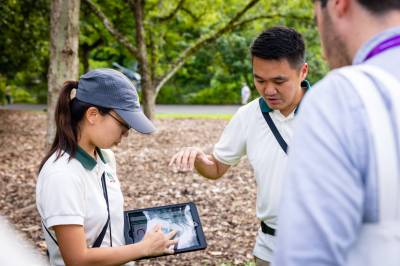
Along with examining the trees from the comfort of air-conditioned offices, the organization also monitors them physically and in the field using special drills that measure the density of trees and can detect cavities. If this rings a bell, it’s likely because of [John Opsahl]’s OpenDendrometer, which was a finalist in the Climate-Resilient Communities Challenge of the 2022 Hackaday Prize. Among other things, OpenDendrometer can help determine whether a tree is experiencing water stress, or if the growth rate has slowed over time.
Given that we rely on trees for shade, oxygen, food, and visual appeal, it makes perfect sense to monitor them even though they don’t move around much. Hopefully, this plants a seed in the minds of other governments.


While I appreciate the value add in this survey and monitoring system from an ecological study point of view, and I know a life has infinite value (outside of courts, insurance and certain parts of the world) but from a life saving point of view I’m not quite sure this is putting the resources in the right place. A device per tree and a team monitoring that many trees, obviously depending on budget and people power, doesn’t seem as effective as putting those resources elsewhere.
How about just don’t be standing under the tree in the first place? Perhaps in an urban setting where trees are around people’s homes – that would make sense.
“While tree-triggered deaths are fairly few and far between, there are plenty of other ‘tree incidents’ that can occur, such as a branch falling, or a tree trunk snapping or uprooting. Depending on the size of the branch, this can be a dangerous nuisance as it could block roads, obscure signage, or destroy property. Thanks to the efforts of the National Parks Board, these incidents have dropped from around 3,000 per year at the turn of the millennium to under 500 per year today.”
That’s why they do what they do. Let’s not get too fixated on the tree death.
It is important to weigh the costs against the benefits though. For example, did they prevent 2,500 nuisances at the cost of a whole army of government employees with clipboards? I have numerous trees around my home that could present a hazard to those near and dear to me, but I have precisely zero people using lidar and digital twins to monitor them.
I think the point is they didn’t deploy people with clipboards. The article mentions “using LiDAR point clouds” although it doesn’t explain how these were created, a quick Google reveals they use a portable scanning unit which can be carried, backpack mounted, attached to a vehicle, or even a drone.
I think you’ve made a point too about tree maintenance and how remote monitoring could prove useful. I would like to think that a monitoring system could also help to pinpoint if a tree is under distress from foreign bodies as well. 🤓👍🏿
Bit of personal experience here, I’ve literally had a tree fall in front of my car after a storm and almost kill me. My car was written off completely. Insurance covered very little but that’s beside the point. I live in a country with a lot of trees and 99% of them wont fall down any time soon. I think the damage caused by free falling is something we can prevent, but we can also prevent hunger, disease, drowning etc.etc. by putting more resources into it. If a tree does fall on somebody can they sue the authority that looks after them for negligence. I dont know enough here and I’m totally spitballing, but Singapore could build more homeless shelters or tackle any of these https://www.moh.gov.sg/resources-statistics/singapore-health-facts/principal-causes-of-death before they spend valuable resources on IoTrees.
While we’re spitballing, they could also spend the money on democracy and civil liberties: https://freedomhouse.org/country/singapore/freedom-world/2020
A huge limb of a tree I owned broke off during a hurricane and totaled my neighbor’s car. That happened despite having it pruned by a professional arborist every few years. That is what insurance is for. It is important to align costs and benefits.
“How about just don’t be standing under the tree in the first place?”
So, are you saying that parks and other open spaces shouldn’t have trees, or that people shouldn’t go to such places?
“Perhaps in an urban setting where trees are around people’s homes – that would make sense.”
What you wrote there describes most of Singapore. So you are saying that this makes sense?
And the tilt sensor (once the system is deployed island-wide) will also a help catch the few people who cut down trees illegally. Yes, even Singapore has problems with that – especially in the north near Sembawang and Yishun.
It seems just as likely that the Singaporean surveillance-state bureaucracy has just invented a whole new world of things to keep track of.
Up next: Nanosensors for blades of grass to predict illegal brown patches!
To think that in 2019 I felt bad for cycling to nearby forest and spilling 4 quarts of used oil I had after doing change myself for the first time.
Before you shout at me: I wanted to get rid of it safely, I went to Point of Selective Collection of Communal Waste (PSZOK) but I got refused there because formally I’m not a resident of town I live in. I didn’t register as resident because I planned to leave this city right after finishing university. Unfortunately it didn’t go this way. Long live goverment absurds!
I seem to be in the minority here, but I’m from the US and I find this program tremendously useful. I live in a coastal area with a mix of pine trees and scrub oak trees (they look like oaks but they grow more horizontally, with thinner trunks and branches, and thrive in salty, sandy soil). We occasionally experience tropical storms and other weather, and even with young trees the problems presented are enormous. We have no replacement for human beings with chainsaws and lengthy power line repairs, which take time and require alternative power sources and food deliveries until services can be restored.
These events almost always happen in bursts, overwhelming emergency services and requiring volunteers from the community. What we DO have is permanent GIS infrastructure, which could be adapted to track trees across the coast. It’s misleading to think about one individual tree or one individual forest, as trees in this sort of climate grow together and may be inaccessible from the ground without destroying surrounding trees.
This reminds me of a chapter in Kunetka & Strieber’s 1986 near future dystopian “Nature’s End”. Amidst a more advanced state of the sub-optimal ecological change we see today, surviving individual trees in Vermont are valued to the point where each one is instrumented to track its health. The idea is that the “homocene” era ecology is completely in thrall to human activity, and thus requires close human monitoring to enable mitigating responses.
great inovation and nice to know. Singapore is our travel list for next year.
You could have just put the old oil in the container the new oil came in, then put it in a rubbish bin.
Damn, that was supposed to be a reply to Jake Simmons above.