We found it nostalgic to watch [ve3iku] fire up an old Loran-A receiver and, as you can see in the video below, he got it working. If you aren’t familiar with LORAN, it was a common radio navigation technique before GPS took over everything.
LORAN — an acronym for Long Range Navigation — was a US byproduct of World War II and was similar in many ways to Britain’s Gee system. However, LORAN operated at lower frequencies to improve its range. It was instrumental in helping convoys cross the Atlantic and also found use in the Pacific theater.
How it Worked
The video shows a Loran-A receiver, which, in its day, would have been known as LORAN. The A was added after versions B and C appeared. Back in the 1940s, something like this with a CRT and precision electronics would have been very expensive.
Unlike GPS, keeping a highly synchronized clock over many stations was impractical at the time. So, LORAN stations operated in pairs on different frequencies and with a known distance between the two. The main station sends a blip. When the secondary station hears the blip, it sends its own blip. Sometimes there were multiple secondaries, too.
If you receive both blips, you can measure the time between them and use it to get an idea of where you are. Suppose the stations were 372 miles apart. That means the secondary will hear the blip roughly 2 milliseconds after the primary sends it (the speed of light is about 186 miles per millisecond). You can characterize how much the secondary delays, so let’s just say that’s another millisecond.
Reception
Now both transmitted blips have to make it to your receiver. Let’s take a sill example. Suppose you are on top of station B. You’ll hear station A at the same time station B hears it. Then, when you subtract out the delay for station B, you’ll hear its blip immediately. You could easily guess you were 372 miles from station A.
 It is more likely, though, that you will be somewhere else, which complicates things. If you find there is a 372-mile difference in your distance from station A to station B, that could mean you were 186 miles away from each station. Or, you could be 202 miles from station A and 170 miles from station B.
If you plot all the possibilities, you’ll get a hyperbolic curve. You are somewhere on the curve. How do you know where? You take a reading on a different pair of transmitters, and the curves should touch on two points. You are on one of those points.
This is similar to stellar navigation, and you usually have enough of an idea where you are to get rid of one of the points as ridiculous. You do, however, have to take into account the motion of your vehicle between readings. If there are multiple secondary stations, that can help since you can get multiple readings without switching to an entirely new pair. The Coast Guard video below explains it graphically, if that helps.
Receiver Tech
The receiver was able to inject a rectangular pulse on both channels to use as a reference, which is what the video talks about being the “pedestal” (although the British typically called it a cursor).
LORAN could operate up to 700 nautical miles in the day, but nighttime propagation would allow measurements up to 1,400 nautical miles away. Of course, the further away you are, the less accurate the system is.
During the day, things were simple because you typically just got one pulse from each station. But at night, you could get multiple bounces, and it was much more difficult to interpret.
If you want to dive really deep into how you’d take a practical fix, [The Radar Room] has a very detailed video. It shows multiple pulses and uses a period-appropriate APN-4 receiver.
In Care Of…
The U.S. Army Air Force originated LORAN. The Navy was working on Loran-B, but later gave up on it and took over an Air Force project with similar goals. In 1957, the Coast Guard took over both systems and named them Loran-A and Loran-C and decided they weren’t acronyms anymore. Loran-A started going away in the mid-1970s, although some overseas systems were active well into the 1990s. Loran-C survived even longer than that.
Oddly, the development of LORAN took place in a radiation laboratory. GPS isn’t that different other than having super synchronized clocks, many transmitters, and some very fancy math.
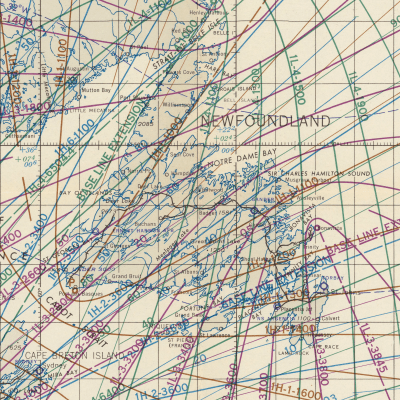
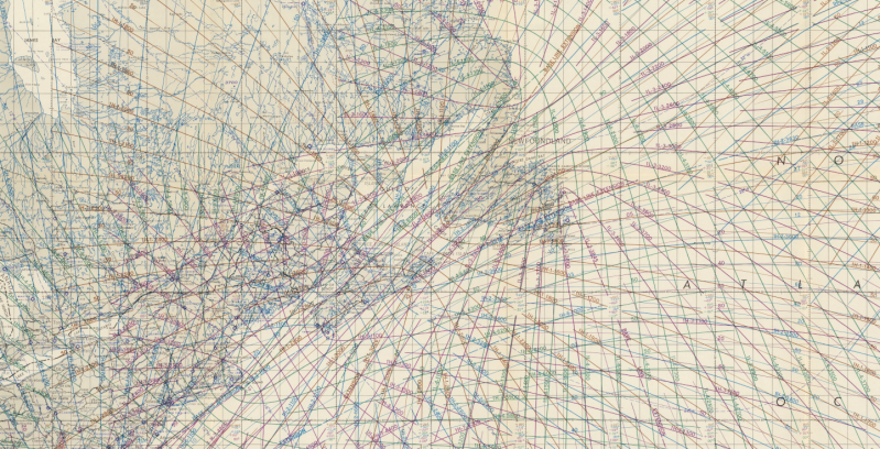
Featured Image: Detail of USAF special Loran chart. (LS-103) from the David Rumsey Map Collection, David Rumsey Map Center, Stanford Libraries.


You had to have books of tables and charts to do it. Or be good at doing trigonometry on a slide rule. The basic technique still has application today, but on a smaller scale you need some really precise time measurement. Like if you want to navigate a robot around your lawn.
Yeah, I’m almost certain the design of GPS is based directly on experience with LORAN. There’s just so many practical similarities. The differences are mostly using computers and atomic clocks to let you put the stations on satellites and automate the process.
New systems are often improvements of existing systems. It would be stupid to trow away all the experience from the past and start from scratch each time.
But also, the “proper” way to build such systems is dictated by physics. History is chock full of inventions invented twice by different people (independent of each other) and at around the same time. Inventions often simply get made when technology enables them. In the first bunch of years after transistors were invented, a whole lot of patents of different ways to connect transistors were “invented”.
Didn’t ruin LORAN A the 160m amateur radio band for decades ?
Before LORAN (back in 1928) there was eyeballing a countryside and reading a map looking for LFR (Low-Frequency Radio) Ranges and listening to the radio to hear a constant tone or a Morse code A ( .-) and N (-.) sound from the transmitters .
ref: US1937876
The stations emitted directional electromagnetic radiation, into four quadrants. The radiation of one opposing quadrant pair was modulated (at an audio frequency of 1,020 Hz) with a Morse code for the letter N (-.), and the other pair with the letter A (.-). The intersections between the quadrants defined four course lines emanating from the transmitting station, aligned along four compass directions, where the N and A signals were of equal intensity, with their combined Morse codes merging into a steady 1,020 Hz audio tone. These course lines, where only a tone could be heard, defined the air routes.
So a pilot would know when they were on course, because they would hear both signals merge into a constant tone, and they would know when they were off course because they could hear one signal more distinctly than the other. And depending on the N or A being more distinctly heard, after consulting their navigation charts for the properties of the LFR being used, they would adjust their yaw to get back on signal, and on the correct course. As well as looking for visual clues in the landscape to confirm location.
Back in the 90’s we had a loran-c receiver on board. An advanced model that displayed the actual WGS84 coordinates. For coastal navigation we had a Decca device, a more accurate short range navigation system.
I remember using Loran-C back in the early 1980’s, we had one in CIC, next to the radar screen which I also used. Oh good memories.
So a radio version of a PAPI?
Yeah, that’s a relative of another WW2 radio technique (Knickebein) used to guide in German bombers at night by indicating a flight line, and later triangulating another onto it to indicate a drop point.
This short range landing approach system was used to navigate an approach to airports, but did nothing for the general case of terrestrial and nautical navigation .
Outstanding recollection!
Australia developed VAR, for visual aural radio range. It had two visual courses, displayed like a localiser, and two A and N aural courses. The visual courses were aligned with air routes, with the aural courses often aligned to give cross bearings when passing other nav aids. It was in VHF, so less interference than MF. Also developed a domestic DME system in VHF with about 40 channels. Worked well and later replaced with VOR/DME.
Even if some people consider it’s good, VAR is the cancer that is killing football making it beuracratized mess closer to golf than good old fußball.
What about Shoran, Decca Main Chain, Hi Fix, Sea Fix. Where do all these fit into the scheme of things from this era?
Does anyone remember the ‘Transit’ satellite navigation system that also preceeded GPS ?
I remember it well! The USN had a Transit satellite receiver onboard each Fleet Ballistic Missile Submarine, along with LORAN receivers. I operated and maintained both systems.
Yes, as a marine electronics engineer, I’ve spent more than a few hours watching and waiting to see if the Transit satellite would pass over and the Magnavox or Polytechnic Marine receiver could get 5 good fixes then calculate your position. Was a good upgrade from Loran or Decca…and there was Omega too ..as long as you held your breath and got the 5th star for the 5th fix!
Saw a YouTube video recently about transit. According to the video it was used for Polaris missile guidence.
LORAN was invented in the shower by Alfred Loomis after listening to a member of the Tizzard mission describe Chain Home. They were going to name it after Loomis, but he declined. Jean Connant’s book about Loomis gives more details. The Tizzard mission brought the magnetron to the US.
Loomis organized and later disbanded the MIT Rad lab and helped Alvarez build the Berkeley synchrotron. Utterly amazing person. He held annual meetings at his laboratory mansion in Tuxedo Park which were attended by Bohr, Einstein et al.
Jean Conant’s book – Tuxedo Park – an excellent read
Great writeup! The speed of light however is about 186,000 miles per second…not per millisecond :-)
The article specifically states that the speed of light is about 186 miles oer millisecond.
I believe the statement was 186 miles / millisecond.
Could LORAN be run at set times on a ham band to allow experimentation? I think it’s allowed within the rules
A good read of the rules should reveal an answer.
Yes, in many cases it will be allowed. As long as you comform to the ‘You must transmit your callsign every X minutes’ rule, and those for unmanned beacons and their modulation. If you keep bandwidth low, you won’t be bothering many people especially if you do it during daytime on 160m only. Range will be very predictable in the daytime.
I love these kinds of technology resurrections. Grew up using a loran receiver on Lake Ontario. Our charts had all the loran TDs (time delays) in addition to lat/long and were pretty busy charts. Like anything old tech, it helped have a much better understanding of new tech that came along. I always ended up the navigator.
GPS is still used in china de HR1/k2lct: https://rntfnd.org/wp-content/uploads/2018/04/China-eLoran.pdf
I hated LORAN. Used it in the Pacific and found it highly inacurate. Thank God GPS came along!
There’s a bit of a morbid and dark history with LORAN most folks don’t know about.
The Coast Guard personnel who worked on these stations received very high doses of bremsstrahlung (a kind of x-ray) radiation while working on the huge tubes required to power these stations. Others were exposed to the high wattage output while maintaining energized towers.
Many of them have been diagnosed with rare or exotic cancers, found to be sterile, or are only having daughters if they’re able to conceive at all. There is a good write up on it here; https://www.loran-history.info/health/va_buddy_letter.pdf .
This is an exposure synopsis history; https://www.loran-history.info/health/loran_exposure_history.pdf .
To this day Coast Guard Electronics Technicians have to maintain an exposure card that tracks the amount of time they spend near energized antennas and radar sets. If you’re ever on a military ship and see red lines painted around antennas those are the no go zones when someone is using them. The problem is most radio rooms and OPCENs don’t tell the deck force crew when they’re energizing said antennas and there is no warning light.
There was a LORAN-C station in my hometown of Williams Lake, BC located on the southern end of Becher’s Prairie. I had visited it several times. I could see the strobes of the tower flashing every night. It’s a bit strange those strobes no longer light up the night sky. I do, however, have a memento of the tower before they completely removed it all :)
I was a quartermaster (navigator) aboard the USCG ship Yocona out of Astoria Oregon in the early 1980s. Loran C was a wonderful luxury that provided a seemingly automatic means to determine our location to within less than a nautical mile. However, it could be tricky at times and had a number of builtin limitations. Many problems were easily discernable or automatically detectible. One common error required constant comparison to other methods and good judgment and occasional guessing. Loran C could lock on to the envelope of the wrong pulse, which would result in being off by 10 us, or some multiple. The distance per 10 us varied by location, but was typically several miles. So it was important to always keep a dead reckoning plot and combine with position data from other sources such as visual and radar landmarks. The good news was that Loran C combined with all of our other sources was good enough that I never needed to learn how use celestial navigation 😅
My old boss loaned one to Per Linstrand and Richard Branson to navigate across the atlantic.
It was a LORAN C We got it back full of salt water as they difched near ireland. Richard invited 2guys to a big party where food and beer flowed. Richard swaggered in with wooly pullover with holes in the elbows.
I have been told new Loran stations are secretly installed recently to have a non-satellite based backup in case of WW3
There is work being done in Europe on an Enhance LORAN system that supposed to function like a ground segment to GPS. Think of it like a wide are RTK system for survey drones, or VORTAC navigation but for surface and ground traffic.
Years ago, when I was working in Motorola Federal Goverment Division, I stopped in to visit the Loran C sight in George, WA. It was a very interesting tour the Coast Guard members that manned it gave me.
Quite a few years (decades…) ago, we were bringing my sailboat from Catalina back to Ventura, it was about midnight and we had our old satnav/Transit receiver up and running, they were turning off that system and I think we got the last sat fix before the system was shut down.
We did quite a bit of sailing to Mexico, etc and would pick up a satellite fix and then DR until the next fix.
I was invited to crew on an old Vagabond 47 sailboat to Hawaii, because we didn’t trust the electronic navigation we all learned celestial nav, which was a PTA.
But we made it!
I was a USCG LORAN tech in early 70’s. Look for short youtube video “Tower to the sky” for story of building my duty station in Micronesia.