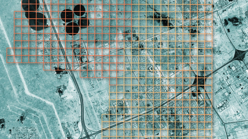
Satellite imagery is in the news right now, but not all satellite constellations are the preserve of governments. Satellogic operates a series of CubeSats with Earth imaging payloads, and best of all, they maintain an open dataset. [Mark Litwintschik] takes us through using it.
Starting with a script to recover the locations of the satellites, he moves on to the data itself. It’s in a huge S3 bucket, for which parsing the metadata becomes a big data question rather than one of simple retrieval. After parsing he loads the resulting data into a database, from which he can then perform queries more easily. He uses Qatar as his example, and shows us the resulting imagery.
The dataset isn’t comprehensive, it’s obvious that the areas surveyed have been done at the behest of customers. But who knows, your part of the world might be one of the areas in the dataset, and now you have all the tools you need to explore. It certainly beats low-res weather satellite imagery.


Mark’s blog is great — he does a wonderful job of walking through how to make use of satellite data.
His latest post (https://tech.marksblogg.com/wyvern-open-data-feed.html) is on how to use hyperspectral satellite data from Wyvern, a Canadian earth imaging company (and, disclaimer, my employer).
If you haven’t come across the term “hyperspectral” before, think of it as imagery with a lot of very narrow colour bands (rather than being bucketed into just a few broad ranges). It makes a great complement to Satellogic’s imagery — there are lots of neat things you can do by combining the two (crop speciation, finding disturbed earth, bathymetry, etc etc).
What is the Dragonette’s spatial resolution (in cm/px?) I couldn’t find it on your website.
Our spec is 5.3m/pixel.
It seems both wyvern and satellogic data are shared as static STAC catalogs, which is nice. It would be super nice if they supported STAC API so they could be searched without needing to download all the metadata first!
I wish there was more high resolution open source hyperspectral or even multispectral satellite data. It’s super fun to play with, especially if you have a background in computer vision and spectroscopy. Makes RGB kind of silly
Just saw this on Soar atlas. It was only sadly only RGB imagery. No multi spectral available?