For quite a long while now, latitude and longitude has been the way humankind has navigated the globe. This is a perfectly workable system, but it’s a little overwrought for daily use by the layperson. What3Words seeks to provide a simpler solution.
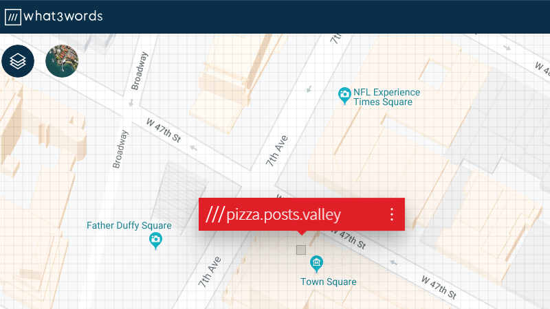
The system is based on splitting the surface of the globe into a grid of 3 m x 3 m sections. This includes oceans and bodies of water. With the grid layed out, each section is given a name consisting of three English words strung together. For example, ///eggs.form.breakfast denotes a spot in the outskirts of Chengdu, China, while ///crops.cards.gifts is a good approximation of that spot where the Naked Cowboy hangs out in Times Square, New York.
Addresses in this format are written with three leading forward slashes, along with a dot between each word. An attempt has been made to only use uncontroversial words, as well as to make sure no crude addresses are created by awkward combinations. Don’t worry, we checked – but if you do find anything good, drop it in the comments below.
It’s a tool that’s been around for a while, but an interesting one nonetheless. It’s something that needs a wider societal acceptance to become truly useful; we imagine it could be good in a small social circle once everyone is familiar with it. It may yet catch on – only time will tell!


Problem is that the algorithm is not open, and there is no promise of what happens when the company folds, or get bought, or anything else. you need to use their api, with no promises as to how the data is stored and used and sold. does not work offline either.
It also doesn’t seem to allow approximation or projection. And how do you do arithmetic?
I.e. you can’t describe all local regions as around “pizza” or describe a slew of countries as all being on the “doughnut” lat or long.
That’s a feature, one word being wrong or out of order can put an address far away from the actual location, making errors more obvious.
But why is it useful?
If anything, that’s a problem because you might remember the address wrong, and you can’t even guess what the correct one should be because it’s pointing to somewhere in Timbuktu, instead of to the neighboring shop.
It is useful because if you receive an address that is supposed to be in one part of the world but it resolves to another then you know that there’s an error. Whereas if the address is only off by a few km then you will be less likely to detect the error.
You don’t know how far away the wrong address is. It might be at the south pole, or it might be in the next county.
If the address is off by a few kilometers, the ambulance is still in the right neighborhood, rather than going 200 miles off in the wrong direction.
umm, with out extra information then how can you know if there is even an error. say that you call up emergency services and in a panic you mess up one of the words, that could send emergency services to the next street over, the next county over or just disconnect you because you are telling them that you are on the other side of the world. None of that is obvious without that extra piece of information like where they are expecting you to be calling from. So yeah its obvious if the location you give is from another country, but what if it is nearby? like within range of the same cell towers (information that emergency services is likely to have) which raises the question, with a closed algorithm, how can you be sure that any type of mix-up (word order, mispronunciation, heavy accents) will be entirely obvious?
Can’t really call it a feature if there is no way to verify that any potential error would be obvious given the limited extra data available. ABC, Always be critical, especially of anyone trying to make a profit as their motivations are only to liberate the money from your pocket, providing a benefit to you is a nice side bonus but not always necessary.
Well, there are already plenty of problems it introduces. Not open, terrible i18n, etc.
https://shkspr.mobi/blog/2019/03/why-bother-with-what-three-words/
Interesting concept… I don’t see how they’ll avoid all “awkward” addresses. An area near me has the address:
///deny.firm.rear
They will probably drown in lawsuits from landowners who find the choice of words inappropriate. Because there seems to be no way to repair it, one court order could be enough to drive them out of business.
Eh? What? Is it April fools day and nobody told me or what?
W3W has the major drawback that each phrase provides no information, just uniqueness. You have no way to tell how far apart two addresses are, or where in a general sense a location is. This makes it difficult to imagine common cases where this address system is preferable to anything already in use.
This! Lat/lon has only a few degrees of arbitrariness: where you place the prime meridian, whether you call the poles 0 and 180 or -90 and 90, etc. I guess add DMS vs decimal degrees to the list. Still, very few choices to completely describe the system.
I’m not sure how many squares there are on the earth, but _every single one_ is arbitrary in this system. It’s the maximally unsystematic system.
And for that, it’s beautiful in a way. Shame about it not being open. An enterprising hacker could script their API and pull the whole database fairly easily and serve it up for free. I wonder how they’re trying to prevent this.
Ratelimits
///takes.more.time
Already done. See https://whatfreewords.org/
In all cases, I guess https://github.com/google/open-location-code is a better system. At least, the address are hierarchical so you can know the distance between 2 addresses. What’s missing in the latter case is a word coding for these address so you don’t have to spell what appears to be gibberish.
Nice.
Of course, since the naming is entirely arbitrary, you could make a near-infinity of competing systems. One where “small.potato.vacuum” pointed to square 1, one where it pointed to square 2, …
What “plus codes” misses out on is simplicity, though. I can’t parse G24N88828+Z24 without any special training, and it would be awkward to read out. I think they’re missing the important part of the gimmick here.
That wouold be a good way to destory W3W before they destory existing methods.
Seems W3W is all about dumbing down. And making money. Obviously this is not altruism.
So they will push like crazy for adoption, they are already embedded with emergency services and then the facebook generation.
Meanwhile we have GPS
Before that in the UK we have the OS grid system.
Lets reinvent hte wheels because of stupid people that CBA to learn something mildy complex.
But will call 999 demanding help because they are on top of a mountain wearing a pair of shorts and flip flops when the weather comes in….
> I can’t parse G24N88828+Z24 without any special training
Well, from what I understood of the system, the G24N part could actually be replaced by any nearby town or city that resolves to the same square, and the 88828 is your approximate location, and the +724 is just extra precision.
So you could say “Lazytown 88828” and people could find you to within 30 meters was it?
That’s the power of the system.
Already exists: https://whatfreewords.org/
Out over open ocean the words generally seem to be a minimum of three and up to five syllables, which would make sense, so maybe not completely arbitrary.
For this use case, there’s https://github.com/google/open-location-code It’s a hierarchical system where you can get address with the minimum amount of letters/digit, but you can still compute the direction & distance between 2 points.
What’s missing is a “human pseudo DNS” other this coding, so it’s using words to state addresses.
What’s also missing is the point that addresses don’t always refer to physical locations, but end-points.
For example, my mail does not always come to my physical address – for the point that you can’t fit a microwave oven through a mail slot in a door. Hence, if I give the delivery address as a geographical location, the company has to jump through extra hoops to figure out where they should actually be delivering the parcel.
Equally, if I give the geographical location of my apartment, the taxi driver has no idea where they should be picking me up. Which side of the block should they wait at? Closest to my apartment, or to the building door?
It is a hash code in some ways. Hash’s don’t tell you anything without the table, yet everyone uses them. Doesn’t this ideas assume you are using an interactive map? Shouldn’t that make it obvious if there is an error? And isn’t it likely to be much more obvious than a small numerical error in lat/long or a house number? This reminds me of the useabilty and error detection built into imperial/ANSI versus metric for noisy environments. Imperial is all one syllable names that sound nothing like each other. Metric is 4 syllable names that are nearly indistinguishable. I hate those eight dates I ate.
1. it relies on a language. //some.funnny.square is not translatable to //manche.lustig.quadrat I would not even think of other languages where the order of words or syllables denotes the meaning.
2. it is only useful with a possibiliy to georeference it (location on a map, address), whileas traditional addresses or place descriptions have an intrinsic geolocation
3. it is not possible to give approximate locations. An “I live in Berlin” or “in Post area DE-10557” is not possible.
4. it is a typical vendor-lock-in
5. what is its relation to HaD?
5. Well, being so poorly implemented, it can be said to be a hack.
Better yet, why are the comments section so obsessed about policing the content of Hackaday?
Customers expect to get what it says on the tin
Some customers have myopic definitions of what constitutes a “hack”, but more to the point this has sparked several interesting discussions.
Which is besides the point. Should HaD be a marketing channel for proprietary technology, or a blog/newsfeed about hacks related interests relevant to its community like it says on the box?
Some times the editors get it wrong.
You mean you would expect to use this outside an interactive map app? Why?
Smart, but it’s like someone inventing something that wasn’t really asked for, and probably will never be used. See, even if I today invented yet another alternative to – as example – entering phone numbers, it would never be used. Simply because devices and standards everywhere are not made for it.
Think about it: we still today largely live with ASCII which was developed like 50 years back.
Actually, most of us use UTF-8 now.
Technically you’re both right for the first 127 characters
we really needed a global positioning system for stoners.
I prefer Open Location Code aka Plus Code.
– it doesn’t need online service.
– it doesn’t need dictionary.
I think this company is astroturfing… I remember a story a few weeks ago about this same app. They claimed a 9-1-1 operator (or equivalent) told a person to download the app so they could “find them”. I found out about this app a while ago and it’s interesting, but ultimately useless.
I’ll stick to QG62LN35 as the way to describe where “home” is.
And if yoy want to use words, Juliet November Three Five Uniform Bravo.
FN20lb here.
Maidenhead works, very good precision in eight characters.
Came to say this. Hams (and many others, I’m sure) have been using the Maidenhead grid system for many years to good effect. It’s easy to use, easy to translate to a map, easy to write, and easy to say. Greetings and 73 from central New Hampshire, FN43gm.
UK emergency services will already accept these to help locate an accident / victim. They have tied it into the call handler systems. Much easier for lay people than grid reference and pretty accurate.
Here on ad-a-day… is a nice astrofurfing piece on another garbage company. Tune in next week for an article about how the Amazon© Ring™ doorbell helps stop crime – complete with testimony from the local police!
See also https://www.bbc.co.uk/news/technology-49754820 which is an informative BBC summary of problems (not including the separation distance of two references mentioned above),
On the other hand the emergency services here in the UK have difficulty turning out to places without a postcode, such as a burning hayrick in open countryside. They are adopting W3W for this purpose.
It’s hard to see an advantage. It has an obvious application for someone remembering a static location, give a vulnerable person three words to describe their home location in case they need to contact the emergency services from a non-landline. In any other case, Lat and Long is much more useful and accessible.
The BBC report mentions people calling for help then being sent an app to get three words, it would be just as easy for the app to send a lat/long etc.
But the emergency services cannot respond to an Ordnance Survey Grid Reference, much less a global coordinate system. (For those outside the UK the Ordnance Survey of Great Britain is a UK-wide reference system tied into the detailed maps available in this country. OSGB coordinates are an option on many satellite navigation systems).
Maybe they need an app for that instead of sending one to a caller in distress.
Not sure why there’s so much negativity for this. It’s a simple little app that requires no internet connectivity (GPS signal only) and is brilliant in emergencies.
My 18yr old daughter’s car broke down in the middle of nowhere and she was in a panic. Pulled up the w3w and we could find her within a 3m square in seconds – all whilst she had no data on her phone, only a poor voice signal. An hour later we were with her and she was safe. Car was knackered though, but I guess no app can fix that :)
Even the emergency services in the UK are recommending it be installed for emergencies.
So why didn’t she had an app which gave GPS coordinates then?
I guess that didn’t come up on her facebook feed being pushed to her.
That’s the problem with this app.
It’s trying to replace something that already works and is free, with the end goal of monetising it.
The UK emergency serivces are reccommending it because they are also being lobbied AND because stupid people cannot do simple tasks like OS grid or gps coordinates. Part of our ever increasing culture of lack of responsibility.
Yeah, I guess the NATO phonetic alphabet is for stupid people who cannot do simple tasks as well.
Because three words are much easier to convey in an emergency situation that 41.267283 by -76.380981. The neck beards and autists are ruining sites like this.
copy&paste your GPS location from your navigation app and send it by SMS or any instant messenger.
Right, because that’s always an option.
I just checked mine; there’s a “Share my location” button right in the app, where you can send the information along with any of the messaging apps on my phone, email, SMS, or post it on my facebook.
If I’m on the phone, talking into it, I have at least SMS available, probably Edge (GPRS), and most likely 3G, so there are multiple means for me to send the information without a special app that translates GPS coordinates to three arbitrary words.
The problem with the emergency services however is that they’re so much being the curve that they can’t even receive text messages. In that situation, I would send the message to someone else on my contact list with the words HELP included.
>”Right, because that’s always an option.”
If you are able to download an app, turn on your GPS, and then read out the resulting three words to the emergency services operator, you are able to do the other thing which you could have done in the first place.
What makes you think autists are the ones doing the ruining?
no you are right, its way easier to use the phone that you are using to communicate with emergency services to copy a link from them, download an app and then over the phone relate 3 words via voice when the data channel exists? But i mean i guess thats what i should expect from someone who is willing to degenerate a group of people they have never met by insulting their facial hair or implying that they have special needs. GTFOH, its people like you who ruin sites with your lack of critical thinking skills:
Sure it may be easier to tell someone three words vs a GPS coordinate, but look at the steps required to get those three words and all the ways that the GPS coordinates could have been communicated before that translation. You know, like text, email, built in location services (which most emergency services should be able to pull up on cellphones that dial in)
The perfect solution is actually letting the emergency services poll the gps coordinates on any cellphone that dials into them, through both the phone hardware itself as well as the network hardware. there is no need for a third party company which is not a non profit to seek to make money off of others misfortune. plain and simple, no matter how easy it is to say three words over a voice protocol when other protocols exist and before you reply; if there is no data communications available to their phone then how will they download the app? and equally as likely: if there is no gps signal then how will the phone know what three words to translate their position to?
W3W is a solution to a problem that no one has other than laziness.
I’m going to bed that you are a paid shill. whenever you call emergency services, your phone already sends your location.also, SMS uses the same exact signal as normal cell phone calls do. Not data. So sending your location from something like Google maps or Apple maps over SMS would have worked as well. In conclusion, I hope you got well paid for your comment.
Here’s a good reason why: https://github.com/github/dmca/blob/master/2016/2016-07-05-what3words.md
I sent this in on the HAD tip line – it’s not an sneaky placement ad, and I have no affiliation with the company. As an former HAD writer, it’s comical to see that people think there are ads on here. Ads equal money, and there are no piles of money to be found at HAD. :)
Anyways….I think some of you are missing the point and this just one of them: “The system is designed to solve the an often-ignored problem of 75% of the earth’s population, an estimated 4 billion people, who have no address for mailing purposes, making it difficult to open a bank account, get a delivery, or be reached in an emergency.” “Mongolia will become a global pioneer next month, when its national post office starts referring to locations by a series of three-word phrases instead of house numbers and street names.” Link: https://qz.com/705273/mongolia-is-changing-all-its-addresses-to-three-word-phrases/
Not to mention search and rescue. Plus, now you can get a pizza delivered to places that don’t have a physical address. :)
I think *you* are missing the point. This company provides zero value over an open standard (lat/long, northing/westing, maidenheads, whatfreewords, etc, etc) and their primary presence is carefully tailored ads to promote people being locked into their service so that they can extract their toll.
It is a clever idea, and there is no law against them trying to make money, but there really is no reason to support then, let alone play into their astroturf campaign and promote their services over open/free alternatives
so, how do the Mongolians who don’t know English use the system, or are you implying that there is a direct translation for every single word in the English language to every other language in a 1 to 1 relationship (hot tip: there isn’t)
This is just flash, its a monetization of hype because the problem was already solved. It translates GPS coordinates into three English words, guess what, the GPS coordinates would have been enough in most cases and numbers are pretty universal as no language that i know of has multiple words for the same number. All of the benefits that you have mentioned were possible with GPS coordinates and this system just translates those coordinates into three English words…. not so good for non English speaking people is it now? shoddy translations are going to cause more problems than this “solution” is going to solve!
How many of those 4 billion people (which is no way near 75% of 7.7 billion) speak English, need junk-mail, need a bank account etc etc. This will fail just like Facebook trying to bring the internet to rural India or Africa, its a first world solution to a first world problem: people cant be bothered to learn how to locate themselves on a map given the existing tools that have been around for centuries (sextants were used before satellites)! That is why everyone thinks that this is an advertisement on hack a day! because the majority of us see how stupid this entire idea is and how it just furthers the dumbing down of society into becoming reliant on some third party company who may or may not exist in 5 years.
Maybe Mongolia can step up then and do it. With rampant homelessness and mental health problems here in the USA, I really don’t have any concern that some sheepherder 10,000 miles away is not in the Silicon Valley ecosystem and cannot be ‘found’. Maybe he likes it that way.
W3W are an extremely litigious company and are very hostile to any form of open interoperability/reverse engineering. It’s also very dubious attempting to assert rights over what’s basically a numbering system and encouraging widespread use of a system which is monopolized.
https://wiki.openstreetmap.org/wiki/What3words for yet another list of reasons W3W is best avoided.
>”Ads equal money”
More precisely, ads equal someone else paying money for you visiting a particular website that shows ads. This is unethical. This should not be.
IIRC they charge a fee to emergency services to use this. To my mind, that is despicable.
And they have a PR division doing an incredible work of seeding these stories in the press, flying around to convince device-makers they’d be fools for not implementing it, etc.
Google’s competing “plus codes” (later standardized as Open Location Code) isn’t going to catch on without a similar push to displace the evil moneygrubbing W3W.
A old-school way of doing this is what hams do and use https://en.m.wikipedia.org/wiki/Maidenhead_Locator_System
I found place where time stands still …https://w3w.co/yesterday.today.tomorrow
Since this is online only, to me this appears to be a geolocation tracking system, to profile it’s users for advertisers. But then again I’m probably not their target market.
What makes you think it is online only?
Can you tell me how they can have an offline API to their databases and word lists.
https://docs.what3words.com/api/v3/
This only work by the application uploading a GPS longitude and latitude and returning a three word string.
I’ll stick to the Maidenhead Locator System which can easily be calculated offline, and is not closed source.
http://n1sv.com/PROJECTS/How%20to%20calculate%20your%208-digit%20grid%20square.pdf
You could even add a Fourth(~1km), Fifth(~100m), Sixth(~10m) or Seventh (~1m) pair to increase the precision.
Sorry, they do have it offline (ref: https://support.what3words.com/en/articles/2212844-does-what3words-work-offline )
But I’ll stick to the non data harvesting Maidenhead Locator System, which works offline, can can be calculated with a pencil and paper if needed.
It requires licensing a database from them (large), using their code as provided (messy) and paying $$$ (licensing model is unclear, but some users state per user, others state lump sum).
Since those terms are a non-starter for anyone with a brain, i summarized as “not available” sorry.
You replied to me and I was talking about the Maidenhead Locator System. So I just to be clear to anyone else that is reading this that it is none of the above. If you can calculate your Maidenhead Location with a only a pencil and paper it does not require any database. And you can easily roll back from a Maidenhead Location to a latitude and longitude and then use the standard Vincenty’s formulae to calculate the distance between any two points on our local spheroid.
But the three word API is everything that you said.
///detonated.anticipating.females
///manly.exhaling.upstairs
///extinct.developer.shows
(and I think I can continue like that)
What is this? A DNS for coordinates?!
Nope, it’s worse than that; DNS values are hierarchical so if two DNS locations differ in only the last set of digits, ther are more likely to be part of the same organisation – not so with W3W which is more like allocating DNS for every single node from a random number generator.
This has the benefit of making errors obvious.
Which is of no practical use. If you enter the address and you end up in Mongolia, you still don’t know where you actually should be going, and you can’t even guess because it’s nowhere near the real location.
Besides, don’t assume that obvious errors are obvious.
If you enter a three-word address wrong and it sends you France, how long will it take you before you start questioning your car’s satnav? 50 miles down the A10? When you’re at the ferry across the canal? People follow car navigators through wheat fields and into rivers, completely disregarding the fact that the road ahead doesn’t look anything like a road.
Likewise, if you say the three words to the emergency services operator, and they hear “fee” instead of “feed”, the ambulance may go to the next county. You don’t know how far away the wrong address is – it might still be in the same country.
///smoke.this.herb
LOL, it gets better :). ///inhale.herb.smoke
You can buy a ///second.hand.still in Alaska. Need a boat, though.
I guess Microsoft’s secret heaquarters are in Idaho: https://what3words.com/bloated.operating.system
Yep – this is why no one like to write for HAD.
I’m known as someone who usually supports the HackaDay writers to a fault, but I feel you might be being a bit harsh to the folks in this thread, as they were just doing what was asked in the article. Quote from the article: “…but if you do find anything good, drop it in the comments below.”
Thats stupid crap. Just educate people to understand/use standard coordinates that every GPS/Galileo/…-receiver spits out and that are understood by Openstreetmap, Google Map, … No need for yet another commercial thing with proprietary stuff and that is probably logging and selling some data to $somebody.
I worked 10 years for a company making navigation devices. But I still can’t remember even the coordinates of my company’s headquarters. Even though I saw them almost every day in those 10 years.
There is already a standard for this, and it exist since a lot of time !
https://en.wikipedia.org/wiki/Maidenhead_Locator_System
THIS! I also came in here to say “grid squares” have been in use for decades and work extremely well. There is zero need for a closed-sourced, monetized system.
Isn’t 3m x 3m the block size in Minecraft?
That would be a very large block. I think they’re closer to 1x1x1.
They are exactly 1x1x1
Why am I reminded of the old VCR+ codes?
And where are they today? Sitting next to the buggy-whip manufacturers.
Got to be one of the stupidest ideas I’ve seen this month.
English-centrism makes it a non-starter.
The words have no meaning. Give me latitude and longitude and I know roughly on the globe where you’re talking about, without recourse to some database. Give me three words and I have no idea.
And the claimed rationale — “it’s a little overwrought for daily use by the layperson” — is hardly specific or obvious, nor is it obvious that if so, this silly system addresses the alleged problem.
Ok, this is a point, coordinates might be harder to remember than three words. But still, you can just write them down, put them into your smartphone or some other device, invent some mnemonic to not forget them, use another system like the one radio operators use and so on. No need for proprietary stuff. And btw, for somebody speaking some african language for example remembering three english words might be hard.
OR, we could use a system that defines points on the globe precisely… numerically. Without the mish-mash disorder of random words that cannot convey relative position information when comparing two points.
Oh, wait! We already have ten versions of that.
The instant problem I see with this method of localization is that it doesn’t provide any relative information…
How far away is pizza.dog.house from tree.glass.yoghurt?
While the current longitude latitude system gives a rough idea of the direction at least…
Not to mention that the current long.lat system also can show you your progress.
As an example: 54.911 by 3.138 is more north west of 54.852 by 3.223
Though, anyone saying that this is in the middle of the North sea is also correct.
But the idea of the long.lat system is though not to find your way around a city. But the long.lat system is generally the backbone for maps to use for localization.
And to be fully honest, W3W is nothing but a abhorrent cipher of the long.lat system, also with lower precision, since the long.lat system has infinite precision not some arbitrary 3 meters, it is just up to you how accurately you can measure it.
Though, I can fully see from where the W3W came from, likely from the statement, “Using the Earth’s axis and an arbitrary point in England is so hard to relate to when being thousands of miles away from it.”
But at least I know where it is. W3W doesn’t tell me anything with its three words, since it doesn’t give you relative, nor absolute position. Unless you ask them, and that is a stupid system…. It is literally as useful as assigning a randomly generated ID number to each 3 meter square on the Earth’s surface. But the words W3W uses can have some logical relationship with absolute position. But the use of 3 words for a 2D map makes less sense, since surely they don’t take elevation into consideration?
In the end, W3W is a tame looking, but useless positioning system that frankly would have no useful meaning when actually navigating. Unlike the long.lat system that one can know that the 5th decimal place is roughly in meters. (Or the 6th decimal place is roughly a third of a foot.) But in the end, one can just ask any of the modern map services about where something is, and how far it is there, or even get directions too…
One of mine ///pizzas.joyously.unhurried
I’d like it if there was a way to get a list of all the combinations in a selected area.
Absolutely shameful to see this PR fluff piece on Hackaday. W3W is a scourge to open information, suing the pants off anyone who tries to make an open implementation, and paying automakers and others to implement their system at the exclusivity of open options.
I would expect a piece about alternatives to the evil empire, not how great the emperor himself is.
I like using airport codes to describe my location.
Where am I? YVR is close enough.
Where’s a good place to drink beer as I type this? MUC
IATA, ICAO, FAA?
Is ///crime.infested.hell-hole taken?
I had to give this one a try to see where it went… https://what3words.com/bacon.cheese.burger
It changes the 3 words after bringing up the map, but funnily enough it’s a medical center :}
The system in the article isn’t even a standard, so it’s actually worse than you suggest.
How about you change to a decimal based lat/long. Two 7 digit values gives you 3m accuracy. Might as well change to decimal time so the upper two digits of longitude gives you your local time offset.
Why not lat-long in Radix 60? I’m guessing they will be short enough to work with. Lets see 47.3293° N, 122.5801° W is the same as l.Jj , 22.yM. Hmm. The upper/lower is a pain. Base 36 is 1B.2JH , 3E.4H5 where I’m converting the whole number and fractional part separately to aoid repeating decimals (36imales?).
Want to see what xkcd does with this.
I am thinking some combination of
geohashing https://xkcd.com/426/
with password generation passwords (correct horse battery staple)
https://xkcd.com/936/
https://what3words.com/horses.battery.staple
Central Nunavut
https://what3words.com/correct.horses.battery
East of Kawawachikamach in Quibec
https://xkcd.com/2170/
The what3words web site is lame in that it takes a lot of messing about to figure out
where it is showing you if you type in an arbitrary location.
(Have to scroll out a lot. Should start at a scale where there are some readily identifiable nearby features. Which for most of the earth is a very large scale.)
I note that there is some debate in the comments over whether this is awesome or awful. I side with the awful, and I also note that what3words is being advertised heavily in the UK right now as being of great help to the emergency services. That use case makes no sense to me, so I started to put a proof of concept of something I felt would be more useful to that use case together. I haven’t done any work on it for a while, and it certainly needs more polish but https://www.craig-james-stewart.co.uk/blog/tags/location-finder/ is the updates on what I have.
In that example the person you want to locate would need a smartphone with location services enabled, and access to the internet, but that’s no worse than the requirements for what3words, and they don’t need a specific app to determine their location, or to read it out over the phone.
Can’t believe no-one has mentioned homophones, or near-homophones. My current location contains a past-tense word ending with d; taking off the ‘d’ I get a location on another continent. That means to give my location verbally and especially anytime sound is unclear, I’d have to spell it out, making 23 characters including the dots.
Hey, I’ve got an idea that’ll work for a lot of places: 3 words and a number! e.g.
Australia.Sydney.Wallabyway.32
Rural addressing works too, with 10ths of km from the start of the road forming the number.
I’ve been using this for the past few years when I visit Thailand. I can’t read Thai but I can find stuff on map with satelite overlay. Using what3words addresses in the NAV Mii android GPS app makes it much easier to get taxi’s to where you need to be with out been able to speake the local language.
I don’t buy it. Use Google maps and show it to them. That what everyone does.
https://what3words.com/long.trouser.snake somewhere near Rome
///fart.fart.fart (in Sweden)
More addresses consisting of the same 4-letter word repeated:
http://qallee.net/w3w.php
seems useless numbers don’t have language barriers. I’ll stick with lat long