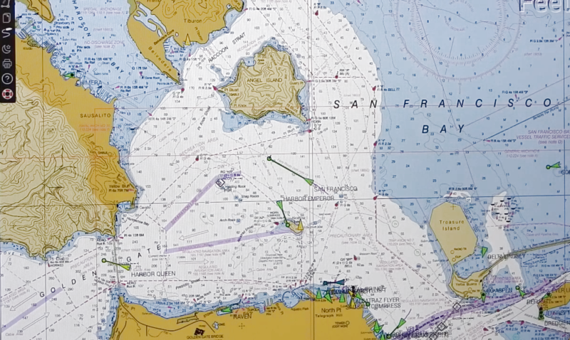
As the Raspberry Pi in its various forms continues to flow into the wild by the thousands, it’s interesting to see its user base expand outside beyond the hacker communities. One group of people who’ve also started taking a liking to it is sailing enthusiasts. [James Conger] is one such sailor, and he built his own AIS enabled chart plotter for a fraction of the price of comparable commercial units.
Automatic Identification System (AIS) is a GPS tracking system that uses transponders to transmit a ship’s position data to other ships or receiver stations in an area. This is used for collision avoidance and by authorities (and hobbyists) to keep an eye on shipping traffic, and allow for stricken vessels to be found easily. [James]’ DIY chart plotter overlays the received AIS data over marine charts on a nice big display. A Raspberry Pi 3B+, AIS Receiver Hat, USB GPS dongle and a makes up the core of the system. The entire setup cost about $350. The Pi runs OpenCPN, an open source chart plotter and navigation software package that [John] says is rivals most commercial software. As most Pi users will know the SD card is often a weak link, so it’s probably worth having a backup SD card with all the software already installed just in case it fails during a voyage.
We’ve seen AIS receiver stations built using the RTL-SDR, as well as a number of projects around the AIS equivalent in aviation, ADS-B. Check out [John]’s video after the break.


> for a fraction of the price of comparable commercial units
To be fair a commercial unit transmit as well as receives (the above uses a Si4362 which is RX only). And I’m sure it has to meet actual safety standards as well as being FCC certified.
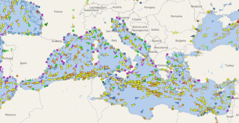
excellent FlightRadar24 implementation on the sea
my congratulations
This video is sponsored by openCPN, oh wait…
OpenCPN is cool software, runs on variety of platforms (Windows, Linux, RPi, even TinyCore Linux). It supports .mbtiles, OpenStreet maps you can generate (again for free) from Maperitive, add cheap USB-GPS dongle and you have position display solution for your ship or bus or whatever you like. It also supports network GPS source.
I’d hardly say it’s a hack if you install and use software the way it was intended to be used, but nice article for getting people more familiar with this excellent opensource software.
I used OpenCPN to plot my sextant fixes (while on land). It’s a very useful tool.
Brave New World ! Open source is a great thing for innovation and competition. Question is will open CPN stay open source moving forward ? Should we make this open source too ? http://Www.NeySEApilot.com it’s a patented software defined gps autopilot navigation system for ships , yachts and boats. Uses OTS hardware and does not need a sea trial for it to be deployed. Self driving functionality for ships yachts and boats. Not a pid controlled solution either. Simple. Should we open source it like open CPN ? Thx. J
If you are one of the authors or owners of NeySeaPilot then making it open source would be a great idea. If you don’t have an ownership position, then I suspect the argument wouldn’t win much favor with them. There have been cases where closed source software is opened, but usually when the owning company can’t make much money on it anymore and would like to dump the support onto the open source community. Looks like an interesting project though.