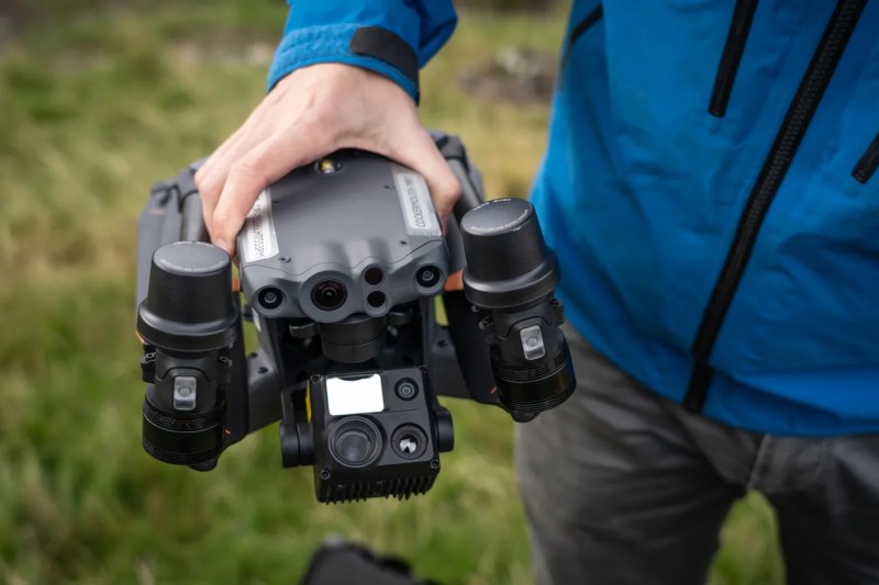
When a new technology first arrives in people’s hands, it often takes a bit of time before the full capabilities of that technology are realized. In much the same way that many early Internet users simply used it to replace snail mail, or early smartphones were used as more convenient methods for messaging and calling than their flip-phone cousins, autonomous drones also took a little bit of time before their capabilities became fully realized. While some initially used them as a drop-in replacement for things like aerial photography, a group of mountain rescue volunteers in the United Kingdom realized that they could be put to work in more efficient ways suited to their unique abilities and have been behind a bit of a revolution in the search-and-rescue community.
The first search-and-rescue groups using drones to help in their efforts generally used them to search in the same way a helicopter would have been used in the past, only with less expense. But the effort involved is still the same; a human still needed to do the searching themselves. The group in the UK devised an improved system to take the human effort out of the equation by sending a drone to fly autonomously over piece of mountainous terrain and take images of the ground in such a way that any one thing would be present in many individual images. From there, the drone would fly back to its base station where an operator could download the images and run them through a computer program which would analyse the images and look for outliers in the colors of the individual pixels. Generally, humans tend to stand out against their backgrounds in ways that computers are good at spotting while humans themselves might not notice at all, and in the group’s first efforts to locate a missing person they were able to locate them almost immediately using this technology.
Although the system is built on a mapping system somewhat unique to the UK, the group has not attempted to commercialize the system. MR Maps, the software underpinning this new feature, has been free to use for anyone who wants to use it. And for those just starting out in this field, it’s also worth pointing out that location services offered by modern technologies in rugged terrain like this can often be misleading, and won’t be as straightforward of a solution to the problem as one might think.


That is not a custom drone software. That is software outside the drone that uses the video and processes it.
It’s like saying “I made aeroplane software” when writing a new version of ADS-B decoder.
Purely from the wording, you’re not wrong. But as I understand it, their software includes also the autonomous flight which they kind of optimized for searching. From the original content: ” In their spare time, they’d been developing a new piece of piloting and image analysis software”.
Perhaps we should not act like patent examiners and interpret words in a nit-picking way. ;-)
What these folks did and still do is really great! It shows that you sometimes need to be stubborn and do things despite what some worryguts think. Although the story has a sad part. Hopefully, their work will help to find missing persons in time in the future!
If it quacks like a duck, walks like a duck….
A system like this could be run purely on flight hardware but it would function the same.
So pull up in a jeep, deploy X number of drones from charging points on the back, photograph 1 square klick (one square kilometer; 0.62 square miles), at a typical drone velocity of 16 to 48 km/h (10 to 30 mph) with a carefully selected number of drones this should take mere seconds to complete. While moving 1 kick over, download and process all data, using an AI model that had previously been trained with datasets designed to flag GPS coordinates for all found humans.
In fact the drones could be deployed when entering the a new grid and automatically land in the back of the jeep at their recharging point when exiting the grid. It may need spare drones to allow for any difference in charging times or some kind of rapid battery pack swapping by human or machine.
In fact with the right algorithm maybe only get drones to land and upload their data when their battery goes low enough with a say 60% safety margin.
But I guess that howling wind, driving rain and heavy snowfall may limit the usefulness of drones. But at nighttime at least they could use Infrared Thermal Imaging cameras, which would highlight all sources of heat. But of course a separate nighttime AI model that had previously been trained with a fully IR dataset might be required for optimal results.
Definitely an interesting application or AI and drones.
And don’t forget another thing. Today, such searches are often carried out using a helicopter where humans stare into the landscape trying to identify something “unusual” (which does not belong there). How long does it take before they get tired? As it requires high concentration, I assume it is in the range of some tens of minutes, most likely less than an hour.
Automated imaging and image analysis – even with traditional algorithms – sounds definitely helpful here. Not replacing humans, not in all situations, but as an additional aid. I also could imagine using autonomous “model planes” instead of multicopter drones to allow for longer flight times or larger areas. But this highly depends on the landscape.
Drone Swarm, For good rather than Bad..
Technology can go both ways..
Cap
Look at it this way even “salt” in the wrong hands can be used for total evil purposes, I mean pure evil. With common salt, normal water and a DC current you can make sodium hypochlorite based bleach. And I will just leave it there, because everything else that you should never mix that with are pretty much all common household products.
And that is just common household salt, at the end of the day everything boils down to people with good intentions and people with bad intentions. Oh and knowledge, the more people know the less evil they generally are inclined to do, the emptier the vessel well ….
Why a Jeep??! Why not a Ford Bronco or a Tesla Cyber Truck? lol
I’ve a friend who worked for a power company and they need to sometimes drive up 45 degree slopes in heavy snow with chains around all four wheels.
Extreme cold and using EV batteries is not an optimal choice. I was thinking of any kind of generic pickup truck that the drones could take off and land in without problem while in motion.
What really would be a good addition would be to add a RECCO detector on drones. Since its a passive component for the one in distress, it makes it easier for hikers to just have it on person as a backup, should other tech either run out of power or malfunction. Honestly I’m surprised that SAR, and hiking groups aren’t trying to bring RECCO into the forefront of usage.
Interesting technology, so a RSCCO reflector is basically an antenna tuned to 457 kHz and a diode and nothing else.
Sorry that is for the avalanche system (lower frequency has a greater penetration depth). The normal RSCCO is ~900MHz active ping and the returned passive ping is double so ~1800MHz
It is called a “harmonic radar”
Here in the alps RECCO is available in next to every helicopter used in rescue missions. It’s main intention is avalanche rescue, so you find it quite often in ski wear. However, the active transmitter is rather bulky. And even a hand-held one weighs almost 1kg.
Just been to their (RECCO) website. It seems that they want to extend the use of the system to more than just skiing. (They want to continue earning money. ;-))
We are using the PX4 eco system (ref. https://px4.io/) for exactly that… it includes the hardware specifications (Pixhawk ref. https://pixhawk.org/) autopilot firmware (PX4), communication protocol (MAVLink ref. https://mavlink.io/en/) and Ground Station Application (QGroundControl ref. https://qgroundcontrol.com/). The latter running on Linux, iOS, Android and Windows and providing all the necessary tools for planning and execution of such missions, taking the specification of the sensor into account (FOV, resolution, overlapping, etc). And rhe best part: it’s all open source, has a huge community and is widely used for highly automated systems 😉
“Thanks to new image-analysis software, humans can be more easily located among even dense foliage and rocky ground.”
Step two: add gun turret to drone. #skynet
ideal for army
;(