We always enjoy [History Guy]’s musing on all things history, but we especially like it when his historical stories intersect with technology. A good example was his recent video about a small secret group during the Second World War that deployed to the European Theater of Operations, carrying out secret missions. How is that technology related? The group was largely made of scientists. In particular, the team of nineteen consisted of a geographer and an engineer. Many of the others were either fluent in some language or had been through “spy” training at the secret Military Intelligence Training Center at Camp Ritchie, Maryland. Their mission: survey Europe.
We are spoiled and enjoy several different GPS systems that can pinpoint our position quickly and easily, but that’s a modern invention. In the old days, everything came down to a geodetic reference point, usually an iron rod or some form of marker with a well-known position. Using surveying equipment, you could position other locations by referring to the reference points.
You might think that the exact location of a city isn’t that important if you are invading it. But, as the [History Guy] points out, sending artillery over the horizon being off even a little bit can have disastrous consequences. Of course, other countries had good references, but they were often not made available for obvious reasons.
The Army sent out a call for “geodesists.” They found Floyd Huff, a Civil Engineer with the requisite experience. They made him a major, and he led a secret band through liberated areas right behind the front line. They carried about 1,800 pounds of cameras and a database of both what was known and locations like libraries and schools that might have enemy geodetic data.
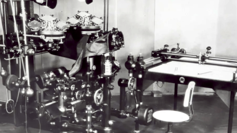
It paid off. Between talking to captured soldiers, finding sympathetic academics, and finding bombed-out libraries, they were able to use their cameras to make microfilm to get better data to the front lines immediately. They even found the entire database from the German Army, but had to mount a significant operation to secure it before the Russians took over the city. They even captured high-tech equipment the Germans used to change aerial photographs into topological maps.
Some of the techniques these secret scientists developed have had far-reaching consequences on mapping. The video explains it, and, as usual, it is fun to watch and educational. If you prefer to read, you might enjoy this older article from The Smithsonian.
Like many secret agents, they aren’t well known because — well, you know — they work in secret. Huff is featured in the — we aren’t making this up — National Geospatial Intelligence Hall of Fame.
With modern tech, it is easy to forget what a technical accomplishment it is to know exactly where things are. Of course, GPS is supremely complicated, but not for us, its users.


Yes, it’s a real thing.
https://www.nga.mil
Uh, did ya guys watch the video? Those people doing the job were engineers.
Still sort of an issue.
The nation where most of the worlds civilian maps are printed has draconian rules about idiotic dashed lines and required inaccuracies in their own city/infrastructure/military locations.
Who they think will be fooled is a good question.
But what poo bear says, goes.
“The nation where most of the worlds civilian maps are printed has draconian rules about idiotic dashed lines and required inaccuracies in their own city/infrastructure/military locations.
Who they think will be fooled is a good question.
But what poo bear says, goes.”
Do you understand that that makes no sense? “Do you hear the words that are coming out of my mouth?”
Whatever you’re selling you’re doing a piss-poor job of it.
Derp.
Buy a Chinese map without the West Philippine sea marked as Chinese territory.
They are illegal to print in China.
Dimwit.
“With modern tech, it is easy to forget what a technical accomplishment it is to know exactly where things are.”
A statement orthogonal, or cognate, to “if World War III is fought with nuclear weapons, the one after it will be fought with spears”.
“high-tech equipment the Germans used to change aerial photographs into topological maps” – for “topological” read “topographical”.
But the real question is.. was the property (equipment) ever given back to its rightful owner? ;)
As military equipment, it would have counted as ‘war booty’, so the rightful owner is the United States. https://ihl-databases.icrc.org/en/customary-ihl/v1/rule49