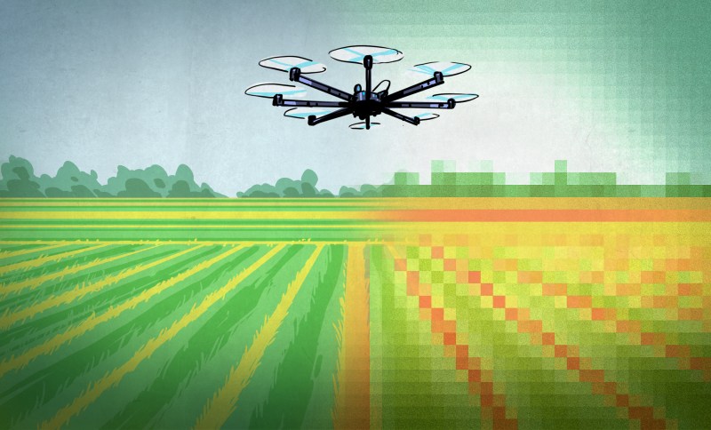
Whether you call them UAVs (Unmanned Aerial Vehicles), UAS (Unmanned Aerial System), Drones, or something less polite – people are more familiar than ever with them. We’ll call them drones, and we’re not talking about the remote-controlled toy kind – we’re talking about the flying robot kind. They have sensors (GPS and more), can be given a Flight Plan (instructions on where to go), and can follow that plan autonomously while carrying out other instructions – no human pilot required. Many high-end tractors are already in service with this kind of automation and we’ve even seen automated harvesting assistance. But flying drones are small and they don’t plant seeds or pull weeds, so what exactly do they have to do with agriculture?
There are certain things that drones are very good at, and there are things in agriculture that are important but troublesome to do or get. Some of these things overlap, and in those spaces is where a budding industry has arisen.
Let’s cover what drones can offer and what growers can use, then dig into what is out there and happening over some fields right now.
These Things are Important to Farmers, but are Limited or Troublesome
- Confirmation: Verifying that plants are growing where and when they should, and checking this as early and often as possible.
- Early Detection of Problems: Detecting areas of poor growth and crop damage as early as possible, limiting impact and maximizing the chances of doing something about it.
- Fertilizer Planning: A crop will never grow completely evenly, and choosing where to put fertilizer and how much to use based on plant density and health (instead of spreading it uniformly) can save significant money. This is called Variable Rate Application and anything that helps it get done more accurately saves money and increases crop yield.
The common thread here is knowledge of what is actually going on, right there in the ground. The term for this is “ground truth”. The usual way to obtain ground truth is by putting your feet on the dirt and using your eyes. But this doesn’t scale well, since crops can cover very large areas. Eyeballing things from a vehicle doesn’t help much, because if there are areas of poor growth mixed throughout a field, it’s very hard to perceive that visually. One part of a field looks pretty much like any other when you’re at anything near eye level. You don’t have the right perspective. That is where drones come in.
What Drones Do
The kinds of drones that have a use in agriculture might look like toys but they are much more obedient. They have capabilities that include:
- Carrying cameras and taking pictures tirelessly, consistently, and with precision.
- Having an unobstructed bird’s-eye view of things, thanks to being airborne.
- Being fast; they are able to cover large areas quickly without needing roads or paths.
Those abilities are used, along with some back-end software processing, to quickly get a depth of information on crops that simply wasn’t accessible before.
Here is what happens: a human gives a drone a flight plan that covers a field. The drone flies over the field in a pattern while taking pictures with one or more special cameras. These pictures are geotagged and overlap each other. After landing, software is used to stitch the photos together into a large mosaic, and processing is done to interpret the amount of light reflected in different wavelengths. Generally speaking, the healthier the plants, the more they reflect in near-infrared – a higher wavelength than visible light not normally perceptible to humans, but can be captured by cameras. Processing this data makes areas of healthy growth stand out compared to everything else, and makes areas of poor growth or stressed plants easy to identify. Having this data generated nearly on demand opens the door to all kinds of better decision-making for growers. Problems are detected earlier and more accurately, and no time is wasted checking on areas where all is well.
How Plant Health Gets Measured
Plant leaves – technically their main pigment, chlorophyll – strongly absorb visible light for use in photosynthesis. But healthy plant leaves also strongly reflect near-infrared (NIR). Different species of plants reflect somewhat differently, but non-plant material does not reflect in this way at all. Gathering this data and processing it in a way that makes it useful is how remote imaging detects plant health.
![Leaf reflectivity [source: Agribotix]](https://hackaday.com/wp-content/uploads/2016/04/leaf-reflectivity-via-agribotix.jpg?w=400)
NDVI isn’t quite enough by itself, however. It has practical limitations, and the issues satellite imaging has had to solve are different from the challenges drone imagery faces. Applying the concept to drone imagery has had its own quirks, as this blog entry by startup Agribotix explains in some detail. But fundamentally the NDVI principle is still what allows modern drones to take pictures of a crop with specialized cameras, use computers to process that data, and turn it into a color-coded aerial map that is easily understood.
![NDVI processed images. Left: crop growth as a green gradient blended with normal visual imagery [Source: Agribotix] Right: NDVI processing with plant growth as a red gradient [source: Public Lab Wiki]](https://hackaday.com/wp-content/uploads/2016/04/nvdi-sample-images-agribotix-and-public-lab.png?w=800)
What’s Around the Next Corner
Providing growth maps and health reports in a timely fashion is currently the most mature application of drones in agriculture, but it is not the only one. Other applications are on the map – such as using drones to not only plan fertilizer application, but to dispense fertilizer directly. In areas where irrigation farming is common, managing a large amount of irrigation hardware is a big job that could be helped by airborne observation. Anything that puts more complete information into grower’s hands faster is a potential for growth, and drones allow more ways to do that than ever before.
Of Course, There are Things in the Way
Implementation issues for emerging industries aside, there are still plenty of other challenges to drone usage. Drone usage outdoors is highly weather dependent. Flying can be limited by weather, but changing conditions like varying sunlight and cloud cover can make data harder to process. Most crops are in rural areas with limited internet access and cellular infrastructure. Limited flight time is a factor, especially for multirotor aircraft. Drones and their cameras are expensive. They might be capable of autonomous flight, but they still require maintenance and skilled operators. Drones are not very good at carrying payloads – we will probably see package delivery by drone before fertilizer application by drone is common. And of course, there’s uncertain government regulation.
There are plenty of variables in agriculture and drone usage only applies to a small number of them, but it’s a budding industry that seems to be growing as quickly as it can – and the world of agriculture is certainly no stranger to high-tech solutions and expensive equipment. But the devil is always in the details, and even when you have all the pieces available, implementation can be rocky. Have any of you been involved this growing industry? Let us know in the comments – we want to hear from you!


Although small drones are indicated here it seems obvious that heftier specimens would surely take over the crop dusting business and if the maping of the fields could be digitalized (which probably requires no major technological advance) the whole dusting business could be made automatic.
“it seems obvious that heftier specimens would surely take over the crop dusting business ”
Yes, and we should call this new invention a “helicopter.”
Doesn’t really matter what form factor it has, if it’s autonomous it is pertinent to this article.
Funny, but you have to pilot a helicopter and not a drone. That’s the whole point of this.
I don’t think they have any autonomous flight algorithms that are crazy enough to dust crops.
https://www.youtube.com/watch?v=kYs215TgI7c
I suspect they could.
In Asia, drones are currently being used in crop dusting applications.
Programming like this has been available for quite some time. The same programming that can send a drone on route of predetermined GPS waypoints can be used to set the flight pattern to crop dust. Triggering the spray is no different than triggering any other device bolted on to the drone.
The comment was in jest. If you’ve seen crop dusters fly you would think they were mad. Under powerlines, spraying right up to the tree line and pulling up suddendly. It’s quite the spectacle.
They have had GPS assisted farm equipment for years. All the driver has to do is follow the onscreen line for optimum seeding/harvesting. Seems like moving the operator to a remote location is already available.
Whoops. Always refresh before responding to a cached version or you’ll like like me.
And, since it’s now big enough, why bother with unstable and ever-changing technology when you can just stuff a full-size flesh and blood operator in them?
Because size is directly proportional to cost, and that’s both purchase and maintenance…
The human risk is a big factor, agricultural pilot is one of the most dangerous jobs out there, and the second most on aviation (only lose to power line inspection with helicopters)
No kidding, I saw this huge agricultural drone on sale and I thought somebody was pulling my leg…
http://www.robotdigg.com/product/659/Single+rotor-UAV+for+agriculture
I imagine the “war on terror” will keep these out of the US, but China is clearly doing some R&D…
There is still the problem with overhead power lines, and trees.
Helicopters have an advantage over crop dusting planes in that the prop wash helps push the spray onto the target (plants/insects on the plants) whereas turbulence and turn around time/distance are the big disadvantages of planes.
There is a project in progress that is attempting to map the environment with a high level of detail (including power lines, trees, etc).
http://hivemapper.com/about
The rotor wash is actually a negative; seems like a positive but no it’s not. This is referred to as “spray drift” and causes lots of problems with neighboring land when the fog of spray floats across the field.
If you look into spray nozzles for agriculture you’ll see there’s a lot of focus on “droplet size”. Nozzles with larger droplet sizes are used on windy days, of course.
What is the actual chance of hitting power lines? With a full size plane or chopper that’s quite obvious, but what about a <1m (3 feet) drone?
Also, powerlines generate a heck of an electric field, should be fairly simple and cheap to make dedicated sensors for that…
The Yanmar Agricultural RC Helicopter has been a common sight in Japan for many years. Definitely not a toy (first reported fatality last year – an operator hit by the rotor blades). Interesting to see them at work, though; the operator will fly the ‘copter forwards up the field and then backwards on the return leg to save turn-around time. There’s obviously already a lot of smarts built into the machine to make it easy to fly for (relatively) inexperienced operators and to enhance fail-safe operations (if it gets out of radio range, it will hover in place until the operator gets close enough to regain control — remember, this is Japan, fields are very small), so we’ll probably see fully autonomous before too long.
The author writes “Most crops are in rural areas with limited internet access and cellular infrastructure.” That may have been true 10 years ago, but not any more – the areas where farming takes place are generally very well connected today.
I think Internet access in rural areas of the US is still a large problem. 2015 FCC Report concludes that 50% of rural population lacks access to 25/3 Mbps service. Granted, I’m at about half those speeds even though I could pay a higher price to get them (I live in a city).
This depends a lot on location and what you consider rural. Where I typically hunt in Wisconsin, in the middle of the National forest, I can get 4G in my tree, at least 30 miles from the nearest “City” (Pop ~900). Granted broadband home internet is still few and far between outside of town, no cable plants and the average phone line is too long to support DSL. Small towns though (<2K pop) have pretty decent options, even stretching for a ways outside the city limits for DSL. My brother in law lives about 15 miles outside of town and gets OK DSL, occasionally netflix has trouble loading (the horror!), and you can get 100Mbps cable inside the city limits. My dad lives about 15 miles outside of town the other direction and recently switched to satellite from cellular internet (his only options).
However I've spend some time in Montana which has almost redefined 'rural' for me. You can find a lot of spots where you have almost no connectivity, cellular or otherwise. I've noticed many people use Satellite internet, which is decent (good down speeds, slow up speeds and high latency) if a mountain isn't blocking your view of the Southern sky that is. Of course a lot of the more remote places are either mountainous, BLM ranch type grazing land, or National Forest land. I suppose you could use a drone to monitor your cows though.
You’re not off the grid or anything, it’s true. But it can mean that uploading the camera footage for processing isn’t practical to do in the field, and needs to wait until you get back to a network jack or something.
Apparently the Author doesn’t live in a rural area. I see the TV Ads for the Zimmatic Fieldnet system every day when I watch the local news:
https://www.youtube.com/watch?v=WUl-FaAbs9M&index=6&list=PLmU_3m0szboQd1Fdcb70xWhztKA9JC5NR
For those with video blocked: It’s a 3G-based system to control irrigation pivots (sprinklers), pumps, etc. Basically, they are selling farmers on the idea that they can monitor and control growing on their phone/tablet while they are out fishing instead of walking the rows. Extending this to UAV-based crop reporting based on GPS-programmed autonomous flights isn’t too far-fetched.
Connecticut is pretty spotty for cell reception. Too many hills and valleys.
It’s the landscape; not really the technology’s fault.
But if the FAA funding bill passes in the form from the senate, it will make all of this virtually impossible.
The second the rest of the world gets a proven competitive advantage using the technology the bill will get a few amendments.
Hi
There are even more possibilities for UAVs in agricultural use.
1.
Near Karlsruhe in Germany there was a smaller multirotor used to deploy eggs of a moth with larvae of “Schlupfwespen“ (a parasitic wasp,. This sounds a bit odd, but these wasps are also a natural enemy of a bug called “Maiszünsler“, which is devastating to growing corn plants. The wasps are leaving the moth eggs when grown and attacking the bugs for laying new eggs in the bugs and breading of a new wasp generation.
Finally bug problem solved.
Links (only in German sorry):
– http://www.badische-zeitung.de/herbolzheim/herbolzheimer-bauer-bekaempft-schaedlinge-per-drohne–87037193.html
– http://www.swr.de/swrinfo/drohnen-in-der-landwirtschaft-quadrocopter-und-co-als-fliegende-helfer/-/id=7612/did=15594428/nid=7612/v17nu0/index.html
2.
UAVs can be used to scan grasslands before mowing them with tractors for hay production. So you can make sure to not drive over fawn (child deers) with your mowing machines and don’t cut them into pieces.
Links (only German again, sorry):
– http://m.welt.de/vermischtes/article140814078/Drohnen-sollen-Rehe-vor-Tod-durch-Maeher-retten.html
I’m quite sure there are many more possibilities like scouting woods for good lumber grounds or such.
Love the way these ‘toys’ can be used for great things and not only being used from guys showing off at YouTube how many kilometers they can fly their 50 centimeter drone above crowded cities and still watch the live stream via their iPhones. Bloody idiots.
At least the idiots are subsidizing development of everybody else’s drones!
I’m imagining drone laser pesticide control.
“Drones are not very good at carrying payloads”
Anyways, how easily would it be to steal or crash one of these things?
This statement is only correct if you are talking rotary wings, I worked with fixed wing UAVs that can carry more than 15kg of payload (if this is larvae eggs or ladybugs, you can cover a huge area).
All research in the past years is on the direction to make UAVs even more human independently, the most of the problems are caused by human error (the same as in general aviation)
I’m a wheat farmer in a arid area, it’s exciting to see the progress in drone crop monitoring. With current farming practices it’s not useful for my crop because there aren’t any cost effective ways to fix a stressed crop. for other crops and areas it will be useful.
From my perspective small rovers with wheels or legs would be more useful than anything with propellers. Weed-fertilize-plant-weed-harvest-till do it with a fleet of small cheap rovers and you could obsolete most of our current equipment and need for herbicides. that will be the next big improvement.
This is being done in the Netherlands
http://www.kennislink.nl/publicaties/preciezer-bemesten-met-drones-en-bodemscanners
Geese are ruining the new crops around where i live, and i see the local farmers employing a wide array of scarecrows and whatnot, to little effect. If I was to design a simple drone based agricultural product, it woul be a simple small quadcopter, with a downwards facing camera. Fly high and look for the white dots within the geo-fenced field, that are most likely geese. fly low over the areas spotted, and return to some charging station when low on power, rinse and repeat when recharged
The only issue with the idea is that one goose taking off in fright is enough to bring down most drones.
Autonomous Charging is not an issue anymore, at Skysense (http://www.skysense.co) we developed a charging pad able to autonomously recharge commercial drones the moment they land on the platform. Technology has been successfully tested by security firms like Prosegur and most recently at NASA JPL for few agricultural projects including persistent monitoring of crop fields.
Most use hacked multi-spectral cameras, but you can create a workable index using only two LEDs as sensors.
https://thecavepearlproject.org/2019/08/30/creating-a-normalized-vegetation-index-sensor-with-two-leds/
Be fun to see if you could make a back-yard scale version with one of those ‘ultra-mini’ toy drones, that told you when to water the lawn.