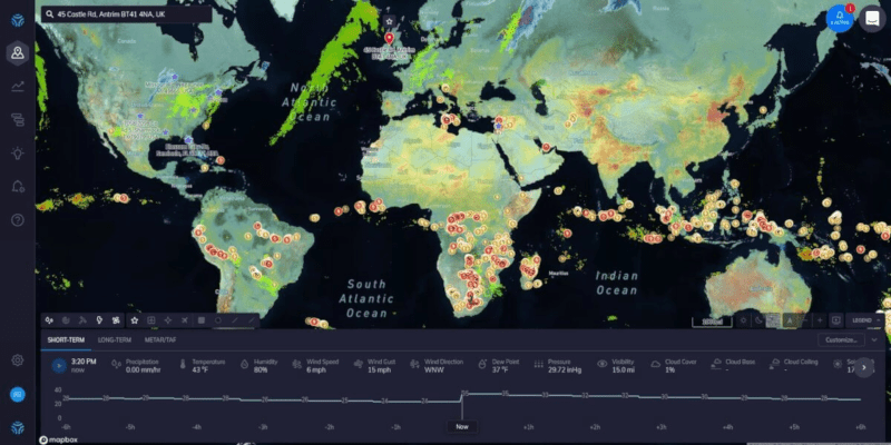
“How’s the weather?” is a common enough question down here on the ground, but it’s even more important to pilots. Even if they might not physically be in the cockpit of the craft they are flying. [Justin Parsons] explains how weather affects drone flights and how having API access to micro weather data can help ensure safe operations.
As drone capability and flight time increase, the missions they will fly are getting more and more complex. [Justin] uses a service called ClimaCell which has real-time, forecast, and historical weather data available across the globe. The service isn’t totally free, but if you make fewer than 1,000 calls a day you might be able to use a developer account which doesn’t cost anything.
According to [Justin], weather data can help with pre-flight planning, in-flight operations, and post-flight analysis. The value of accurate forecasting is indisputable. However, a drone or its ground controller could certainly understand real-time weather in a variety of ways and record it for later use, so the other two use cases maybe a little less valuable.
While on the subject, it seems to us that accurate forecasting could be important for other kinds of projects. Will you have enough sun to catch a charge on your robot lawnmower tomorrow? If your beach kiosk is expecting rain, it could deploy an umbrella or close some doors and shutdown for a bit.
If you insist on using a free service, the ClimaCell blog actually lists their top 8 APIs. Naturally, their service is number one, but they do have an assessment of others that seems fair enough. Nearly all of these will have some cost if you use it enough, but many of them are pretty reasonable unless you’re making a huge number of calls.
How would you use accurate micro weather data? Let us know in the comments. Then again, sometimes you want to know the weather right from your couch. Or maybe you’d like your umbrella to tell you how long the storm is going to last.


uhmmmm sucks, I should have focused more on a project I started to use a helium balloon that I can change the helium in it as it floats higher to prevent the balloon section from blowing up. So it can stay afloat. and put it on some path that it could use the winds to be moved around by somewhat.
You might find this interesting – I wrote a short article a while back about how the Japanese war balloons worked. They did altitude control as you describe, with a very clever approach. https://medium.com/focus-on-history/the-paper-war-balloons-of-world-war-two-fe763782f85
You could consider a “super pressure” balloon.
It is a balloon that will stop expanding at a certain altitude (without bursting), therefore, stop rising.
Perhaps, mark this as an Advertisement?
I tried to ClimaCell API after signing up for the Developer account and receiving the API key. When I entered my latitude and longitude, the returned temperature was 30° F below my otherwise accurate smart phone app. Bah
Pretty sure that for the vast majority of “drone” flights there is a far more accurate and high quality option available for weather conditions and predictions. It’s called having a look. Local weather is not that hard to read and predict. It’s not very often that you’d have a hard time accurately predicting “it’s going to remain dry for the next 30 minutes” or “There’s a thunderstorm forming to the north that will make it’s way over here, winds will pick up and shift direction rapidly in about an hour”.
I really don’t see the added value of this data to be honest.
I have photos of the sky above my home where the clouds look like a waffle because there are two layers moving at almost 90 degrees to each other, and when the photo was taken there was very little wind at ground level. The point being that the atmosphere can be very stratified. I think that nothing short of a 3D doppler and H2O reflectance radar map that has been processed to show the motion vectors, then fed to an AI to extend the vectors so that one end is history and the other is a prediction, would be useful.
About ClimaCell…
1. The HaD “ClimaCell blog actually lists their top 8 APIs” link to here:
https://www.climacell.co/weather-api/https://www.climacell.co/blog/top-8-weather-apis-for-2020/
…is busted. It leads to a 404 dead end. I can’t seem to find a working link to the “top 8 APIs” ClimaCell page mentioned in the HaD post.
2. “The service isn’t totally free, but if you make fewer than 1,000 calls a day you might be able to use a developer account which doesn’t cost anything.” Yup, <1K calls a day is "Free", but they demand your First, Last, Company Name, and Email. Still not so bad if you really need the data though (and you don't want to lie).
3. Unless you get more info after you log in, the ClimaCell API documentation seems to lack enough detail to be useful. That makes me worry there might be a proprietary library and encryption involved. Also the API data format does not seem to follow any standard schema (e.g., XML, JSON, etc.)
I found the busted link: “The Top 8 Weather APIs for 2020″…
https://www.climacell.co/blog/top-8-weather-apis-for-2020/
FWIW I found this snippit about the API/Schema: “App Integration & Format: AWS, Autodesk, REST API using JSON for the requests and the responses, with HTTPS support”.
There is a drone weather homepage from a similar service like ClimaCell called meteomatics.com (they provide global weather forecasts and history data). Meteomatics by itself flies autonomous drones to improve the weather data and has developed a special application for drone pilots called https://www.droneweather.ch which includes forecasts up to 2500m in the free tier and 10000m in the professional tier. Currently it gets redesigned and more features will be added soon