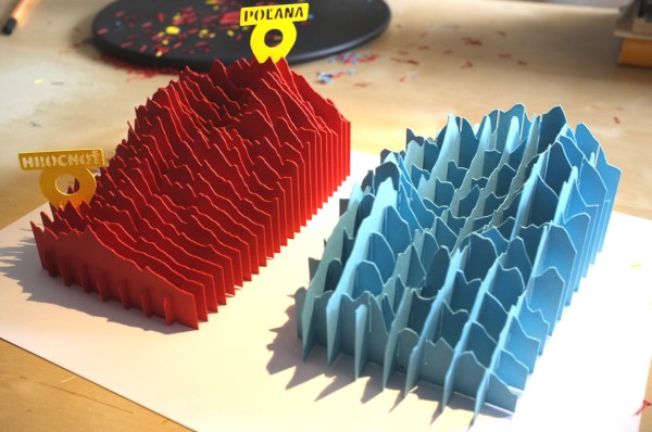
If there’s a science fair coming up, this trumps just about any 2D poster. It’s a 3D topographical map of an inactive Slovakian volcano, Poľana. [Peter Vojtek] came up an easy way to generate SVG topo patterns using Ruby.
Topographical data is available through the MapQuest API. You should be able to model just about any part of the world, but areas with the greatest elevation difference are going to yield the most interesting results. The work starts by defining a rectangular area using map coordinates and deciding the number of steps (sheets of paper representing this rectangle). The data are then chopped up into tables for each slice, converted to SVG points, and a file is spit out for the blade cutting machine. Of course you could up the game and laser cut these from more substantial stock. If you have tips for laser-cutting paper without singing the edges let us know. We’ve mostly seen failure when trying that.
The red model explained in [Peter’s] writeup uses small cross-pieces to hold the slices. We like the look of the Blue model which incorporates those crosses in the elevation representation. He doesn’t explain that specifically but it should be easy to figure out — rotate the rectangle and perform the slicing a second time, right?
If you’re looking for more fun with topography we’ve always been fond of [Caroline’s] bathymetric book.


