Most maps and educational materials for teaching geography are highly visual in nature. For those with a visual impairment, it can make learning more difficult when suitable resources are not available. After visiting a boarding school in Moscow, [Sergei] set out to build an interactive map to teach students geography regardless of their vision status.
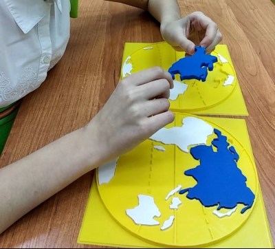 After seeing the poorly embossed paper maps used in the school, [Sergei] decided there had to be a better way. The solution was 3D printing, which makes producing a map with physical contours easy. Initial attempts involved printing street maps and world maps with raised features, such that students could feel the lines rather than seeing them.
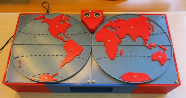
Taking things a step further, [Sergei] went all out, producing an interactive educational device. The build consists of a world map, and contains audio files with information about countries, cultures, and more. When the ultrasonic sensor detects a user in range, it invites them to press or pull out the removable continents on the map. The device can sense touch, thanks to a pair of MPR121 capacitive touch sensor boards which are used to trigger the audio files.
It’s a great way to use the sense of touch to teach where the sense of vision may be lacking. Previous Prize entries have worked in this field too, like this haptic glove to help vision-impaired users interpret camera data. We can’t wait to see what comes next as technology improves!