Your Name In Landsat

We’re guessing most readers can cite things from their youth which gave them an interest in technology, and spurred on something which became a career or had a profound impact on their life. Public engagement activities for technology or science have a crucial role in bringing forth the next generations of curious people into those fields, and along the way they can provide some fun for grown-ups too.

A case in point is from NASA’s Landsat engagement team, Your Name In Landsat. Type in a text string, and it will spell it out in Earth features seen by the imaging satellites, that resemble letters. Endless fun can be had by all, as the random geology flashes by.

The text entry form with a pop-up warning only A to Z are accepted.
No text emojis, boo hiss!

In itself, though fun, it’s not quite a hack. But behind the kids toy we’re curious as to how the images were identified, and mildly sad that the NASA PR people haven’t seen fit to tell us. We’re guessing that over the many decades of earth images there exists a significant knowledge base of Earth features with meaningful or just amusing shapes that will have been gathered by fun-loving engineers, and it’s possible that this is what informed this feature. But we’d also be curious to know whether they used an image classification algorithm instead. There must be a NASA employee or two who reads Hackaday and could ask around — let us know in the comments.

Meanwhile, if LANDSAT interests you, it’s possible to pull out of the air for free.

Remembering Virginia Norwood, Mother Of NASA’s Landsat Success

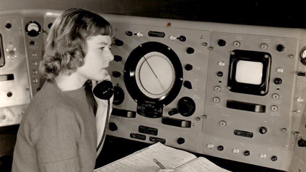
Virginia T. Norwood passed away earlier this year at the age of 96, and NASA’s farewell to this influential pioneer is a worth a read. Virginia was a brilliant physicist and engineer, and among her other accomplishments, we have her to thank for the ongoing success of the Landsat program, which continues to this day.

The goal of the program was to image land from space for the purpose of resource management. Landsat 1 launched with a Multispectral Scanner System (MSS) that Norwood designed to fulfill this task. Multispectral imaging was being done from aircraft at the time, but capturing this data from space — not to mention deciding which wavelengths to capture — and getting it back down to Earth required solving a whole lot of new and difficult problems.

Continue reading “Remembering Virginia Norwood, Mother Of NASA’s Landsat Success”

Seeing Plant Health In Infrared

aerial

Since the 70s, NASA, NOAA, and the USGS have been operating a series of satellites designed to look at vegetation health around the world. These satellites, going under the name Landsat, use specialized camera filters that look at light reflecting off chlorophyll to gauge the health of forests, plains, oceans, and even farms. It’s all very interesting technology, and a few very cool people want to put one of these near infrared cameras in the hands of everyone.

The basic idea behind gauging the health of plants from orbit, or the Normalized Difference Vegetation Index, is actually pretty simple: absorb red and blue light (thus our verdant forests), and reflect nearly all infrared light. By removing the IR filter from a digital camera and adding a ‘superblue’ filter, the NDVI can be calculated with just a little bit of image processing.

The folks behind this have put up a Kickstarter with rewards including a modified webcam, a custom point and shoot camera, and a very low-cost source of one of these superblue filters. Just the thing to see how your garden grows or how efficiently you can kill a houseplant.