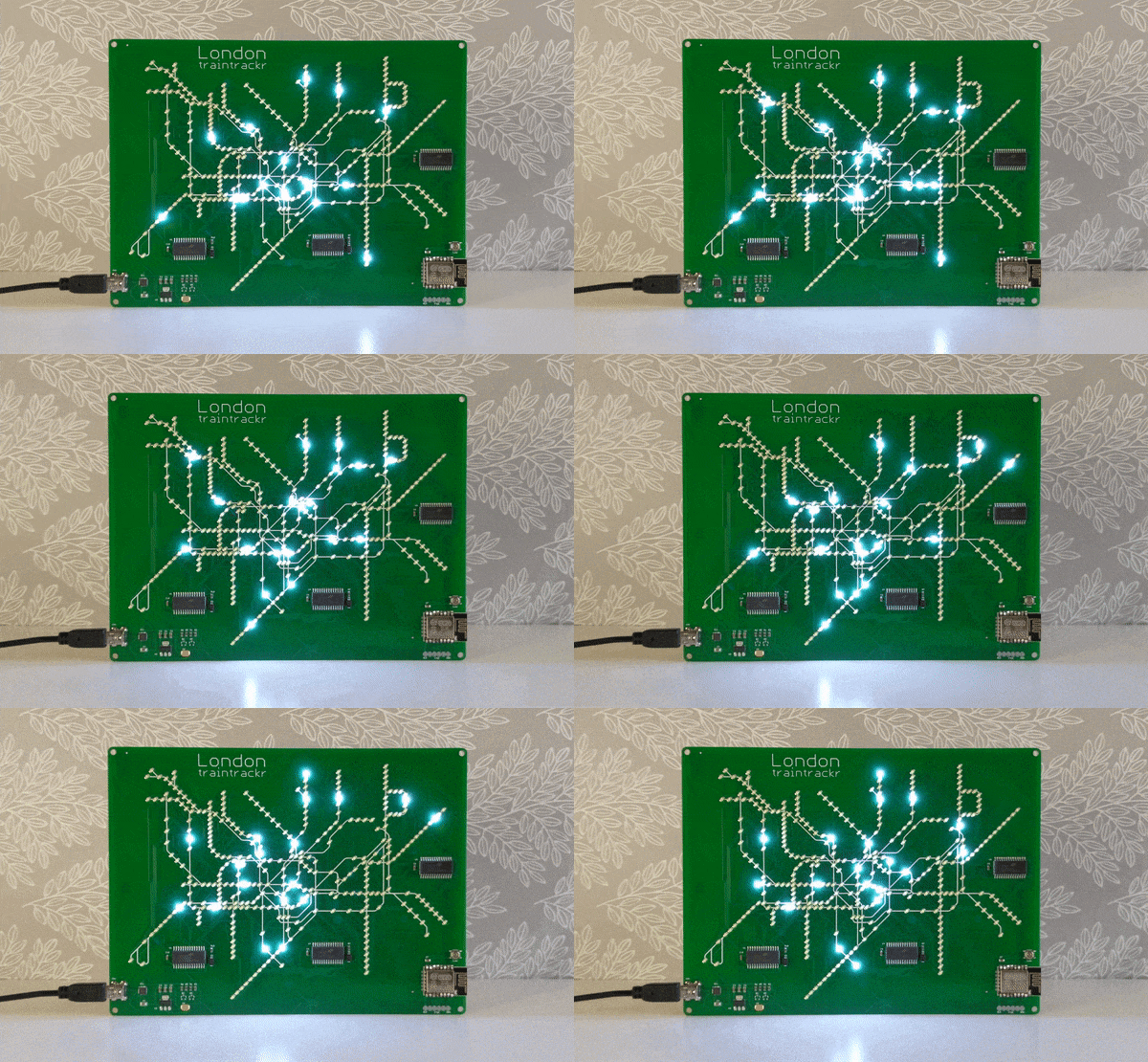
If you’re a frequent traveler on a public transit system, it can be helpful to know when the trains or buses are arriving and if there are any delays. We might reach for a tablet to mount on the wall, but that relies on keeping the OS, the software, and its library dependancies up to date. For true reliability you’ll need to build directly in hardware, which is exactly what this map of the London tube system uses.
The base map is printed directly on PCB, with LEDs along each of the major routes to indicate the current location of the trains. A few small chips handle the WiFi connection — it appears to our eye to be an ESP8266 — and pulling the information about the trains from the London Underground API (it would be virtually impossible to build everything for this project in hardware). The hardware can be easily reprogrammed, and with the PCB layout this could be adapted for other public transit fairly easily.
Even apart from the philosophical differences on design between hardware and software approaches, we still appreciate the aesthetic of LEDs on PCB. In fact, we’ve seen a whole host of artwork on PCBs ever since the price came down dramatically in the past two decades.
Thanks to [Al] for the tip!


That is awesome! When I refreshed the page all I saw was the picture – no title or text. Yet it only took about 2 seconds for me to go ‘Oh cool! A subway map! With it being that immediately obvious I’d say the execution is brilliant.
For rev2 I’d suggest color LEDs to match the color of the line on the wall maps.
Brown (Bakerloo) and Black (Northern) might be an issue.
They already do colour versions. It’s the next picture down in the linked website, I think.
There’s already a colour LED version. But you do have to click the link to see it.
Too late (or you didn’t read the linked article). There is already a colour version in the pipeline (the northern line being shown in white BTW).
I’ll probably catch a lot of flack for this, but an LCD panel strikes me as a much better solution than a PCB in this case (maybe a Pi Zero W and a cheap panel).
But then you could also publish a webpage with real-time maps. The charm of this project / product is in the design.
From the linked site it seems they’re way ahead of you.
How about a RaspberryPI driving an HDMI display screen? Or is that just too easy?
> The hardware can be easily reprogrammed, and with the PCB layout this could be adapted for other public transit fairly easily.
Huh?
It isn’t quite an ad but if you click through the link to buy one they do provide some information (it is an esp8266 – don’t know why hackaday had to “eyeball” that assessment) on how to reprogram it. But it doesn’t look intended to be diy as they probably see it as a threat to their business model – fair enough. It’s slightly amusing that it is reprogrammable – what else can you repurpose an underground transport map into? Good for security updates I suppose but not quite as laden with opportunity as we often hope for a reprogrammable device.
It’s probably reprogrammable because they assume TFL might improve their API at some point and break everything.
Which is very likely anyway – things always change – but even more so if this thing is a success and the API queries stretch their capacity. London Transport is already nearly bankrupt.
There are like 15 lights on at once, this must be super super super super off peak since if expect 10x that, especially given the trains travel in both directions…
I guess it just seems like there’s more trains in reality because if you watch the map carefully, you’ll see they are actually teleporting from one section to another.
Yeah, I’m trying to understand what the lights are supposed to mean. I’m hypothesising that it’s a trains arrival at a station. I just did a quick google for a live train tracker, and there are… many:
https://traintimes.org.uk/map/tube/
Good luck with software updates when new metro lines are added. Cool project tho:)
Each LED is a station. Presumably the LED lights when a train enters the station. This doesn’t show the direction of travel, trains between stations, or which line the train is on (many stations are served by multiple lines). So this is a bauble rather than a useful source of information for the traveller. Which is fine, it is a pretty thing.
Perhaps everyone here already knows this, but apparently the modern subway map was invented by an engineer who was inspired by electrical schematics. For London, actually.
Before then, all transportation maps were just lines on a normal scaled map.
That is a myth. It was developed over many years and iterations. Any similarities to electric circuits are merely coincidental.
The map designer, upon hearing this, stated that he’d had never seen a circuit board before. That was in the days when electronics were expensive and you didn’t go willy-nilly opening them up.