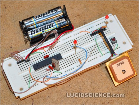
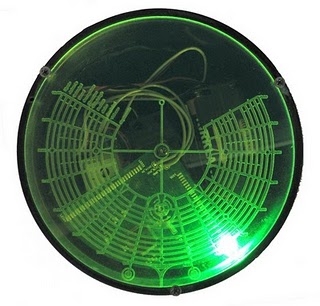
[Markus] built his own reverse geocache puzzle box but on a smaller scale than the original. His is based around a PIC 18F2520 and powered by two AAA batteries. The user interface includes one button, a 16×2 character LCD, and a piezo speaker. The box unlocks itself when the GPS module inside detects the proper location on the globe. There is also a secret code that can be tapped on the button to unlock the box prematurely, and another to show the locations in which the user attempted to open the box. This build doesn’t leave much room for a payload, but [Markus] did a great job designing the board and making the components fit as efficiently as possible.
gps hacks196 Articles
A Cop In Every Car
[Michael] designed this display board to mimic the appearance of a police car pulling you over. It resides in the rear window of his car (facing forward) as the controller board measures the speed of the vehicle. An Arduino grabs NMEA data from a GPS module and compares it with a table of speed limits. If you are speeding, based on your current location, the reds and blues flash as if you’re getting pulled over. The thrill of getting busted for a lead foot doesn’t sound like much fun to us but to each his own.
Incidentally, [Michael] is using the EM406 GPS module, the same one as the Frustromantic Box used.
More Functional GPS In Minutes
[Sparky] notified us of his hack to allow interaction with the core of an Aldi GO Cruise 4300 GPS Windows CE OS. All that’s required is a few programs and registry edits to the GPS, which anyone can accomplish within a few minutes. But we suggest you go slow and double-check your work; nobody wants a bricked system. After you’re done you can run such great programs like the one [Sparky] suggest for 4WD enthusiasts, Ozi Explorer.
HUD For Real Life Capture-the-flag
If you’ve played any of the Splinter Cell games you’ll remember the PDA that [Sam Fisher] carried around with him. What if you could have one of your own when playing capture-the-flag? [Brad] has created the ZephyrEye as an electronic command and communications device for real-life games.
Each player carries around their own unit. The ZephyrEye has a GPS module, Xbee module, LCD screen, and control buttons. This allows a player to setup one of several different games, map out the game field including base locations and flag locations, and monitor a time limit and scoring. Other players can join the game in progress. The best part? The GPS modules report tracking to each handheld and act as radar for your team and the enemy team. We’ve got a couple of demo videos after the break.
Words can’t describe how delighted this would have made us back in the day. We don’t play outside with the other neighborhood kids anymore (insert dirty-old-man joke here) but that might change just because of this device. We may end up joining [Barney Stinson] for some amazingly awesome laser-tag games after all.
[Brad’s] posted hardware information and source code so that you can use to throw together a dozen or so units. We think the next version should incorporate a wearable display.
Live High Altitude Balloon Launch
[Terry] is planning to launch his high altitude balloon within the next few days. As we’ve seen before he has gone for a general setup – GPS tracking, environment sensors including temperature and humidity and pressure, and 2 on board cameras – all with an expected height of about 100,000 feet. What makes this project unique is the transmission of live telemetry data to a Google Maps or Google Earth interface.
The planned launch date is Sunday the 24th about 00:00 UTC so long as the Civil Aviation Safety Approval for the launch is passed.
As a final note [Terry] wanted to let inspiring balloon launchers to check out the UK High Altitude Society – who have been an invaluable source of information.
Hacking The OnStar GPS V2
[Andy] has provided us with his new guide to hacking the OnStar GPS. Previously, we have covered a way to grab the GPS data from an unused OnStar system, however in recent years GM has added much more complex systems, which make it harder than swapping out a serial line. For the new version, [Andy] has figured out GM’s Controller Area Network (CAN), which they call GMLAN. He has also done most of the software snooping and sleuthing, and has mostly solved GMLAN’s method of announcing GPS data. There is sample code available to convert this information into generic latitude and longitude.
Unfortunately for the project, (and very fortunately for [Andy]), he has a child on the way and new job responsibilities, so he is offering up his results to the HaD community to finish up, double check, and provide a good how-to for everyone else. To anyone who decides to pick up this project and run with it, let us know!
Arduino Now Controlling – The Crop Harvest?
[youtube=http://www.youtube.com/watch?v=LDzHwy28kng]
We’ve seen the Arduino board in charge of some pretty unique tasks in the past. Harvesting locally grown soybeans was not one of them.
[Lance] rigged this beast up in order to automate the monotonous task of driving up and down the vast soybean fields of Iowa. The 15 ton farm combine’s hydraulic steering pump is at the mercy of a team of gadgets, including a GPS, Windows 7 PC, and the omnipresent Duemilanove (which acts as the output card, connecting the PC to the pump). So far, it is reported to be doing a great job, straying only about an inch and a half from its desired, GPS-programmed, path. Even if the Arduino decides to go totally berserk and drive the combine off course, speeding around at 5mph makes it pretty avoidable. A supervisor is also in the cabin at all times, looking out for errors. [Lance] eventually hopes to offload all steering-related calculations to the ATmega328P onboard.
Commenters are welcome to share heavier-duty uses for the Arduino (if they exist).