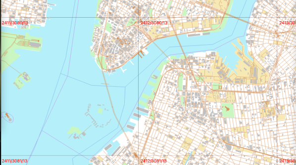
There are adults out there driving who were born after Google Earth came out. Potentially distressing facts aside, those who were around to remember the magic of scrolling in and out with infinite levels of detail was an experience that burned into our brains. Perhaps still curious 21 years later, [Craig Kochis] dove into how vector maps work by implementing one himself.
Some standard helper functions convert latitude and longitude into Mercator coordinates (x and y coordinates on the screen). He used WebGL to draw a canvas, making the whole thing interactive on the webpage itself. The camera position and zoom level stored as a matrix that is used to transform the map projection. By grabbing polygons that describe the shape of various borders and then converting those polygons into triangles with earcut, [Craig] has a part of a country rendered to a screen. Continue reading “Choose Your Own Vector Map”