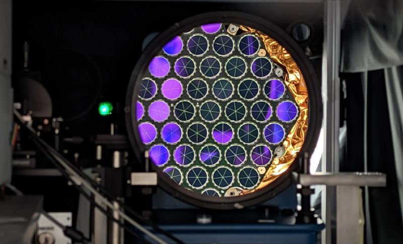
Although GNSS systems like GPS have made pin-pointing locations on Earth’s sphere-approximating surface significantly easier and more precise, it’s always possible to go a bit further. The latest innovation involves strapping laser retroreflector arrays (LRAs) to newly launched GPS satellites, enabling ground-based lasers to accurately determine the distance to these satellites.
Similar to the retroreflector array that was left on the Moon during the Apollo missions, these LRAs will be most helpful with scientific pursuits, such as geodesy. This is the science of studying Earth’s shape, gravity and rotation over time, which is information that is also incredibly useful for Earth-observing satellites.
Laser ranging is also essential for determining the geocentric orbit of a satellite, which enables precise calibration of altimeters and increasing the accuracy of long-term measurements. Now that the newly launched GPS III SV-09 satellite is operational this means more information for NASA’s geodesy project, and increased accuracy for GPS measurements as more of its still to be launched satellites are equipped with LRAs.


I wonder how much this could help with jamming/spoofing.
I.e. determining a true signal by confirming the satellite position.
Rule # 42 of HAD is that for every topic, there is an XKCD that applies. In this instance,
https://xkcd.com/2170/
The retroreflectors on the moon are frustratingly difficult to hit for an amateur because the return loss is so high and the ping time so long.
I wonder if optically pinging GPS satellite targets will become a new sport? Return loss and ping time are going to make it easier, but now you have a nearly invisible moving target to hit, with sub-arcminute accuracy — a whole ‘nother challenge.