
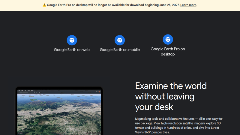
Come next year, those looking to explore the globe virtually via Google Earth will have to do so on their smartphone or from within their browser, as the search giant has decided to discontinue the service’s desktop client in June 2027.
The good news is, the lights won’t be going out immediately. According to a post made on Google Earth’s official support community by Community Manager [Aamir F.], the June cutoff date applies to new downloads, but nothing is changing on the backend, so existing installs will continue to work.
 Now, while it’s safe to assume that you’ll have little trouble finding an alternate download of the Google Earth client for years to come, there’s no telling how long before they quit working. It probably goes without saying that Google won’t be providing updates to the software anymore, so if there’s any kind of breaking change on either the API side or at the OS level, that’s the end of the road. There’s always a chance that Google will decide to release the source and turn the whole thing over to the community… but we wouldn’t hold our breath on that one.
To be fair, we have absolutely no doubt that the majority of Google Earth users already access the service via the smartphone app or their browser. Honestly, you could say the same thing about most services these days. So in that respect, it’s not much of a surprise that Google doesn’t feel like keeping the native version going. That said, several commenters in the community thread pointed out features from the desktop client that aren’t available in the other versions.
Are you still using Google Earth on the desktop? Will this change impact something you’re working on? We’d love to get your take on this in the comments below.
Thanks to [Mark Lloyd] for the tip.









Feeling bittersweet. It was a software that worked well on old PCs and it was among my “standard” software to install on a new computer (back when I used windows, and didn’t mind proprietary software). It was the only option to get routes for a road trip since smartphones didn’t exist (and my family didn’t own a garmin GPS) so I printed out the route for my dad to follow.
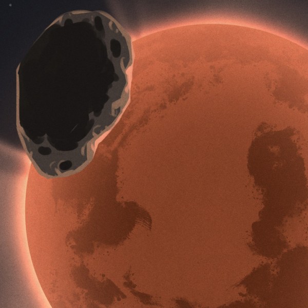
The features to view other planets and moon was really cool and way ahead of time. I had fun viewing mars and its geographical features
I also remember a rudimentary flight sim (feature? minigame?), it was fun honestly
I mapped several farms, drew in water lines and fences and calculated areas. So pity it will be discontinued.
I remember when it was called Keyhole.
Maybe they got hit by a trademark infringement and had to change the name?
In the geospatial world I’m not sure it makes sense to associate yourself with a top secret program of spy satellites. You don’t have to offend anyone to have them start thinking your basic services are covered by ITAR.
(Side note: the .kml file format is a relic of that time, as it stands for “keyhole markup language”)
Concern about the name may have been a factor, but I think it was mainly changed because Google likes naming products after themselves.
Keyhole Inc. was a geospatial data and satellite imagery company that Google bought out in 2004. Keyhole’s name undoubtedly was a homage the spy satellites, but it hadn’t been a downside for them – in fact, they’d had startup funding from IN-Q-TEL (the intelligence investment firm funded by the CIA).
I’m pretty sure the Google Earth desktop software is a direct continuation Keyhole’s “Earth Viewer” software. Despite its aging design and increasing jank, I’ll sorely miss it. I know most people don’t care about the “pro” features, like complex area measurement, viewshed analysis, data & image overlays, etc., but they really are handy.
That’s too bad. The desktop client offers a lot more functionality than the crippled browser versions.
I hope they up the game on the remaining access.
That’s my biggest concern, and why I use the desktop version. I’m sure part of it is simple familiarity of the interface for me. As long as it’s not stripped down to fit on the web I’m not sure I would have any beef. Its not as if I can actively use it without the data connection.
Time to save a copy.
Yes I still use it. No the waypoint and route features available in the web version are not as extensive, at least they weren’t last time I looked. Which admittedly was quite a while ago. Time to check it out again I guess.
Just another useful tool for the Google graveyard.
Pretty sure development stalled out due to a protected, restricted version or competitor. They either don’t have an inroad to where they wanted to be, or, they made it and can’t backport features.
We use it to help our staff find nearby installers, so I guess I will have to find something different.
Google can kish’m tuchas after they killed Reader . The move to cloud only, the end of physical media, the forever march towards more efficient enpewpifications…all this bodes ill for the scratching sniffing masses. Next up, lock down the formats? Here’s wishing you the bluest skies and hopes that something more open comes tomorrow.
Google services have always been cloud only, they’ve never sold physical media, and don’t have any proprietary file formats. Did you comment on the wrong article?
Depth of scope past the particulars of this incident is the part I think that is missing in your response. That this is a part of a large trend…trend is too small a term…the tsunami of retreating excellence, that is what we need to carry forward with. Accountability of our vendors, hosts, and sources is vital to a functional state that benefits the users as well as those who control the means of production .
Buckle up me droogies, this is going to be a bumpy ride.
Ok, boomer.
Change happens.
You’ll survive.
Survival is the best you can come up with? It’s little wonder the creeping meatballism keeps katamaring up your unrealized hopes and dreams. Back to the g00ncave for you, keep up the serfmaxing and one day you too might have a viable post on the topic. Till then keep hope, and your larval stage thinkum, alive.
Google services haven’t always been cloud-only: Back in the 2000’s, they sold the ‘Google Search Appliance’, which was basically a 2U server that you could use to index your local network. They were sold to businesses who had a lot of stored files and wanted a way to search them. https://en.wikipedia.org/wiki/Google_Search_Appliance
Another piece of science fiction is discarded as obsolete. The first big example was the flip-phone, based on the communicators from Star Trek TOS. Google Earth is based on the program Earth from Neil Stephenson’s early novel, Snow Crash. The only real difference between reality and fiction (aside from being a VR program) is that SC Earth was a subscription service that could provide access to information from various satellite reconnaissance companies, including parts of the former US government.
A terrifying portend.
“A terrifying portend” said the This-Is-Fine dog as he spots a mote of ash in his mug of boiling coffee while the flames lick the walls around him.
en****ification strikes again. the web apps are inferior and not a replacement but these big corporations would rather hire h1b web developers for table scraps than pay an actual developer. the past 10 years have felt like watching barbarians play in the broken aqueducts they no longer know how to fix society wide.
You thinks it’s not Vibey McVibster behind the cloud apps? Your optimism is noted.
I believe enshittification is considered an acceptable word.
I’ve seen it used on a few ‘respectable’ publications and in open discussion by respected individuals.
i like how we are oppisite politically but hate google for the exact same reasons.
Good point. It’s a bit like the fictional Umbrella company by now. It seeks out for world domination.
END OF LIFE….
As goes Google Earth, So will go ALL the other things they are using as candy to talk you into the white van.
Lock it down to HIGHLY INFLATE the cost to use it.
Another AI cost that will not be externalized anymore.
Daily the computer WORLD is going to shrink.
After Bill Gates evil on the market, It’s going to collapse.
That really sucks. Part of the reason I use it (and almost everything else) on my desktop is that it’s a heck of a lot easier to see things on my massive 32″ 3440×1440 desktop monitor than my janky little phone with a tiny 6″ screen. Being constrained to mobile devices is a definite step backwards, waaaay backwards.
i’m with this guy. i don´t know what size my monitor is, but i’m sure it’s a lot bigger than my OnePlus. i’ll really miss just hitting that icon and pasiting in some Russian or Ukrainian name and … bingo! There it is! i also have a list of pins i’ve collected all these years … places in the Holy Land, places from my hometown, lots of friends places all over Mexico, the over 50 ejidos in the Mexicali Valley. Ug, what am i going to do. Yup, there we were… merrily going along our own way, forgetting that it was not our way, but Google’s Way. Sigh.
I have it on 3 x 32″ 4k portrait screens – 6480 x 3840 . The web browser chokes on my setup.
Another great product by Google sunsetted for not making enough money I guess – like Picasa, Chromecast, Crisis Map, Search Appliance, Orkut, Reader…
Yes, I do still way prefer the desktop client – it’s faster and doesn’t run in a browser.
At first I thought you were being sarcastic in the article about nobody using the client any more, but towards the end I was surprised to figure that you were being serious!
Everyone should go download KDE Marble immediately! It’s great!
Good callout — I will look at this and add it to our spatial viewer inventory if appropriate…
Well another good product to add to the Google Graveyard :( While I will say the maps and layout is waay better than the web version, I won’t be sad to say goodbye to the memory hogging Keystone updater that Google insists to put in its products. Truth be told I never really ever used it for mapping, but for the little built-in flight simulator that actually was pretty fun with a ps3 controller :)
Given the huge range of plugins and data sources available for QGIS there is not much point to Google Earth these days particularly when one can just vibecode up any extension one needs via the Python API , QGIS even has better access to Google’s datasets!
Just ask the chatbot, it’s quicker! Plus you might as well accept that soon the chatbot will be the only option for everything, if they have their way, and they will, because they’ve consolidated so much power that soon it will be illegal to not give them your money. Good times!
(something something guillotines, redacted, etc.)
“(something something guillotines, redacted, etc.)”
“Now Dat’s Funny Right There …
well that sucks. I really don’t like the idea of uploading personal usage kml files to be processed in the cloud. why, because I’m sure google will not in any way find some way to use forced cloud for mass surveillance and data-mining [sarcasm]. looks like going to move to QGIS.
Oh man, this is sad news. The desktop app is soooo much more performant, faster refresh, more responsive to navigation controls – it has the build in flight sim mode, and can be driven with with a 3D mouse. Way more integrations for markups and measurements. The future is devolving faster than predicted – stupefaction and corporate corner cutting eating the heart out of the engineering cultures that built the modern era.
Sidenote – there’s a great German language 2021 film “The Billion Dollar Code” about a group of Berlin hackers who came up with the original algos for resolving the data at relevant elevations smoothly. And their predictable treatment by Silicon Valley. ..
This really sucks for those of us who work with city municipalities and use Earth desktop to map out comms, electrical, and other underground utilities. Web version is harder to work with, clunkier.
I know of people who work in spatial activities, and they use QGIS, ArcDesk, ArcMap, ArcPro, and Google Earth Pro. The loss of any of these is a PITA to them.
So many fun times zooming in and out in random cities over the years!
Timelines being handy.
I tried using it on my Mac a while back and every time I run it my machine would have to be restart to work properly again. This and Chrome at the time convinced me to move away from most of Google.
Lots of dads are gonna be upset.
You would be absolutely amazed at how commonplace Google Earth Desktop is used in professional GIS work. Mapping and planning for construction of infrastructure.