
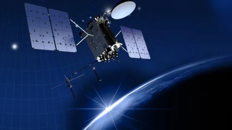
GPS has become fairly common in our everyday lives, not only able to pinpoint our locations on Earth but also as an incredibly accurate timekeeping method. But since these satellites are around 20,000 km above Earth, the received signals on the surface of the planet can be incredibly weak. This makes them prone to jamming and spoofing, a weakness of the technology that has long been known. Although attempts to mitigate these problems have been ongoing, there has recently been a large-scale attempt to interfere with these signals that put all mitigation efforts to the test.
One proposed way to improve resilience is to supplement existing GNSS systems with low-Earth-orbit navigation satellites. In this example, a company called Xona is using a satellite called Pulsar-0 that operates in low-Earth orbit (LEO) and provides positioning and timing signals that are around 100 times stronger than standard signals from GPS/GNSS satellites. It is able to receive GPS signals as well, ensuring the two systems agree on one another. And, because Pulsar’s navigation signals originate from LEO and are much stronger than conventional GNSS signals, Xona expects them to be significantly more resistant to jamming.
Beyond geopolitics, spoofing GPS has some applications in finding legendaries in Pokemon Go as well as making it fairly trivial to steal GPS-guided drones.










Maybe let the satellites form a mesh network and have a global time based key tied to the position and designation of the satellite itself, akin to multifactor authentication, satellites nearby provide details of their neighbours and they need to tally up, so to spoof it, you’d need to fake several signals at the same time. Sure, it doesn’t stop a man in the middle in space or some sort of denial of service, but it would be more robust than a simple set of beacons with known locations.
They already fake several signals at a time to spoof GPS – they simulate multiple satellites, otherwise it wouldn’t cause a notable change in location.
I’m pretty sure they just jam the RF spectrum with noise. The GPS signal is just here, but well below the noise floor that’s 20dB to 40dB higher than average. It’s much easier to do that than trying to fake a fleet of GPS satellites for a similar effect.
The idea is to get the S/N ratio as close as you can then you strong arm the orbital signal with skew and timing alterations that cause errors in predictable ways. With commercial systems BTW… the MIL gear is all encrypted.
American destroyers don’t just run into things… and a carrier hitting something is going to need some heavy explanations.
Spoofing will always have limited results because the good timing stuff is all encrypted… so it’s timing can’t be spoofed only blocked.
Five minutes after i post the above, the post gets deleted?
I see it. not deleted.
How do you reply to a post that is deleted?
Why not mention Galileo authentication for the public??
Do your research HAD https://www.u-blox.com/en/technologies/osnma-galileo-spoofing
There are lots of different authentication services, at this point. HAD is just republishing somebody’s press release as news.
I thought one can cross-reference all four, GPS, Magellan, Glonass, Beidou, no?
Oops, wrong autocarrot, sorry, that was not Magellan but rather Galileo.
Yes, but even then.
If you run “cheaper” GPS equipment (we usually run 4 on each vessel), you are talking about 60k for just the receivers, then you got expensive cabling, expensive antenna’s, yearly licensing fees, installation and maintenance costs and everything combined, and you still don’t have any protection against spoofing. That’s just basic stuff with rtk. That’s not netans level gear. To protect against spoofing you need both cross-referencing and you need segmented antenna’s so you can disable parts of it, and you need different methods of doing that at the same time. Spoofing is usually done by bouncing the athmosphere. Signal is sent up and goes back down. It’s not like you can just disable the piece where you expect the spoofer is located at. I’m not an amateur radio guy, those are probably a lot more knowledgeable about how this is done.
eh, if you want to bounce the atmosphere you need to do so under 30mhz, which is way below the frequency of gps. also would be awkward to spoof with because it’s unpredictable.
i can’t find the article i read but it’s done with a system of around 6 russian satellites in an erratic molniya orbit.
it’s already know how to avoid spoofing, such as more intensive encryption and coupling to the internets time servers but that requires considerable expense to update all the technology deployed.
I did see the article on YT channel “Veritasium” its header:
“Something is jamming GPS over Europe. Here’s what we found “
You are probably correct. I’m not an expert on that subject but I heard they are bouncing it up and down through the atmosphere with ground stations. Using satellites sounds like a much easier method to disrupt it for a long period of time, especially when you have a long history of space flight.
intensive encryption and syncing ntp might be a nice way. allowing m-code might be a nice feature in the current state of things. We use different methods for verification, such as dvl systems but that has drawbacks too.
Almost seems like they need a powerful ground-based backup. There’s an unused chunk of spectrum at 100kHz that seems perfect for an OOK-ed system of transmitter chains.
Oh, wait, some idiot government bean counter decided to eliminate a system just like that a few years ago…
GPS was supposed to be supplemented by terrestrial stations, but those are few and far between.
DGPS is land based corrections. I did some military testing on WAAS way back in the day, which is also land based.
None of those matter though if the actual weak gps signal is obscured with noise. GPS jamming is also not a “new” thing, people are just aware/freaking out because veritasium.
Yeah, even unintentional ‘jamming’ happens from oddball spurious electronic noise, which itself can be broadband and low power, so hard to find.
Fixed GPS reference ground stations have shields around them that block terrestrial interference, listening only to signals some angle above the horizon (generally some variant of choke ring, graded-resistivity ground plane, annular slot loaded ground plane, etc.). Though intended to reduce multipath interference and improve position precision for those fixed sites, it’s not a stretch to use them to mitigate intentional ground-based jamming interference. They’d be a bit ungainly for (say) drones, but still reasonable for larger vehicles.
GPS IS supplemented by terrestrial stations, at least in North America. Local WAAS ground station measurements are used to transmit corrections by the WAAS satellites. Receivers then combine that with the GPS data to refine their position estimate.
DGPS, at least the survey-grade instruments, skips the satellite hop and generates position fixes relative to a (very) local reference site. They can get sub-centimeter precision.
DL and INS.
https://www.sciencedirect.com/science/article/pii/S2590123024018085
QuINS
https://strongernavy.org/quantum-navigation-lockheed-martins-quins-and-the-future-of-u-s-naval-operations/
Cool!
If GPS becomes less reliable then I look forward to the homebrew positioning systems and/or supplements that the HAD community will start building!
Local/municipal/community (low-power) Decca beacons.
I wonder if military drones and such used phased array antennas for their GPS receivers, to reject the jammers and pick up the real satellites from the noise, knowing their approximate location?
They would use inertial navigation, geocompass for heading, and cesium oscillators for holdover when GNSS-denied.
These are the same tools we use for navigation underground.
This comment wants to grow up to be be a hackaday article…
Yes!
Yeah thirded
I feel like with cel coverage being what it is we could easily implement a terrestrial backup system by adding a beacon to every cel tower. Power and timebase is already there and possibly even the right radio.
Your phone already kind pf does this. Cell towers know their own location, so your phone knows its somewhere in a circle around that tower. Add another two towers if your phone can see them and you have 3 LOB which is enough for a fix, although phones only use A-GPS to decrease the fix time of regular gps it could absolutely be used on its own with minor tweaks.
WiFi as part of location.
https://gadgetstouse.com/blog/2022/08/11/google-wifi-location-access/
BLE for indoors.
https://easytechsolver.com/can-bluetooth-track-your-location/
Why not simply add an electronic digital signature to GPS signal? (Of course, it doesn’t work on small amounts of data, but it’s possible to artificially increase the amount of information transmitted by satellites.)
There is extensive testing of jamming resilience at White Sands/Alamagordo New Mexico. There are notices to airmen and GPS reception can be lost over a radius of more then 400 miles. Air Traffic Control can request the jamming be turned off briefly. It figures in a recent medical flight that flew into a mountain range. The jamming wasn’t the cause. There were a series of bad decisions, but if the GPS was functioning some warning systems would have worked.
The point is that a single source of jamming can cover a very large area.
Considering the story I heard earlier about increasing aviation close calls. The solution was based around GPS.
It seems like you could at least geeatly increase the coat and complexity of GPS spoofing if you generated some (even small) private keys to be rotated often and had each sattelite broadcast small signed messages along with the public keys needed to verify the next couple days of signed messages. At that point if you wanted to pass yourself off as a fake GPS sattelite you’d need to do so continually, within range of your spoofing target, for at minimum the duration of the key rotation interval.
That wouldn’t prevent jamming, but it would increase the cost and complexity of spoofing by a significant factor and since the spoofing transmitters would need to be running for several days in range of the target it would make them easier to detect and eliminate, as well as making it less practical to target moving vehicles from a fixed spoofing rig because once they wandered in from outside they’d see that the signatures of the spoofed messages no longer jibed with the previously announced public key as per the key rotation schedule.
This would require using one of the extra data fields over a significant time scale so targets might be spoofed for seconds or minutes but not hours or days (it would require that receivers be on and listening to get primed with the announced public keys).
In essence the signatures would say “I’m still the same satellite I was yesterday and the day before” rathet than saying “I am so-and-so”, though I suppose you could also sign the satellites’ public keys with a trusted cert, etc. but that would require more data and thus a longer interval to acquire the upcoming timespan’s public keys…
The US military is already using spoof resistant encryption for GPS. Look up GPS M-code
What’s a bit crazy about all this is that Starlink or LEO could easily supplant GPS and all the other GNSS systems. They are much more dense constellations, much lower altitude, and much higher power. In their current configurations they don’t have such tight (sub-meter) orbital accuracy or tight (sub-nanosecond) clock accuracy as the other GNSS systems, but they are close, and could be improved.
Just wait for the Amazon-branded LEO navigator to show up. With ads from space, and an ad-free version for a low monthly premium. And the Tesla AutoNav system powered by Starlink, with AI options.
Seriously. Why has this not already happened?
Hah. Been done. Of course. At least as a demo.
https://navi.ion.org/content/72/1/navi.685
2 meter accuracy in 20 seconds of acquisition time, with no cooperation or actual information from starlink, just the radio signal itself.
Imagine what they could do with even just a tiny bit of data from the satellites (ephemeris, timing).
It’s an almost certainty that this has already happened and active in some form. SpaceX has a good relationship with the US military. Not utilizing a constellation of thousands of LEO satellites packed with modern tech would be borderline criminal.
The broadcast industry is trying to get into this as well with the Broadcast Positioning System being baked into the new ATSC 3.0 broadcast standards. Multi-megawatt transmitters will be hard to jam or spoof.
https://www.nab.org/bps/
Lots of marketing speak on that site…
I’m not sure how much of the hype NAB is trying to generate about BPS is to protect their public airwaves licenses because outside of a backup for Emergency Management Systems and “National Security” the only applications I’ve heard from those in the industry for BPS was for hyper-targeted advertising over broadcast.
Periodically.
Something is jamming GPS over Europe. Here’s what we found
Veritasium
8,832,908 views – Jun 5, 2026
https://www.youtube.com/watch?v=tz23G_UXCGA