As anyone who has lusted over the technical specifications for Canon’s new Digital Rebel XSi knows, the capabilities of the average point and shoot camera are severely limited. Using the CHDK firmware hack, the features of Canon point and shoot cameras can be significantly expanded, allowing for ultra-high speed photography, very long exposures, time lapse photography, and RAW capture. This How-To provides a guide to our experiences using the CHDK firmware, and shows just how easy it is to get more out of a point and shoot than ever thought possible.
digital cameras hacks996 Articles
Underwater Camera Housings
Underwater cameras can produce some amazing photography, but who wants to pay for housing if you can make something yourself?
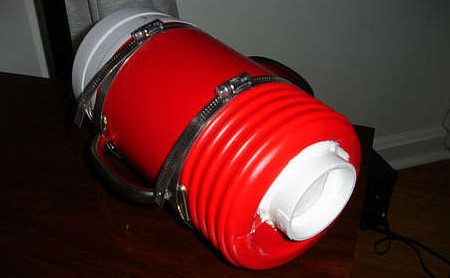
This underwater camera housing on Instructables doesn’t require a specific container, allowing you to choose anything you have around the house that’s watertight and large enough to fit your camera. A finger from a glove is added so you can still operated the controls. A similar project uses an insulated water jug, accommodating any camera that fits inside. Neither of these involve any camera mods.
Custom Mounting Manual Minolta/Sony Lenses
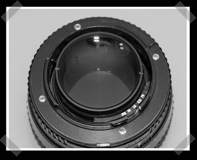
We usually get Canon mods, but [polossatik] sent in some interesting Sony/Minolta lens modding work by [Shaocaholica], who’s been really been taking lens modding to a new level of quality. He picked up several old Rokkor F1.2 lenses and swapped parts around to make four decent lenses. Then he had [Pete Ganz] turn down some new mounts on his lathe. Finally, a quick round of epoxy to add a lens id chip activates the on board image stablization and focus confirmation. Be sure to check out the photo build log here.
Simple Digital Camera Spectroscope
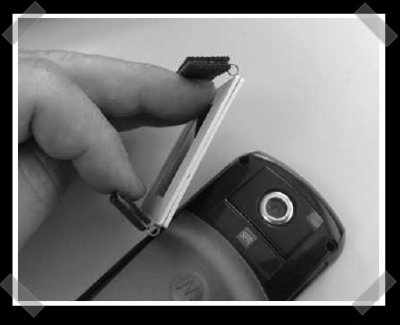
[JC Doré] sent in this [english] interesting optics hack. The rubber grips are made from an old mouse pad, the springs for the clip were salvaged from zip drive floppy discs. A pair of old photo slide frames sandwich a diffraction grating slide. (Like this one) This simple mod allows the slide to be mounted to most cell phones, turning them into digital spectrometers.
Add On-board Light Metering To Your Nikon D40
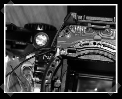
Nikon didn’t build a light metering chip into the D40. That’s fine if you’re using one of their auto lenses with the on-board chip. [Matt] decided to add a sensor to his camera and try it out with his manual lenses. His writeup is a bit challenging to get through, but if you’re really into Nikons, you’ll make it. He had to tap into the ribbon cable inside the body, mount the extra hardware, and add an additional switch outside the body to allow the chip to be turned on and off. The extra sensor adds a bit of a step to taking the shot, but it’s the sort of thing that’ll become second nature pretty quickly.
D200 Hotshoe GPS Redux (el Cheapo Version)
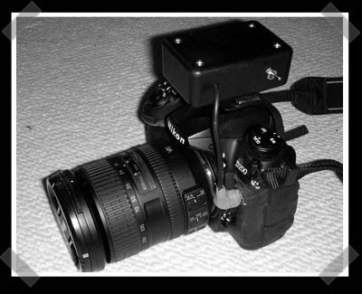
It’s been a while since we talked about putting a GPS on top of a D200. [Rick] sent in his latest version. He used a nice 20 channel sirf III gps from spark-fun, a cheap D200 remote cable and a few parts to send the NMEA sentences down the wire. The biggest improvements include taking the $100 Nikon cable out of the mix and swiping power from the camera for the GPS board. All the info is there, but I had to seriously stare at his wiring instructions for a while despite the low parts count. I like to see actual circuit diagrams!
Super8 Automatic Film Scanner
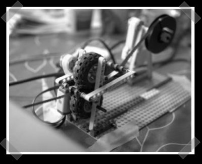
[edocronian] sent in this interesting mindstorm hack. [Harri] had several Super8 reels that he shot during the 80s. His kids put together this mindstorm NXT transport mechanism, and he did the rest with linux. The lego’s pull the reel across an Epson scanner, and some linux hacks run the scanner, identify the frames, and reconstruct the film. Unfortunately, [Harri] didn’t release any of the software hacks he used to pull it off.

