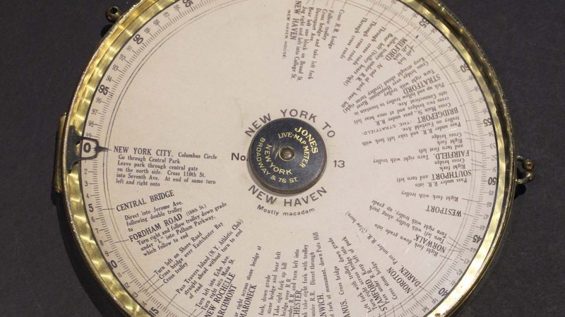
Many of us now carry a phone that can give us detailed directions from where we are to a destination of our choosing. This luxury became commonplace over the last decade plus, replacing the pen-and-paper solution of consulting a map to plan a trip and writing down steps along the way. During the trip we would have to manually keep track of which step we’re on, but wouldn’t it have been nice to have the car do that automatically? [Ars Technica] showed us that innovators were marketing solutions for automatic step by step driving directions in a car over a 100 years ago.
Systems like the Jones Live-Map obviously predated GPS satellites, so they used vehicle odometry. Given a starting point and a mechanical link to the drivetrain, these machines can calculate miles traversed and scroll to the corresponding place in the list of instructions. This is a concept that has been used in many different contexts since, including the “Next Bus in 7 Minutes” type of display at bus stops. Because a bus runs a fixed route, it is possible to determine location of a bus given its odometer reading transmitted over radio. This was useful before the days of cheap GPS receiver and cellular modems. But the odometry systems would go awry if a bus rerouted due to accidents or weather, and obviously the same would apply to those old school systems as well. Taking a detour or, as the article stated, even erratic driving would accumulate errors by the end of the trip.
The other shortcoming is that these systems predated text-to-speech, so reading the fine print on those wheels became a predecessor to today’s distracted driving problem. One of the patent diagrams explained the solution is to hand the device to a passenger to read. But if there’s a copilot available for reading, they can just as easily track the manual list of directions or use a map directly. The limited utility relative to complexity and cost is probably why those systems faded away. But the desire to solve the problem never faded, so every time new technology became available, someone would try again. Just as they did with a tape casette system in the 1970s and the computerized Etak in the 1980s.
[Photo by Seal Cove Auto Museum]


Solo drives in the 90s, I just recorded directions for myself on a cassette tape. We’ll probably eventually find a wax cylinder saying “At gibbet hill, take the high road…”
There was another system in the 30s, had a roller to roller strip map.
Mandatory Sunny reference :P https://www.youtube.com/watch?v=nJtxMnvY3_4
Any odometric device is safer than having to constantly watch (whilst driving) for a exit or turn.
As someone who has frequently been led astray by a confused GPS, I find this device appealing. Yes, I’m sure that it’s severely lacking when compared with electronic solutions. But it would be nice to have a device that doesn’t suffer software glitches or change its mind without warning.
If you’re a Google Maps user, you can create and save a route on the website, then follow that route via “live” GPS. The easiest way is to let Google Maps choose a route, customize it to your liking, and save it.
Thanks for the suggestion! I’ll try it out- it might save me a lot of stress.
remember to turn offline maps on if you’re gonna be out of data range (or bandwidth) to make sure it saves the lot.