High-Altitude Balloon Tracker Does Landing Prediction With Pi Pico

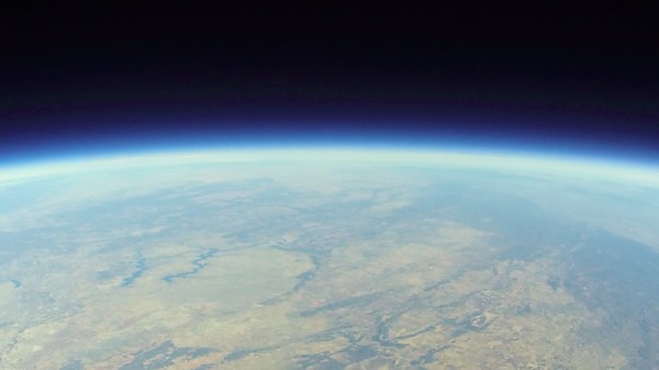
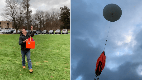
[Dave Akerman]’s ongoing high altitude balloon (HAB) work is outstanding, and we’re all enriched by the fact that he documents his work like he does. Recently, [Dave] wrote about his balloon tracker based on the Raspberry Pi Pico, whose capabilities brought a couple interesting features to the table.

In a way, HAB trackers have a fairly simple job: read sensors such as GPS and constantly relay that data to someone on the ground so that the balloon’s location can be tracked, and the hardware recovered when it ultimately returns to Earth. There are a lot of different ways to do this tracking, and one thing [Dave] enjoys is getting his hands on a new board and making a HAB tracker out of it. That’s exactly what he has done with the Raspberry Pi Pico.

Nothing builds familiarity like actually using a part, and the Pico had some useful things to contribute to a HAB tracker application. For one thing, the Pico has an onboard buck-boost converter that allows it to be powered from a relatively wide voltage range (~1.8 V to 5.5 V), so running it directly from batteries is both possible and desirable from a tracker perspective. But a really useful feature was possible thanks to the large amount of memory on the Pico: dynamic landing prediction.

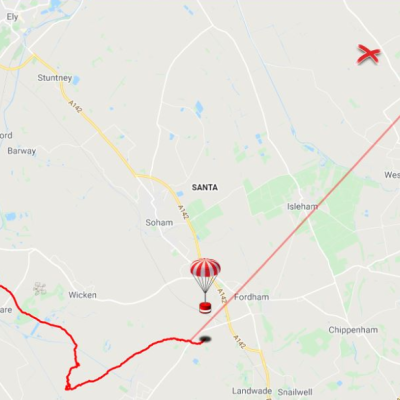
[Dave] does landing prediction prior to launch based on environmental conditions, but it’s always better if the HAB tracker can also calculate its own prediction based on actual observed events and conditions. A typical microcontroller board like an Arduino doesn’t have enough memory to store the required data upon which to do such calculations, but the Pico does so easily. [Dave]’s new board transmits an updated landing site prediction along with all the rest of the telemetry, making the retrieval process much more reliable.

Want to see a completely different approach to HAB recovery? Check out a payload guided by steerable parachutes.

Custom Firmware Makes A LoRA-Enabled HAB Tracker Watch

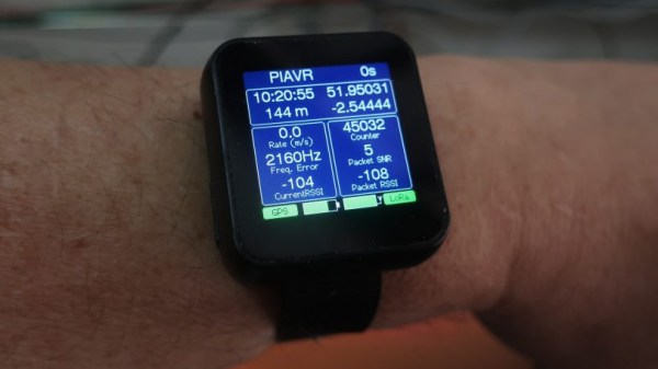
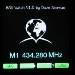
High Altitude Balloons (HAB) are a great way to get all kinds of data and shoot great photos and video, but what goes up must come down. Once the equipment has landed, one must track it down. GPS and LoRA, with its long wireless range and ease of use, are invaluable tools in tracking payloads that have returned to Earth. [Dave Akerman] has made handheld receivers to guide him to payloads, but wanted something even smaller; ideally something that could be worn on the wrist.

One day he came across the affordable LilyGo T-Watch which includes GPS and LoRA functionality, and he started getting ideas. The watch has the features, but the stock firmware didn’t measure up. Not to be deterred, [Dave] wrote new firmware to turn the device into a wrist-worn GPS and LoRA chase watch.

Not only is the new firmware functional, but it’s got a wonderful user interface. GitHub repository for the new firmware is here, and you can see the UI in action in the brief video embedded below.

Continue reading “Custom Firmware Makes A LoRA-Enabled HAB Tracker Watch”

Cheap Muon Detectors Go Aloft On High-Altitude Balloon Mission

There’s something compelling about high-altitude ballooning. For not very much money, you can release a helium-filled bag and let it carry a small payload aloft, and with any luck graze the edge of space. But once you retrieve your payload package – if you ever do – and look at the pretty pictures, you’ll probably be looking for the next challenge. In that case, adding a little science with this high-altitude muon detector might be a good mission for your next flight.

[Jeremy and Jason Cope] took their inspiration for their HAB mission from our coverage of a cheap muon detector intended exactly for this kind of citizen science. Muons constantly rain down upon the Earth from space with the atmosphere absorbing some of them, so the detection rate should increase with altitude. [The Cope brothers] flew two of the detectors, to do coincidence counting to distinguish muons from background radiation, along with the usual suite of gear, like a GPS tracker and their 2016 Hackaday prize entry flight data recorder for HABs.

The payload went upstairs on a leaky balloon starting from upstate New York and covered 364 miles (586 km) while managing to get to 62,000 feet (19,000 meters) over a five-hour trip. The [Copes] recovered their package in Maine with the help of a professional tree-climber, and their data showed the expected increase in muon flux with altitude. The GoPro died early in the flight, but the surviving footage makes a nice video of the trip.

Continue reading “Cheap Muon Detectors Go Aloft On High-Altitude Balloon Mission”