The Final Days Of The Fire Lookouts

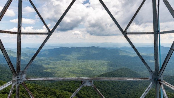
For more than a century, the United States Forest Service has employed men and women to monitor vast swaths of wilderness from isolated lookout towers. Armed with little more than a pair of binoculars and a map, these lookouts served as an early warning system for combating wildfires. Eventually the towers would be equipped with radios, and later still a cellular or satellite connection to the Internet, but beyond that the job of fire lookout has changed little since the 1900s.

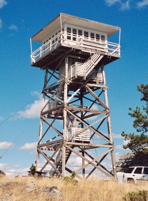
Like the lighthouse keepers of old, there’s a certain romance surrounding the fire lookouts. Sitting alone in their tower, the majority of their time is spent looking at a horizon they’ve memorized over years or even decades, carefully watching for the slightest whiff of smoke. The isolation has been a prison for some, and a paradise for others. Author Jack Kerouac spent the summer of 1956 in a lookout tower on Desolation Peak in Washington state, an experience which he wrote about in several works including Desolation Angels.

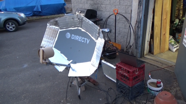
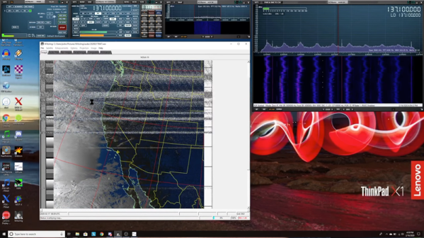
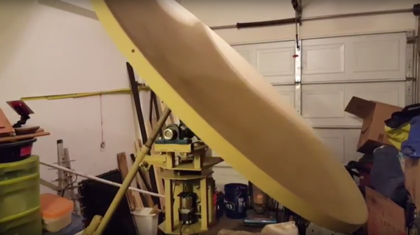
But slowly, in a change completely imperceptible to the public, the era of the fire lookouts has been drawing to a close. As technology improves, the idea of perching a human on top of a tall tower for months on end seems increasingly archaic. Many are staunchly opposed to the idea of automation replacing human workers, but in the case of the fire lookouts, it’s difficult to argue against it. Computer vision offers an unwavering eye that can detect even the smallest column of smoke amongst acres of woodland, while drones equipped with GPS can pinpoint its location and make on-site assessments without risk to human life.

At one point, the United States Forest Service operated more than 5,000 permanent fire lookout towers, but today that number has dwindled into the hundreds. As this niche job fades even farther into obscurity, let’s take a look at the fire lookout’s most famous tool, and the modern technology poised to replace it.

Continue reading “The Final Days Of The Fire Lookouts”

Full Earth Disc Images From GOES-17 Harvested By SDR

We’ve seen lots of hacks about capturing weather images from the satellites whizzing over our heads, but this nicely written how-to from [Eric Sorensen] takes a different approach. Rather than capturing images from polar satellites that pass overhead a few times a day, this article looks at capturing images from GOES-17, a geostationary satellite that looks down on the Pacific Ocean. The fact that it is a geostationary satellite means that it captures the same view all the time, so you can capture awesome time-lapse videos of the weather.  Continue reading “Full Earth Disc Images From GOES-17 Harvested By SDR”

Hackaday Podcast 015: Going Low Frequency, Robotic Machines, Disk Usage For Budgets, And Cellphones Versus Weather

Hackaday Editors Mike Szczys and Elliot Williams discuss the highlights of the great hacks from the past week. On this episode we discuss wireless charging from scratch, Etch-A-Sketch selfies, the robot arm you really should build yourself, bicycle tires and steel nuts for anti-slip footwear, and bending the piezo-electric effect to act as a VLF antenna. Plus we delve into articles you can’t miss about 5G and robot firefighting.

Take a look at the links below if you want to follow along, and as always, tell us what you think about this episode in the comments!

Take a look at the links below if you want to follow along, and as always, tell us what you think about this episode in the comments!

Direct download (60 MB or so.)

Continue reading “Hackaday Podcast 015: Going Low Frequency, Robotic Machines, Disk Usage For Budgets, And Cellphones Versus Weather”

Junkyard Dish Mount Tracks Weather Satellites

There’s a magnificent constellation of spacecraft in orbit around Earth right now, many sending useful data back down to the surface in the clear, ready to be exploited. Trouble is, it often takes specialized equipment that can be a real budget buster. But with a well-stocked scrap bin, a few strategic eBay purchases, and a little elbow grease, a powered azimuth-elevation satellite dish mount can become affordable.

The satellites of interest for [devnulling]’s efforts are NOAA’s Polar-orbiting Operational Environmental Satellites (POES), a system of low-Earth orbit weather birds. [devnulling] is particularly interested in direct reception of high-definition images from the satellites’ L-band downlink. The mount he came up with to track satellites during lengthy downloads is a tour de force of junkyard build skills.

The azimuth axis rotates on a rear wheel bearing from a Chevy, the elevation axis uses cheap pillow blocks, and the frame is welded from scrap angle iron and tubing. A NEMA-23 stepper with 15:1 gearhead rotates the azimuth while a 36″ linear actuator takes care of elevation. The mount has yet to be tested in the wind; we worry that sail area presented by the dish might cause problems. Here’s hoping the mount is as stout as it seems, and we’ll look forward to a follow-up.

It would work for us, but a 4-foot dish slewing around in the back yard might not be everyone’s taste in lawn appurtenances. If that’s you and you still want to get your weather data right from the source, try using an SDR dongle and chunk of wire.

Continue reading “Junkyard Dish Mount Tracks Weather Satellites”

Pictures From Weather Satellites With A USB TV Tuner

europe

Several times a day, a NOAA weather satellite passes over your head, beaming down pictures of weather systems and cloud formations. These transmissions aren’t encrypted, and given the requisite hardware it’s possible for you to download these images from space as [Lovro] shows us in a tutorial video.

To get these near real-time satellite pictures, [Lovro] used one of those USB TV tuners we’ve grown so fond of. A somewhat specialized antenna is required to receive the right hand polarized transmissions from NOAA weather satellites, but with a few bits of wood and wire, [Lovro] made a helical antenna to listen in on the weather satellites transmitting around 137 MHz. After gathering a whole bunch of data from the satellites with SDRsharp, [Lovro] used an image decoder to turn an audio file into a picture taken from space just hours ago.

This isn’t the first time we’ve seen images from a NOAA weather satellite downloaded with a software defined radio; last year [hpux735] did just that with a somewhat inexpensive Softrock SDR. [Lovro]’s use of a USB TV tuner to receive the transmission from NOAA satellites is a lot easier on the pocketbook, though, with the largest expense being an investment in time to build a helical antenna.