Hackaday Links Column Banner

Hackaday Links: August 27, 2023

We mentioned last week how robotaxi provider Cruise was having a no-good, very bad week, after one of their driverless taxis picked a fight with a semi, and it was revealed that amorous San Franciscans were taking advantage of the privacy afforded by not having a driver in the front seat. It appears that we weren’t the only ones to notice all the bad news, since California’s Department of Motor Vehicles issued an order to the company to cut its robotaxi fleet in half. The regulatory move comes after a recent Cruise collision with a fire truck, which injured a passenger in the taxi. Curiously, the DMV order stipulates that Cruise can only operate 50 vehicles during the day, while allowing 150 vehicles at night. We’d have thought the opposite would make more sense, since driving at night is generally more difficult than during daylight hours. But perhaps the logic is that the streets are less crowded at night, whereas daytime is a more target-rich environment.

Continue reading “Hackaday Links: August 27, 2023”

Hackaday Links Column Banner

Hackaday Links: April 2, 2023

It may be hard to believe, but it’s time for the Hackaday Prize again! The 2023 Hackaday Prize was announced last weekend at Hackaday Berlin, and entries are already pouring in. The first-round challenge is all about “Re-engineering Education,” which means you’ve got to come up with a project idea that helps push back the veil of ignorance somehow. Perhaps you’ve got a novel teaching tool in mind, or a way to help students learn remotely. Or maybe your project is aimed at getting students involved and engaged. Whatever it is — and whatever the subject matter; it doesn’t just have to be hacking-adjacent — get an entry together, build a team, and get to work. The first round closes on April 25, so get to it!

Continue reading “Hackaday Links: April 2, 2023”

Citizen-Driven Network Monitors Public Service Radio For Natural Disaster Alerts

Time is of the essence in almost every emergency situation, especially when it comes to wildfires. A wind-driven fire can roar across a fuel-rich landscape like a freight train, except one that can turn on a dime or jump a mile-wide gap in a matter of seconds. Usually, the only realistic defense against fires like these is to get the hell out of their way as soon as possible and make room for the professionals to do what they can to stop the flames.

Unfortunately, most people living in areas under threat of wildfires and other natural disasters are often operating in an information vacuum. Official channels take time to distribute evacuation orders, and when seconds count, such delays can cost lives. That’s the hole that Watch Duty seeks to fill.

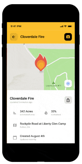
Watch Duty is a non-profit wildfire alerting, mapping, and tracking service that provides near-real-time information to those living in wildfire country. Their intelligence is generated by a network of experienced fire reporters, who live in wildfire-prone areas and monitor public service radio transmissions and other sources to get a picture of what’s going on in their specific area. When the data indicate an incident is occurring, maps are updated and alerts go out via a smartphone app. Reporters have to abide by a strict code of conduct designed to ensure the privacy of citizens and the safety of first responders.

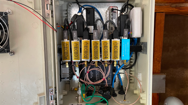
While Watch Duty’s network covers a substantial area of California — the only state covered so far — there were still a significant number of dead zones, mostly in the more remote areas of the Sierra Nevada Mountains and in the northern coastal regions. To fill these gaps, Watch Duty recently launched Watch Duty Echo, which consists of a network of remote listening posts.

Each station is packed with RTL-SDR receivers that cover a huge swath of spectrum used by the local fire, law enforcement, EMS agencies — any organization likely to be called to respond to an incident. In addition, each station has an SDR dedicated to monitoring ADS-B transponders and air band frequencies, to get a heads-up on incidents requiring aerial support. The listening posts have wideband discone antennas and a dedicated 1090-MHz ADS-B antenna, with either a cellular modem or a Starlink terminal to tie into the Watch Duty network.

Hats off to the folks at Watch Duty for putting considerable effort into a system like this and operating it for the public benefit. Those who choose to live close to nature do so at their own risk, of course, but a citizen-driven network that leverages technology can make that risk just a little more manageable.

Hackaday Links Column Banner

Hackaday Links: September 18, 2022

We always love when people take the trouble to show information in new, creative ways — after all, there’s a reason that r/dataisbeautiful exists. But we were particularly taken by this version of the periodic table of the elements, distorted to represent the relative abundance on Earth of the 90 elements that make up almost everything. The table is also color-coded to indicate basically how fast we’re using each element relative to its abundance. The chart also indicates which elements are “conflict resources,” basically stuff people fight over, and which elements go into making smartphones. That last bit we thought was incomplete; we’d have sworn at least some boron would be somewhere in a phone. Still, it’s an interesting way to look at the elements, and reminds us of another way to enumerate the elements.

It’s wildfire season in the western part of North America again, and while this year hasn’t been anywhere near as bad as last year — so far — there’s still a lot of activity in our neck of the woods. And wouldn’t you know it, some people seem to feel like a wildfire is a perfect time to put up a drone. It hardly seems necessary to say that this is A Really Bad Idea™, but for some reason, people still keep doing it. Don’t misunderstand — we absolutely get how cool it is to see firefighting aircraft do their thing. The skill these pilots show as they maneuver their planes, which are sometimes as large as passenger jets, within a hundred meters of the treetops is breathtaking. But operating a drone in the same airspace is just stupid. Not only is it likely to get you in trouble with the law, but there’s a fair chance that the people whose property and lives are being saved by these heroic pilots won’t look kindly on your antics.

Continue reading “Hackaday Links: September 18, 2022”

Modern Wildfires And Their Effect On The Ozone Layer

The ozone layer is a precious thing, helping protect the Earth from the harshest of the sun’s radiative output. If anything were to damage this layer, we’d all feel the results in a very short order indeed.

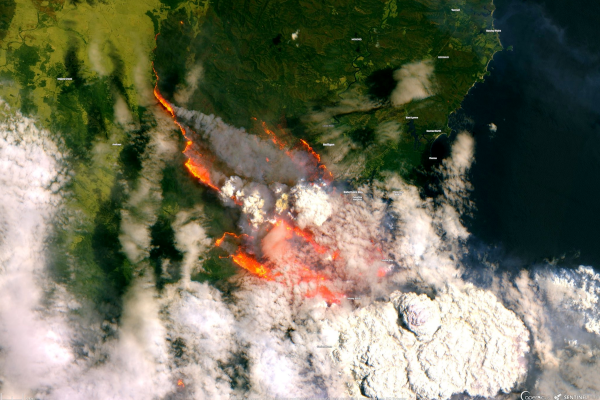
In the past, humanity has worked to limit damage to the ozone layer from our own intentional actions. However, it’s not just aerosol cans and damaged air conditioning systems that are putting it at risk these days. The fierce wildfires we’ve seen so much of in recent years are also having a negative effect. Let’s take a look at why the ozone layer matters, and how it’s being affected by these wildfires.

Continue reading “Modern Wildfires And Their Effect On The Ozone Layer”

Closely Examining How A PG&E Transmission Line Claimed 85 Lives In The 2018 Camp Fire

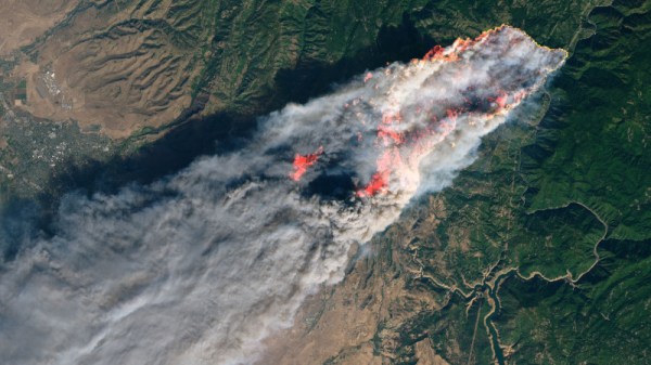
In 2018, the Camp Fire devastated a huge swathe of California, claiming 85 lives and costing 16.65 billion dollars. Measured in terms of insured losses, it was the most expensive natural disaster of the year, and the 13th deadliest wildfire in recorded history.

The cause of the fire was determined to be a single failed component on an electrical transmission tower, causing a short circuit and throwing sparks into the dry brush below – with predictable results. The story behind the failure was the focus of a Twitter thread by [Tube Time] this week, who did an incredible job of illuminating the material evidence that shows how the disaster came to be, and how it could have been avoided.

Mismanagement and Money

The blame for the incident has been laid at the feet of Pacific Gas and Electric, or PG&E, who acquired the existing Caribou-Palermo transmission line when it purchased Great Western Power Company back in 1930. The line was originally built in 1921, making the transmission line 97 years old at the time of the disaster. Despite owning the line for almost a full century, much of the original hardware was not replaced in the entire period of PG&Es ownership. Virtually no records were created or kept, and hardware from the early 20th century was still in service on the line in 2018.

Continue reading “Closely Examining How A PG&E Transmission Line Claimed 85 Lives In The 2018 Camp Fire”

The Final Days Of The Fire Lookouts

For more than a century, the United States Forest Service has employed men and women to monitor vast swaths of wilderness from isolated lookout towers. Armed with little more than a pair of binoculars and a map, these lookouts served as an early warning system for combating wildfires. Eventually the towers would be equipped with radios, and later still a cellular or satellite connection to the Internet, but beyond that the job of fire lookout has changed little since the 1900s.

Like the lighthouse keepers of old, there’s a certain romance surrounding the fire lookouts. Sitting alone in their tower, the majority of their time is spent looking at a horizon they’ve memorized over years or even decades, carefully watching for the slightest whiff of smoke. The isolation has been a prison for some, and a paradise for others. Author Jack Kerouac spent the summer of 1956 in a lookout tower on Desolation Peak in Washington state, an experience which he wrote about in several works including Desolation Angels.

But slowly, in a change completely imperceptible to the public, the era of the fire lookouts has been drawing to a close. As technology improves, the idea of perching a human on top of a tall tower for months on end seems increasingly archaic. Many are staunchly opposed to the idea of automation replacing human workers, but in the case of the fire lookouts, it’s difficult to argue against it. Computer vision offers an unwavering eye that can detect even the smallest column of smoke amongst acres of woodland, while drones equipped with GPS can pinpoint its location and make on-site assessments without risk to human life.

At one point, the United States Forest Service operated more than 5,000 permanent fire lookout towers, but today that number has dwindled into the hundreds. As this niche job fades even farther into obscurity, let’s take a look at the fire lookout’s most famous tool, and the modern technology poised to replace it.

Continue reading “The Final Days Of The Fire Lookouts”