Real-time GPS Tracker With Mobile Phone Uplink

[jayesh] wasn’t actually trying to solve any clever problems when we built his homebrew GPS tracker. He just had the hacker mentality and wanted to build something fun and useful while geeking out with electronics and software.

On the hardware side, he started with an Arduino, then added a GPS module for location detection and a GMS/GPRS module for the data uplink to his server over AT&T’s network. The Arduino uses several libraries and plenty of custom code. On the server, he worked up some wizardry with open-source packages and the Google Maps API. All of the source code and hardware details are well-documented. Put together, it’s a GPS tracker that can update a map in real-time. Sure, there are commercial products that do roughly the same thing, but where’s the fun in that? The principles here can also be put to good use in other microcontroller-based projects.

Exposing Poorly Redacted PDFs


Privacy watchdog group, National Legal and Policy Center has released a PDF detailing Google founder Larry Page’s home (dowload PDF here). They used Google’s Maps and Street View to assemble all of the information. Google is currently involved in a lawsuit resulting from a Street View vehicle traveling and documenting a private road. This PDF was released in response to Google stating that “complete privacy does not exist”.

For some reason the PDF is redacted with black boxes. We threw together a simple screencast (click through for HiDef) to show how to easily bypass the boxes using free tools. You can simply cut and paste the hidden text and images can be copied as well-no need to break out Illustrator. This sort of redaction may seem trivial, but the US military has fallen victim to it in the past.

Map Abstraction API In Javascript


Maybe you’ve tinkered a bit with the Google Maps API. Most of the software produced with it is not all that useful or entertaining, but a few gem have shone through. Still, wouldn’t it be better if applications produced with it could be easily ported to other online mapping services like Mapquest or Yahoo! Maps?

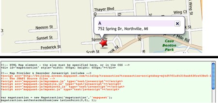
This is possible with Mapstraction, a Javascript API that works with nine mapping services and plans to incorporate more into the fold. Mapstraction has open-source features that normalize functions across the biggest services, which makes searching for map data a consistent, predictable experience no matter which service you use.

Some of Mapstraction’s current features are what you would expect: point, line, and polygon support, image overlay, GeoRSS and KML feed importing, and several others. We’re really looking forward to future versions with OpenStreetMap support. Currently Mapstraction works with only commercial mapping services, but OpenStreetMap combined with Mapstraction directly hits the sweet spot; a customizable, open source map.

[via Hackszine]

IPhone Used To Control Squad Of UAVs

[youtube=http://www.youtube.com/watch?v=CRcld5aAN2E&hl=en]
Building UAVs
is only half the work involved in making them fly; the other half is a control system. The Center for Collaborative Control of Unmanned Vehicles (C3UV) from the University of Califorina, Berkeley has devised a way to control a squad of RC airplanes with an iPhone. The system works by submitting commands and coordinates to a web site via the iPhone’s web browser. The site then sends the commands to the team of drones, which carry out the orders. The drones are outfitted with cameras and a tracking device, which allows them to be monitored on the ground using Google Maps.

The iPhone Terms of Service specifically prohibits it being used to drive remote vehicles, but that shouldn’t really pose a problem: since the orders are deployed via the iPhone’s web browser, they could technically be given by any web-enabled device. Before anyone cries foul, though, bear in mind that the idea is to issue orders from the field, and the iPhone is perhaps the most high-profile mobile web device on the market, which maximizes the project’s exposure. Still, we can’t help but think that they’d have gotten more media attention if they had used a hacked Kindle instead.

Gaming With Real-world Data


We were pretty excited by the prospect of location-aware software and its ability to pull map data into its functions, but what do you get when build software on top of a map-based service? Well, one possibility is 2D gaming on real maps.

Continue reading “Gaming With Real-world Data”