Automated Weed Spraying Drone Needs No Human Intervention

Battling weeds can be expensive, labor intensive and use large amounts of chemicals. To help make this easier [NathanBuilds] has developed  V2 of his open-source drone weed spraying system, complete with automated battery swaps, herbicide refills, and an AI vision system for weed identification.

The drone has a 3D printed frame, doubling as a chemical reservoir. V1 used a off-the-shelf frame, with separate tank. Surprisingly, it doesn’t look like [Nathan] had issues with leaks between the layer lines. For autonomous missions, it uses ArduPilot running on a PixHawk, coupled with RTK GPS for cm-level accuracy and a LiDAR altimeter. [Nathan] demonstrated the system in a field where he is trying to eradicate invasive blackberry bushes while minimizing the effect on the native prairie grass. He uses a custom image classification model running on a Raspberry Pi Zero, which only switches on the sprayers when it sees blackberry bushes in the frame. The Raspberry Pi Global Shutter camera is used to get blur-free images.

At just 305×305 mm (1×1 ft), the drone has limited herbicide capacity, and we expect the flights to be fairly short. For the automated pit stops, the drone lands on a 6×8 ft pad, where a motorized capture system pulls the drone into the reload bay. Here a linear actuator pushes a new battery into the side of the drone while pushing the spend battery one out the other side. The battery unit is a normal LiPo battery in 3D-printed frame. The terminal are connected to copper wire and tape contacts on the outside the battery unit, which connect to matching contacts in the drone and charging receptacles. This means the battery can easily short if it touches a metal surface, but a minor redesign could solve this quickly. There are revolving receptacles on either side of the reload bay, which immediately start charging the battery when ejected from the drone.

Developing a fully integrated system like this is no small task, and it shows a lot of potential. It might look a little rough around the edges, but [Nathan] has released all the design files and detailed video tutorials for all the subsystems, so it’s ready for refinement.

Continue reading “Automated Weed Spraying Drone Needs No Human Intervention”

Amazon Receives FAA Approval For MK30 Delivery Drone

It’s been about a decade since Amazon began to fly its delivery drones, aiming to revolutionize the online shopping experience with rapid delivery of certain items. Most recently Amazon got permission from the FAA to not only start flying from its new Arizona-based location, but also to fly beyond-visual-line-of-sight (BVLOS) missions with the new MK30 drone. We reported on this new MK30 drone which was introduced earlier this year along with the news of the Amazon Prime Air delivery service ceasing operations in California and moving them to Arizona instead.

This new drone has got twice the range as the old MK27 drone that it replaces and is said to be significantly quieter as well. The BLOS permission means that the delivery drones can service areas which are not directly visible from the warehouse with its attached drone delivery facility. With some people within the service range of the MK27 drones having previously complained about the noise levels, we will see quickly enough whether the MK30 can appease most.

As for the type of parcels you can have delivered with this service, it is limited to 2.27 kg (~5 lbs), which is plenty for medication and a range of other items where rapid delivery would be desirable.

Custom Drone Software Searches, Rescues

When a new technology first arrives in people’s hands, it often takes a bit of time before the full capabilities of that technology are realized. In much the same way that many early Internet users simply used it to replace snail mail, or early smartphones were used as more convenient methods for messaging and calling than their flip-phone cousins, autonomous drones also took a little bit of time before their capabilities became fully realized. While some initially used them as a drop-in replacement for things like aerial photography, a group of mountain rescue volunteers in the United Kingdom realized that they could be put to work in more efficient ways suited to their unique abilities and have been behind a bit of a revolution in the search-and-rescue community.

The first search-and-rescue groups using drones to help in their efforts generally used them to search in the same way a helicopter would have been used in the past, only with less expense. But the effort involved is still the same; a human still needed to do the searching themselves. The group in the UK devised an improved system to take the human effort out of the equation by sending a drone to fly autonomously over piece of mountainous terrain and take images of the ground in such a way that any one thing would be present in many individual images. From there, the drone would fly back to its base station where an operator could download the images and run them through a computer program which would analyse the images and look for outliers in the colors of the individual pixels. Generally, humans tend to stand out against their backgrounds in ways that computers are good at spotting while humans themselves might not notice at all, and in the group’s first efforts to locate a missing person they were able to locate them almost immediately using this technology.

Although the system is built on a mapping system somewhat unique to the UK, the group has not attempted to commercialize the system. MR Maps, the software underpinning this new feature, has been free to use for anyone who wants to use it. And for those just starting out in this field, it’s also worth pointing out that location services offered by modern technologies in rugged terrain like this can often be misleading, and won’t be as straightforward of a solution to the problem as one might think.

Solar Planes Are Hard

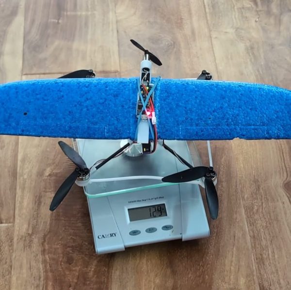
A regular comment we see on electric aircraft is to “just add solar panels to the wings.” [James] from Project Air has been working on just such a solar plane, and as he shows in the video after the break, it is not a trivial challenge.

A solar RC plane has several difficult engineering challenges masquerading as one. First, you need a solid, efficient airframe with enough surface area for solar panels. Then, you need a reliable, lightweight, and efficient solar charging system and, finally, a well-tuned autopilot to compensate for a human pilot’s limited endurance and attention span.

In part one of this project, a fault in the electrical system caused a catastrophe so James started by benching all the electricals. He discovered the MPPT controller had a battery cutoff feature that he was unaware of, which likely caused the crash. His solution was to connect the solar panels to the input of a 16.7 V voltage regulator—just under the fully charged voltage of a 4S LiPo battery— and wire the ESC, control electronics, and battery in parallel to the output. This should keep the battery charged as long as the motor doesn’t consume too much power.

After rebuilding the airframe and flight testing without the solar system, [James] found the foam wing spars were not up to the task, so he added aluminum L-sections for stiffness. The solar panels and charging system were next, followed by more bench tests. On the test flight, it turned out the aircraft was now underpowered and struggled to gain altitude thanks to the added weight of the solar system. With sluggish control responses,[James] eventually lost sight of it behind some trees, which led to a flat spin and unplanned landing.

Fortunately, the aircraft didn’t sustain any damage, but [James] plans to redesign it anyway to reduce the weight and make it work with the existing power system.

We’ve seen several solar planes from [rctestflight] and meticulously engineered versions from [Bearospace Industrues]. If long flight times is primarily what you are after, you can always ditch the panels and  use a big battery for 10+ hour flights.

Continue reading “Solar Planes Are Hard”

Tiny Drones Do Distributed Mapping

Sending teams of tiny drones to explore areas and structures is a staple in sci-fi and research, but the weight and size of sensors and the required processing power have long been a limiting factor. In the video below, a research team from [ETH Zurich] breaks through these limits, demonstrating indoor mapping with a swarm of tiny drones without dependence on any external systems.

The drone is the modular Crazyflie platform, which uses stackable PCBs (decks) to expand capabilities. The team added a Flow deck for altitude control and motion tracking, and a Loco positioning deck with a UWB module determining relative distances between drones. On top of this, the team added two custom decks. The first mounts four VL53L5CX 8×8 pixel TOF sensors for omnidirectional LIDAR scanning. The final deck does handles all the required processing with a GAP9 System-on-Chip, which features 10 RISC-V cores running on just 200 mW of power.

Of course the special sauce of this project lies in the software. The team developed a lightweight collaborative Simultaneous Localization And Mapping (SLAM) algorithm which can be distributed across all the drones in the swarm. It combines LIDAR scan data and the estimated position of the drone during the scan, and then overlays the data for the scans for each location across different drones, compensating for errors in the odometry data. The team also implemented inter-drone collision avoidance, packet collision avoidance and optimizing drones’ paths. The code is supposed to be available on GitHub, but the link was broken at the time of writing.

The Crazyflie platform has been around for more than a decade now, and we’ve seen it used in several research projects, especially related to autonomous navigation. Continue reading “Tiny Drones Do Distributed Mapping”

Single Rotor Drone Spins For 360 Lidar Scanning

Multiple motors or servos are the norm for drones to achieve controllable flight, but a team from MARS LAB HKU was able to a 360° lidar scanning drone with full control on just a single motor and no additional actuators. Video after the break.

The key to controllable flight is the swashplateless propeller design that we’ve seen a few times, but it always required a second propeller to counteract self-rotation. In this case, the team was able to make that self-rotation work so that they could achieve 360° scanning with a single fixed LIDAR sensor. Self-rotation still needs to be slowed, so this was done with four stationary vanes. The single rotor also means better efficiency compared to a multi-rotor with similar propeller disk area.

The LIDAR comprises a full 50% of the drone’s weight and provides a conical FOV out to a range of 450m. All processing happens onboard the drone, with point cloud data being processed by a LIDAR-inertial odometry framework. This allows the drone to track and plan its flight path while also building a 3D map of an unknown environment. This means it would be extremely useful for indoor or underground environments where GPS or other positioning systems are not available.

All the design files and code for the drone are up on GitHub, and most of the electronic components are off-the-shelf. This means you can build your own, and the expensive lidar sensor is not required to get it flying. This seems like a great platform for further experimentation, and getting usable video from a normal camera would be an interesting challenge. Continue reading “Single Rotor Drone Spins For 360 Lidar Scanning”

The Challenges Of Charging Drones From Power Lines

Drones that charge right on the power lines they inspect is a promising concept, but comes with plenty of challenges. The Drone Infrastructure Inspection and Interaction (Diii) Group of the University of South Denmark is tackling these challenges head-on.

The gripper for these drones may seem fairly straightforward, but it needs to inductively charge, grip, and detach reliably while remaining simple and lightweight. To attach to a power line, the drone pushes against it, triggering a cord to pull the gripper closed. This gripper is held closed electromagnetically using energy harvested from the power line or the drone’s battery if the line is off. Ingeniously, this means that if there’s an electronics failure, the gripper will automatically release, avoiding situations where linemen would need to rescue a stuck drone.Accurately mapping power lines in 3D space for autonomous operation presents another hurdle. The team successfully tested mmWave radar for this purpose, which proves to be a lightweight and cost-efficient alternative to solutions like LiDAR.

We briefly covered this project earlier this year when details were limited. Energy harvesting from power lines isn’t new; we’ve seen similar concepts applied in government-sanctioned spy cameras and border patrol drones. Drones are not only used for inspecting power lines but also for more adventurous tasks like clearing debris off them with fire. Continue reading “The Challenges Of Charging Drones From Power Lines”