Watching The Watchers: The State Of Space Surveillance

By now you’ve almost certainly heard about the recent release of a high-resolution satellite image showing the aftermath of Iran’s failed attempt to launch their Safir liquid fuel rocket. The geopolitical ramifications of Iran developing this type of ballistic missile technology is certainly a newsworthy story in its own right, but in this case, there’s been far more interest in how the picture was taken. Given known variables such as the time and date of the incident and the location of the launch pad, analysts have determined it was likely taken by a classified American KH-11 satellite.

The image is certainly striking, showing a level of detail that far exceeds what’s available through any of the space observation services we as civilians have access to. Estimated to have been taken from a distance of approximately 382 km, the image appears to have a resolution of at least ten centimeters per pixel. Given that the orbit of the satellite in question dips as low as 270 km on its closest approach to the Earth’s surface, it’s likely that the maximum resolution is even higher.

Of course, there are many aspects of the KH-11 satellites that remain highly classified, especially in regards to the latest hardware revisions. But their existence and general design has been common knowledge for decades. Images taken from earlier generation KH-11 satellites were leaked or otherwise released in the 1980s and 1990s, and while the Iranian image is certainly of a higher fidelity, this is not wholly surprising given the intervening decades.

What we know far less about are the orbital surveillance assets that supersede the KH-11. The satellite that took this image, known by its designation USA 224, has been in orbit since 2011. The National Reconnaissance Office (NRO) has launched a number of newer spacecraft since then, with several more slated to be lifted into orbit between now and 2021.

So let’s take a closer look at the KH-11 series of reconnaissance satellites, and compare that to what we can piece together about the next generation or orbital espionage technology that’s already circling overhead might be capable of.

Continue reading “Watching The Watchers: The State Of Space Surveillance”

Plasma-Powered Thrusters For Your Homebrew Satellite Needs

It seems as though every week we see something that clearly shows we’re living in the future. The components we routinely incorporate into our projects would have seemed like science fiction only a few short years ago, but now we buy them online and have them shipped to us for pennies. And what can say we’ve arrived in the future more than off-the-shelf plasma thrusters for the DIY microsatellite market?

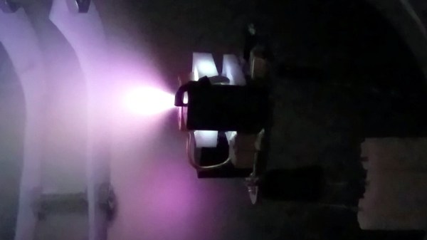
Although [Michael Bretti] does tell us that he plans to sell these thrusters eventually, they’re not quite ready for the market yet. The AIS-gPPT3-1C series that’s currently under testing is designed for the micro-est of satellites, the PocketQube, a format with a unit size only 5 cm on a side – an eighth the size of a 1U CubeSat. The thrusters are solid-fueled, with blocks of Teflon, PEEK, or Ultem that are ablated by a stream of plasma. The gaseous exhaust is accelerated and shaped by a magnetic nozzle that’s integrated right into the thruster. The thruster is mounted directly to a PCB containing the high-voltage supplies and control electronics to interface with the PocketQube’s systems. The 34-gram thrusters have enough fuel for perhaps 500 firings, although that and the specifics of performance are yet to be tested.

If you have any interest at all in space engineering or propulsion systems, [Michael]’s site is worth a look. There’s a wealth of data there, and reading it will give you a great appreciation for plasma physics. We’ve been down that road a lot lately, with cold plasma, thin-film plasma deposition, and even explaining the mystery of plasmatic grapes.

Thanks to [miguekf] for the tip.

Open Source Intel Helps Reveal US Spy Sat Capabilities

On the 30th August 2019, the President of the United States tweeted an image of an Iranian spaceport, making note of the recent failed Safir launch at the site. The release of such an image prompted raised eyebrows, given the high resolution of the image, and that it appeared to be a smartphone photo taken of a classified intelligence document.

Inquisitive minds quickly leapt on the photo, seeking to determine the source of the image. While some speculated that it may have been taken from a surveillance aircraft or drone, analysis by the satellite tracking community disagreed.

A comparison of the actual image, top, and a simulation of what a shot from USA 224 would look like. Ignore the shadows, which are from an image taken at a different time of day. Note the very similar orientation of the features of the launchpad.

The angle of shadows in the image was used to determine the approximate time that the image was taken. Additionally, through careful comparison with existing satellite images from Google Maps, it was possible to infer the azimuth and elevation of the camera. Positions of military satellites aren’t made public, but amateur tracking networks had data placing satellite USA 224 at a similar azimuth and elevation around the time the image was taken.

With both the timing and positioning pointing to USA 224, evidence seems conclusive that this KH-11 satellite was responsible for taking the image. The last confirmed public leak of a Keyhole surveillance image was in 1984, making this an especially rare occurrence. Such leaks are often frowned upon in the intelligence community, as nation states prefer to keep surveillance capabilities close to their chest. The Safir images suggest that USA 224 has a resolution of 10cm per pixel or better – information that could prove useful to other intelligence organisations.

It’s not the first time we’ve covered formerly classified information, either – this teardown of a Soviet missile seeker bore many secrets.

Hackaday Links Column Banner

Hackaday Links: September 1, 2019

The sun may be spotless, but that doesn’t mean it isn’t doing interesting things. A geomagnetic storm is predicted for this weekend, potentially giving those at latitudes where the Northern Lights are not common a chance to see a cosmic light show. According to SpaceWeather.com, a coronal hole, a gap in the sun’s atmosphere that can let the solar wind escape, is about to line up with Earth. The last time this hole was on the Earth-facing side of the sun, the resultant storm gave aurora as far south as Colorado. So if you’re in any of the northern tier states, you might want to find somewhere with dark skies and a good view to the north this weekend.

It’s not only space weather that’s in the news, but weather-weather too. Hurricane Dorian will probably make landfall as a Category 4 storm, probably along Florida’s Atlantic coast, and probably in the middle of the night on Monday. That’s a lot of uncertainty, but one thing’s for sure: amateur radio operators will be getting into the action. The Hurricane Watch Net will activate their net for Dorian on Saturday afternoon at 5:00 PM Eastern time, ready to take reports from stations in the affected area. Not a ham? You can still listen to the live feed once the net activates.

Hams aren’t the only ones getting geared up for Dorian, though. Weather satellite enthusiasts are pointing their SDRs at the sky and grabbing some terrifyingly beautiful pictures of Dorian as it winds up. Some of the downloaded images are spectacular, and if you’ve got an SDR dongle and a couple of pieces of coat hanger wire, you too can spy on Dorian from any number of satellites.

Speaking of which, over on r/RTLSDR, someone has done a little data mining and shown that NOAA 15 is still very much alive. u/amdorj plotted the scan motor current draw and found that it steadily decreased over time, possibly indicating that the bearings aren’t as worn as previously thought. We recently covered the story of the plucky satellite that’s almost two decades past its best-by date; here’s hoping our report on its death was greatly exaggerated.

In one of the weirder bits of marketing we’ve seen lately, NASA decided to name a rock on Mars after septuagenarian rockers The Rolling Stones. The golf ball size rock was blasted about a meter across the Martian landscape when the Mars InSight lander touched down in 2018, leaving a small scar in the dust. The stone had obviously rolled, so phone calls were made and one thing led to another, and before you know it, Robert Downey Jr. is making the announcement before a Stones concert at the Rose Bowl, right in JPL’s backyard. There’s even a cute animation to go along with it. It’s a nice piece of marketing, but it’s not the first time the Stones have been somewhat awkwardly linked to the technology world. We dare you not to cringe.

We’ll finish up today with something not related to space. As Al Williams recently covered, for about fifty bucks you can now score a vector network analyzer (VNA) that will do all sorts of neat RF tricks. The NanoVNA sounds like a great buy for anyone doing RF work, but its low price point and open-source nature mean people are finding all kinds of nifty uses for it. One is measuring the length of coax cables with time-domain reflectometry, or TDR. Phasing antenna arrays? the NanoVNA sounds like the perfect tool for the job.

Life At JPL Hack Chat

Join us on Wednesday, August 21st at noon Pacific for the Life at JPL Hack Chat with Arko!

There’s a reason why people use “rocket science” as a metaphor for things that are hard to do. Getting stuff from here to there when there is a billion miles away and across a hostile environment of freezing cold, searing heat, and pelting radiation isn’t something that’s easily accomplished. It takes a dedicated team of scientists and engineers working on machines that can reach out into the vastness of space and work flawlessly the whole time, and as much practice and testing as an Earth-based simulation can provide.

Arko, also known as Ara Kourchians, is a Robotics Electrical Engineer at the Jet Propulsion Laboratory, one of NASA’s research and development centers. Nestled at the outskirts of Pasadena against the flanks of the San Gabriel Mountains, JPL is the birthplace of the nation’s first satellite as well as the first successful interplanetary probe. They build the robots that explore the solar system and beyond for us; Arko gets to work on those space robots every day, and that might just be the coolest job in the world.

Join us on the Hack Chat to get your chance to ask all those burning questions you have about working at JPL. What’s it like to build hardware that will leave this world and travel to another? Get the inside story on how NASA designs and tests systems for space travel. And perhaps get a glimpse at what being a rocket scientist is all about.

join-hack-chatOur Hack Chats are live community events in the Hackaday.io Hack Chat group messaging. This week we’ll be sitting down on Wednesday, August 21 at 12:00 PM Pacific time. If time zones have got you down, we have a handy time zone converter.

Click that speech bubble to the right, and you’ll be taken directly to the Hack Chat group on Hackaday.io. You don’t have to wait until Wednesday; join whenever you want and you can see what the community is talking about.

Spain’s First Open Source Satellite

[Fossa Systems], a non-profit youth association based out of Madrid, is developing an open-source satellite set to launch in October 2019. The FossaSat-1 is sized at 5x5x5 cm, weighs 250g, and will provide free IoT connectivity by communicating LoRa RTTY signals through low-power RF-based LoRa modules. The satellite is powered by 28% efficient gallium arsenide TrisolX triple junction solar cells.

The satellite’s development and launch cost under EUR 30000, which is pretty remarkable for a cubesat — or a picosatellite, as the project is being dubbed. It has been working in the UHF Amateur Satellite band (435-438 MHz) and recently received an IARU frequency spectrum allocation for LoRa of 125kHz.

The satellite’s specs are almost as remarkable as the acronyms used to describe them. The design includes an onboard computer (OBC) based on an ATmega328P-AU microcontroller, an SX1278 transceiver for telecommunications, and an electric power system (EPS) based on three SPV1040 MPPT chips and the TC1262 LDO. The satellite also uses a TMP100 temperature sensor, an INA226 current and voltage sensor, a MAX6369 watchdog for single-event upset (SEU) protection, a TPS2553 for single-event latch-up (SEL) protection and various MOSFETs for the deployment of solar panels and antennas.

Up until this point the group has been tracking adoption of LoRa through the use of weather balloons. The cubesat project plans to test the new LoRa spread spectrum modulation using less than $5 worth of receivers. Ultimately with the goal of democratizing telecommunications worldwide.

The satellite is being built in a cleanroom at Rey Juan Carlos University and has undergone thermovacuum and vibration testing at the facility. The group has since developed an educational satellite development kit, which offers three main 40×40 mm boards that allow the addition of modifications. As their mission states, the group is looking to develop an open source project, so the code for the satellite is freely available on their GitHub.

Continue reading “Spain’s First Open Source Satellite”

The Death Of A Weather Satellite As Seen By SDR

What is this world coming to when a weather satellite that was designed for a two-year mission starts to fail 21 years after launch? I mean, really — where’s the pride these days?

All kidding aside, it seems like NOAA-15, a satellite launched in 1998 to monitor surface temperatures and other meteorologic and climatologic parameters, has recently started showing its age. This is the way of things, and generally the decommissioning of a satellite is of little note to the general public, except possibly when it deorbits in a spectacular but brief display across the sky.

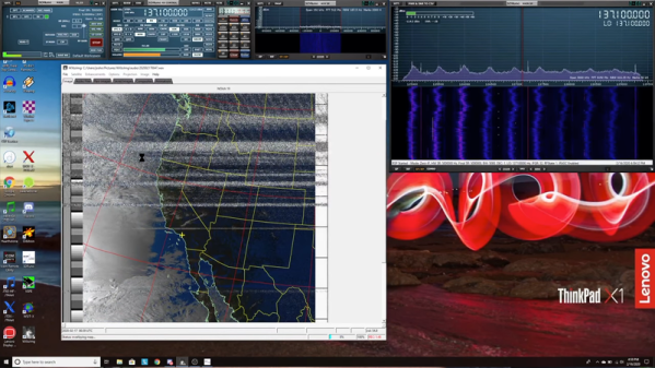
But NOAA-15 and her sister satellites have a keen following among a community of enthusiasts who spend their time teasing signals from them as they whiz overhead, using homemade antennas and cheap SDR receivers. It was these hobbyists who were among the first to notice NOAA-15’s woes, and over the past weeks they’ve been busy alternately lamenting and celebrating as the satellite’s signals come and go. Their on-again, off-again romance with the satellite is worth a look, as is the what exactly is going wrong with this bird in the first place.

Continue reading “The Death Of A Weather Satellite As Seen By SDR”