When all else fails, there’s amateur radio — and handwritten notes. Both ham radio and clear thinking helped rescue a mother and her son from a recent California camping trip gone wrong. While driving to the campsite in the Stanislaus National forest, the 49-year-old mother had the not-uncommon experience of GPS leading her and her 9-year-old son on a merry chase, sending her down a series of forest roads. Eventually the foliage got too dense for the GPS signals to penetrate, leaving the pair stranded in the forest with no guidance on how to get out.
Say what you want about the wisdom of keeping a 50-year-old space mission going, but the dozen or so people still tasked with keeping the Voyager mission running are some major studs. That’s our conclusion anyway, after reading about the latest heroics that revived a set of thrusters on Voyager 1 that had been offline for over twenty years. The engineering aspects of this feat are interesting enough, but we’re more interested in the social engineering aspects of this exploit, which The Register goes into a bit. First of all, even though both Voyagers are long past their best-by dates, they are our only interstellar assets, and likely will be for centuries to come, or perhaps forever. Sure, the rigors of space travel and the ravages of time have slowly chipped away at what these machines can so, but while they’re still operating, they’re irreplaceable assets.
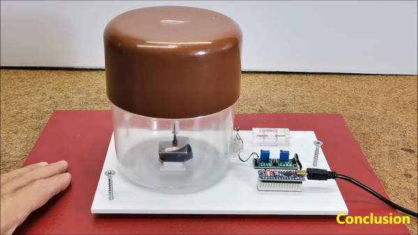
If you’re a child, there are certain things you’re taught even though they’re probably not directly relevant to your life. We teach young kids all about dinosaurs, and we teach older kids all about how the mitochondria is the powerhouse of the cell. We also teach kids about natural phenomena like earthquakes, and the equipment used to measure them. Namely, seismometers. You might like to satisfy your own child-like curiosity by building one of your own, like [mircemk] did.
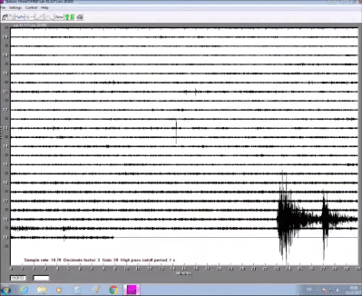
Output from the build showing tremors in the Earth.
The build starts with a sensitive geophone of [mircemk’s] own design. That’s basically a microphone but it’s for picking up vibrations in the ground, not in the air. However, a geophone is not enough. You need to be able to pick up the signals from the geophone and then plot them if you want a seismometer.
First, the signals from the geophone must be amplified, which is achieved with a small circuit based around the LM358 op-amp. From there, the signal is sent to an Arduino where the output is captured via the analog-to-digital converter. This passes the signal to an attached PC which plots the results using a piece of software called NERdaq, which was developed for schools that built their own slinky-based seismometers.
[mircemk] reports that this setup has served as a reliable tool for visualizing earthquake activity for over 6 years. Though, it bears noting, it’s not calibrated so don’t expect to get science grade results out of it. Regardless, though, it’s a super cool way to understand more about what is going on with the geology around us. Video after the break.
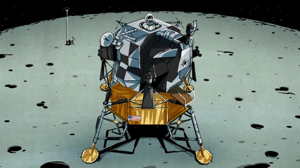
In the vast realm of space exploration, new discoveries often emerge from old data. Thanks to advanced algorithms and keen observers, the seismic activities of our closest celestial neighbor, the Moon, have recently been thrust back into the limelight.
Thanks to the effort of the NASA crew involved in the Apollo 17 mission, it’s possible investigate these phenomena today with datasets from the past. Recently, researchers working with this data turned up some intriguing findings, and published them in a new paper. It reveals that one unexpected source of moonquakes could be the very equipment that Earth’s astronauts left behind. Continue reading “Scientists Call Out Apollo 17 After Investigating Moonquakes Past”→
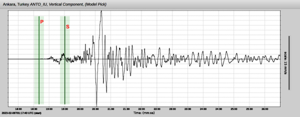
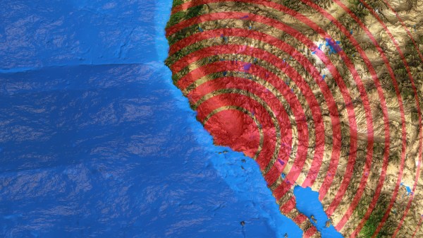
It never seems to fail: at the very moment that human society seems to reach a new pinnacle of pettiness, selfishness, violence, and self-absorption, Mother Nature comes along and reminds us all who’s really in charge. The obvious case in point here is the massive earthquakes near the border of Turkey and Syria, the appalling loss of life from which is only now becoming evident, and will certainly climb as survivors trapped since the Monday quakes start to succumb to cold and starvation.
Whatever power over nature we think we can wield pales by comparison with the energy released in this quake alone, which was something like 32 petajoules. How much destruction such a release causes depends on many factors, including the type of quake and its depth, plus the soil conditions at the epicenter. But whatever the local effects on the surface, quakes like these have a tendency to set the entire planet ringing like a bell, with seismic waves transmitted across the world that set the needles of professionally maintained seismometers wiggling.
For as valuable as these seismic networks are, though, there’s a looser, ad hoc network of detection instruments that are capable of picking up quakes as large as these from half a planet away. Some are specifically built to detect Earth changes, while some are instruments that only incidentally respond to the shockwaves traveling through the planet. And we want to know if this quake showed up in the data from anyone’s instruments.
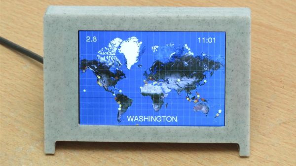
The Internet has brought us the ability to share data all over the globe, and nearly instantaneously at that. It’s revolutionized the sharing of science across the world, and taking advantage of this global data network is this earthquake display from [AndyGadget].
The build relies on an ESP32 fitted with an ILI9486 TFT display. The screen is in color and has a nice 480×320 resolution. This enables it to display a reasonably legible world map using the Web Mercator projection to fit the rectangular screen. The microcontroller then pulls in information from Seismic Portal, a site that aggregates data from seismographs and other sensors scattered all over the world. Data from the site is pulled into the device live and overlaid on the world map, allowing the viewer to see the location of any current earthquakes at a glance.
Earthquakes are highly destructive when they strike, and unlike many other natural disasters, they often hit with minimal warning. Unlike hurricanes and floods, and even volcanoes to an extent, earthquakes can be very difficult to predict. However, in recent decades, warning networks have proliferated around the world, aiming to protect affected communities from the worst outcomes in the event of a large tremor.