Affordable Ground-Penetrating Radar

While you might think of radar pointing toward the skies, applications for radar have found their way underground as well. Ground-penetrating radar (GPR) is a tool that sends signals into the earth and measures their return to make determinations about what’s buried underground in much the same way that distant aircraft can be located or identified by looking for radar reflections. This technology can also be built with a few common items now for a relatively small cost.

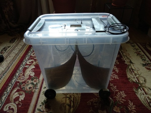
This is a project from [Mirel] who built the system around a Arduino Mega 2560 and antipodal Vivaldi antennas, a type of directional antenna. Everything is mounted into a small cart that can be rolled along the ground. A switch attached to the wheels triggers the radar at regular intervals as it rolls, and the radar emits a signal and listens to reflections at each point. It operates at a frequency range from 323 MHz to 910 MHz, and a small graph of what it “sees” is displayed on an LCD screen that is paired to the Arduino.

Using this tool allows you to see different densities of materials located underground, as well as their depths. This can be very handy when starting a large excavation project, detecting rock layers or underground utilities before digging. [Mirel] made all of the hardware and software open-source for this project, and if you’d like to see another take on GPR then head over to this project which involves a lot of technical discussion on how it works.

Navigating Self-Driving Cars By Looking At What’s Underneath The Road

When you put a human driver behind the wheel, they will use primarily their eyes to navigate. Both to stay on the road and to use any navigation aids, such as maps and digital navigation assistants. For self-driving cars, tackling the latter is relatively easy, as the system would use the same information in a similar way: when to to change lanes, and when to take a left or right. The former task is a lot harder, with situational awareness even a challenge for human drivers.

In order to maintain this awareness, self-driving and driver-assistance systems use a combination of cameras, LIDAR, and other sensors. These can track stationary and moving objects and keep track of the lines and edges of the road. This allows the car to precisely follow the road and, at least in theory, not run into obstacles or other vehicles. But if the weather gets bad enough, such as when the road is covered with snow, these systems can have trouble coping.

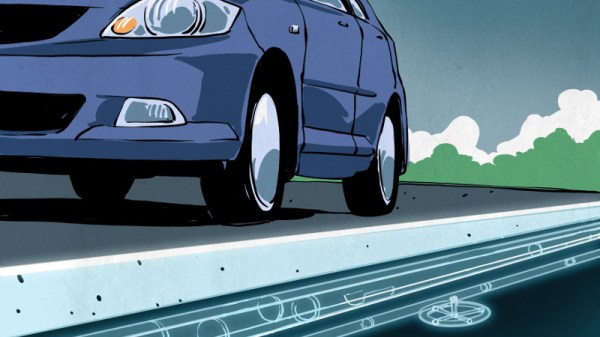
Looking for ways to improve the performance of autonomous driving systems in poor visibility, engineers are currently experimenting with ground-penetrating radar. While it’s likely to be awhile before we start to see this hardware on production vehicles, the concept already shows promise. It turns out that if you can’t see whats on the road ahead of you, looking underneath it might be the next best thing. Continue reading “Navigating Self-Driving Cars By Looking At What’s Underneath The Road”

Knowing What’s Below: Buried Utility Location

We humans have put an awful lot of effort into our infrastructure for the last few centuries, and even more effort into burying most of it. And with good reason — not only are above ground cables and pipes unsightly, they’re also vulnerable to damage from exposure to the elements. Some utilities, like natural gas and sanitary sewer lines, are also dangerous, or at least perceived to be so, and so end up buried. Out of sight, out of mind.

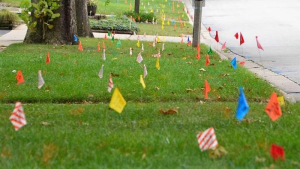
But humans love to dig, too, and it seems like no sooner is a paving project completed than some joker with a jackhammer is out there wrecking the pristine roadway. Before the construction starts, though, cryptic markings will appear on the pavement courtesy of your local buried utility locating service, who apply their rainbow markings to the ground so that nothing bad happens to the often fragile infrastructure below our feet.

Continue reading “Knowing What’s Below: Buried Utility Location”

Trackuino – An Open Source Arduino APRS Tracker

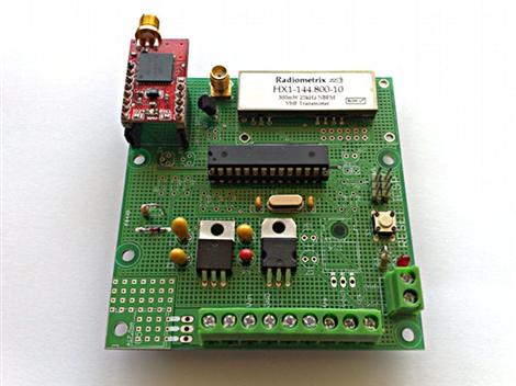
trackuino board

Trackuino is a new open source (GPLv2 license) Arduino APRS tracker designed by [Javier Martin]. If you are unfamiliar: APRS (Automatic Packet Reporting System) is an amateur radio method used to relay small packets of position-tracking data to an online database for easy access and mapping. In this case, GPS telemetry data is used to track latitude, longitude, altitude, course, speed, and time measurements in near real-time via aprs.fi.

Although this reminds us of the WhereAVR that we covered previously, the Trackuino includes an onboard radio so no external handheld unit is necessary. Since the Trackuino was designed primarily for high-altitude balloon tracking, a number of useful related features are also included: dual temperature sensors, support for a humidity sensor, and a remote “cut-down” trigger really make this a complete package.

Initially there was some concern that the 300mW radio used would not be powerful enough to reach the ground-based receivers from peak altitudes. This was clearly not an issue however, as the signal was heard from nearly 600Km away during the maiden voyage. If this still doesn’t sound like enough power, a 500mW radio is also supported.

Make sure to check out [Javier]’s blog for some amazing high-altitude photos and everything needed to get your own Trackuino up and running in no time!

Thanks [Brad]!