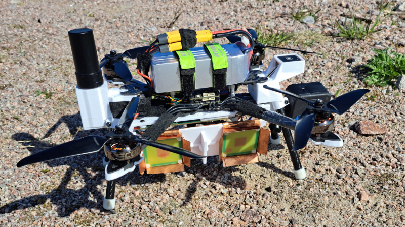
A drone is shown, carrying underneath it a white plastic box. On the side of the box are two patch antennas. A camera extends from one end of the box, and a large GPS antenna from the other end.

Synthetic Aperture Radar Drone Gets Interferometric Imaging

It’s been more than a year since [Henrik Forstén] built the first iteration of his synthetic-aperture radar (SAR) imaging drone, and he’s certainly been productive in the meantime. Not only did he develop a much more powerful autofocus algorithm to clean up the radar images, but he also extended the software to create high-resolution interferometric images.

The main limitation of the original radar system was the GPS, which only had a resolution of about one meter; the autofocus algorithm owed much of its improved clarity to an improved estimation of the drone’s position. A simpler, though more expensive, solution was to add an RTK-capable GPS receiver. RTK (Real-Time Kinematic) receivers use a fixed ground station to constantly transmit a correction signal, letting them reach a couple centimeters of accuracy. Since the drone doesn’t actually need to know its position in real time, it can also use PPK (Post-Processing Kinematic) positioning, which compares recorded GPS signals after the flight to obtain similarly accurate positions.

[Henrik] also implemented a few other hardware improvements, including stabilizing the phase-locked loop used to generate the radar’s frequency sweep. The controller FPGA’s SD card interface had too low a bandwidth to record data in real time, so [Henrik] also implemented a simple, fast compression algorithm to speed that up. Most significantly, he also developed a program for interferometric imaging. The drone flies the same path twice at different altitudes; by comparing phase information from different passes, it’s possible to detect a target’s elevation. Normally, the radar program assumes constant elevation, making tall objects seem to lean toward the radar source; an interferogram, on the other hand, allowed [Henrik] to generate a detailed elevation map.

[Henrik] is no stranger to synthetic aperture radar; we’ve previously covered a bike-mounted iteration and a budget SAR system. If the concepts behind this are still a bit fuzzy, we’ve also covered a guide to making your own SAR setup.
Tearing Down Aircraft Weather Radar Avionics

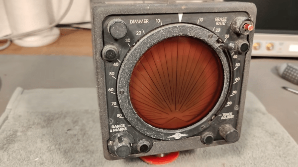
If you’re flying high in the sky, it’s useful to know if there’s turbulence, heavy rain, or other nasty weather ahead. Onboard weather radar is a useful tool that pilots use to scope out conditions ahead. [Thomas Scherrer] came into possession of a weather radar display from a vintage aircraft, and decided to tear it apart for our viewing pleasure. 

The unit in question is a Bendix PPI-1 plan position indicator. This particular 1971 example was scored from a McDonnell-Douglas DC9. [Thomas] only has the display itself, not the radar that would feed it or the power supply to turn it on. Still, even just the readout unit is super interesting to look inside. Right off the bat, there’s a neat dimming filter on the front, and the case itself is really beautifully designed for service. The design is very much of its time, full of neat wire harnesses and chunky through-hole components.  There are some neat surprises inside, too, like an interesting device shaped like a triangular prism whose purpose we won’t spoil here.

If you’re wondering what one of these units looks like in action, you can see such an example on YouTube. The display basically lights up in areas where there were stronger radar returns indicating weather to be avoided.

We love radars around these parts, and we feature them all the time. Video after the break.

Continue reading “Tearing Down Aircraft Weather Radar Avionics” →

Tiny Desktop Robot Has Radar

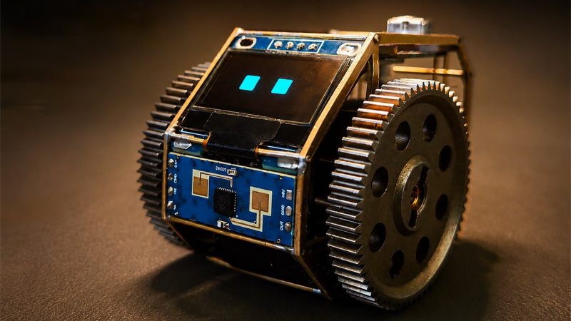
One thing our futuristic world is largely lacking in is droids and robot companions and the like. [solitary dev] is helping to rectify that problem by building a little robot called TongDou.

As [solitary dev] tells it, TongDou is a “tiny open-source desktop gremlin.” An ESP32-S3 serves as TongDou’s brain, buried inside a tasteful brass chassis. An OLED display is TongDou’s face, and he uses a pair of wheels driven by gearmotors for locomotion. A speaker plays back pre-recorded voice lines, while a 24 GHz radar and an IMU enables TongDou to keep track of the space it’s moving through. They are publishing the design files on GitHub so other makers can build their own if so desired.

[solitary dev] hopes to develop TongDou into something to make a “workspace feel less dead.” It’s not dissimilar from the way studios used to use robots to liven up otherwise hackneyed movies and TV shows, and we could absolutely use some of that whimsy in the real world. We’ve featured other fun desktop companions before, too.

Continue reading “Tiny Desktop Robot Has Radar” →

Building A Portable Weather Radar

If you run a large meteorology bureau, then you probably have access to a wonderful weather radar for scrying the heavens. The rest of us aren’t so lucky. If you find yourself bereft of such hardware, though, you could build your own, taking your lead from [Koakno]’s fine example.

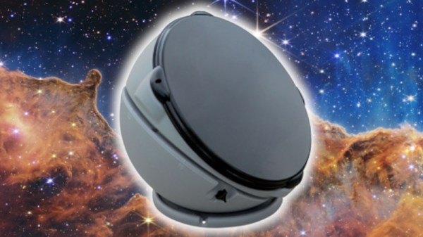
The build uses a satellite dome salvaged from an old RV that [Koakno] scored for just $5. Specifically, a Winegard Carryout Anser GM-5000. The motorized parabolic dish was designed to track TV satellites, but here it’s been repurposed into a scanning radar antenna for X-band signals. It’s paired with a cheap SDR—you can use several on the market—which injects an 850 MHz signal, which is up-converted to 10.4 GHz by the low-noise block (LNB) in the GM-5000 and sprayed out towards the weather.

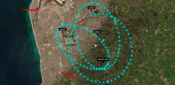
Echoes come back from rain, hail, and debris, and get down-converted by the LNB back into an 850 MHz signal that the SDR can capture. The echoes are then plotted on a Plan Position Indicator (PPI) display, showing what’s going on in the atmosphere around the dome. [Koakno] reckons detection ranges span out to 40 km for things like heavy rain, while a supercell hail core could be spotted at up to 60 km in the right conditions.

It’s worth noting something important, though. [Koakno] explains that this system is currently in violation of FCC regulations, and shouldn’t be used without the proper licenses to access given spectrum. It’s a useful study of how to build a weather radar, but perhaps not something you can just wire together and fire up without getting in a spot of bother.

If you’re a die-hard tornado chaser or you’ve just always longed to stare meaningfully at a PPI display, this could be the build for you. We’ve featured other DIY radars before, too. We’d also like to see yours, so when it’s done and written up, fire us a note on the tipsline!

Passive Radar Explained

It is an old trope in submarine movies. A sonar operator strains to hear things in the ocean but dares not “ping” for fear of giving away the boat’s location. Radar has a similar problem. If you want to find an airplane, for example, you typically send a signal out and wait for it to bounce off the airplane. The downside is that the airplane now knows exactly where your antenna is and, these days, may be carrying missiles to home in on it. In a recent post, [Jehan] explains how radar, like sonar, can be passive.

Even if you aren’t worried about a radar-homing missile taking out your antenna, passive radar has other advantages. You don’t need an expensive transmitter or antenna, a simple SDR can pull it off. You don’t need a license for the frequencies you want to use, either. You are just listening.

Continue reading “Passive Radar Explained” →

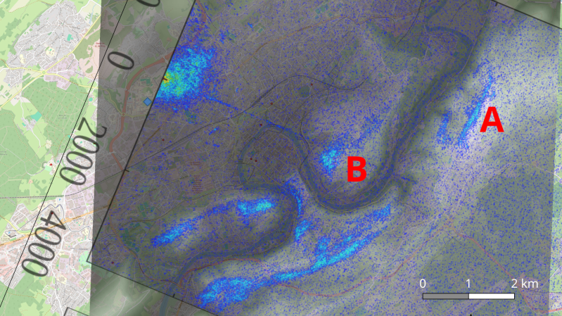
An overlay is shown on a topographical map. High points are highlighted in blue. The letters "A" and "B" are shown in red text at two points.

Using A Scientific Satellite For Passive Radar

The basic principle of radar systems is simple enough: send a radio signal out, and measure the time it takes for a reflection to return. Given the abundant sources of RF signals – television signals, radio stations, cellular carriers, even Wi-Fi – that surround most of us, it’s not even necessary to transmit your own signal. This is the premise of passive radar, which uses passive RF illumination to form an image. The RF signal doesn’t even need to come from a terrestrial source, as [Jean Michel Friedt] demonstrated with a passive radar illuminated by the NISAR radar-imaging satellite (pre-print paper).

NISAR is a synthetic-aperture radar satellite jointly built by NASA and ISRO, and it completes a pass over the world every twelve days. It uses an L-band chirp radar signal, which can be picked up with GNSS antennas. One antenna points up towards the satellite, and has a ground plane blocking the signal from directly reaching the second antenna, which picks up reflections from the landscape under observation. Since the satellite would illuminate the scene for less than a minute, [Jean-Michel] had to predict the moment of peak intensity, and achieved an accuracy of about three seconds.

The signals themselves were recorded with an SDR and a Raspberry Pi. High-end, high-resolution SDRs such as the Ettus B210 gave the best results, but an inexpensive homebuilt MAX2771-based SDR also produced recognizable images. This setup won’t be providing any particularly detailed images, but it did accurately show the contours of the local geography – quite a good result for such a simple setup.

If you’re more interested in tracking aircraft than surveying landscapes, check out this ADS-B-synchronized passive radar system. Although passive radar doesn’t require a transmitter license, that doesn’t mean it’s free from legal issues, as the KrakenSDR team can testify.

Open Source Radar Has Up To 20 KM Range

Phased-array radars are great for all sorts of things, whether you’re doing advanced radio research or piloting a fifth-generation combat aircraft. They’re also typically very expensive. [Nawfal] hopes to make the technology more affordable with an open-source radar design of their own.

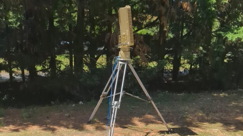
The design is called the AERIS-10, and is available in two versions. Operating at 10.5 GHz, it can be built to operate at ranges between 3 or 20 kilometers depending on the desired spec. The former uses an 8 x 16 patch antenna array, while the latter extends this to a 32 x 16 array. Either way, each design is capable of fully-electronic beam steering in azimuth and can be hacked to enable elevation too—one of the most attractive features of phased array radars. The hardware is based around an STM32 microcontroller, an FPGA, and a bunch of specialist clock generators, frequency synthesizers, phase shifters, and ADCs to do all the heavy lifting involved in radar.

Radar is something you probably don’t spend a lot of time thinking about unless you’re involved in maritime, air defence, or weather fields. All of which seem to be very much in the news lately! Still, we feature a good few projects on the topic around these parts. If you’ve got your own radar hacks brewing up in the lab, don’t hesitate to let us know.