Location Tracking With Twitter And Google Maps


[Ryan O’Hara] built a location tracker he could use on motorcycle trips. Ostensibly this is to give his wife piece of mind be we think that was an excuse to play with GPS and SMS. To stand up to the trials of the road [Ryan] took his breadboarded prototype to the next level, using a manufactured board and a SparkFun enclosure. Tucked safely away is a PIC 18F25K20 gathering longitude and latitude from a GM862, formatting the info into a Google Maps link, and sending it to the Twitter feed via an SMS message. If you’re not familiar with the GM862, in addition to being a GPS module it can send and receive cellular data on a GSM network.

This is a nice solid hardware platform from which we can envision a couple of other hacks. The feed could be parsed to make a nice map graphic like the webpage for that Twittering Road Bike. It also might be nice to have a d-pad and character LCD to post your own tweets to the feed at the end of the day.

Ice Tube Clock GPS

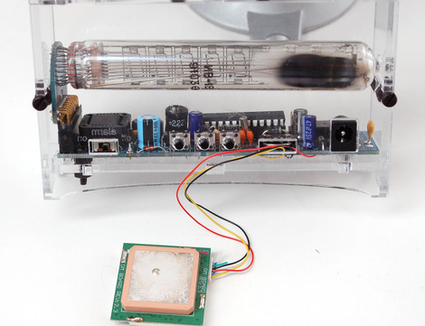
Our favorite Soviet-Era display that found its way into a present-day kit now displays time from orbiting satellites. A GPS module patched into an Ice Tube Clock with modified firmware will be able to provide a satellite-synced time. The firmware, modified by yours truly, parses the GPS module’s NMEA RMC sentences for the time and date information and then updates the clock’s time and date. Fun was had making sure the alarm went off at the correct times when the time was updated by the GPS. Overall, it was a fun project and we look forward to seeing additional Ice Tube Clock hacks.

Reverse GeoCache Puzzle Gets Downsized

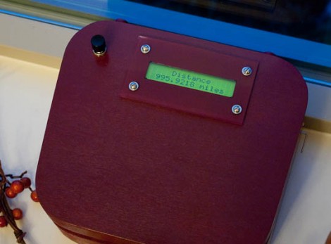
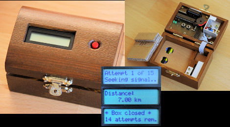
[Markus] built his own reverse geocache puzzle box but on a smaller scale than the original. His is based around a PIC 18F2520 and powered by two AAA batteries. The user interface includes one button, a 16×2 character LCD, and a piezo speaker. The box unlocks itself when the GPS module inside detects the proper location on the globe. There is also a secret code that can be tapped on the button to unlock the box prematurely, and another to show the locations in which the user attempted to open the box. This build doesn’t leave much room for a payload, but [Markus] did a great job designing the board and making the components fit as efficiently as possible.

A Cop In Every Car

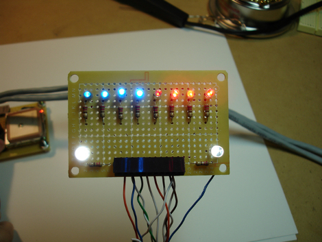
[Michael] designed this display board to mimic the appearance of a police car pulling you over. It resides in the rear window of his car (facing forward) as the controller board measures the speed of the vehicle. An Arduino grabs NMEA data from a GPS module and compares it with a table of speed limits. If you are speeding, based on your current location, the reds and blues flash as if you’re getting pulled over. The thrill of getting busted for a lead foot doesn’t sound like much fun to us but to each his own.

Incidentally, [Michael] is using the EM406 GPS module, the same one as the Frustromantic Box used.

More Functional GPS In Minutes

[Sparky] notified us of his hack to allow interaction with the core of an Aldi GO Cruise 4300 GPS Windows CE OS. All that’s required is a few programs and registry edits to the GPS, which anyone can accomplish within a few minutes. But we suggest you go slow and double-check your work; nobody wants a bricked system. After you’re done you can run such great programs like the one [Sparky] suggest for 4WD enthusiasts, Ozi Explorer.

HUD For Real Life Capture-the-flag

If you’ve played any of the Splinter Cell games you’ll remember the PDA that [Sam Fisher] carried around with him.  What if you could have one of your own when playing capture-the-flag? [Brad] has created the ZephyrEye as an electronic command and communications device for real-life games.

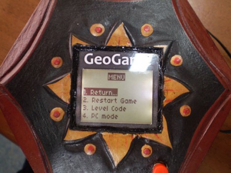
Each player carries around their own unit. The ZephyrEye has a GPS module, Xbee module, LCD screen, and control buttons. This allows a player to setup one of several different games, map out the game field including base locations and flag locations, and monitor a time limit and scoring. Other players can join the game in progress. The best part? The GPS modules report tracking to each handheld and act as radar for your team and the enemy team. We’ve got a couple of demo videos after the break.

Words can’t describe how delighted this would have made us back in the day. We don’t play outside with the other neighborhood kids anymore (insert dirty-old-man joke here) but that might change just because of this device. We may end up joining [Barney Stinson] for some amazingly awesome laser-tag games after all.

[Brad’s] posted hardware information and source code so that you can use to throw together a dozen or so units. We think the next version should incorporate a wearable display.

Continue reading “HUD For Real Life Capture-the-flag”

Live High Altitude Balloon Launch

[Terry] is planning to launch his high altitude balloon within the next few days. As we’ve seen before he has gone for a general setup – GPS tracking, environment sensors including temperature and humidity and pressure, and 2 on board cameras – all with an expected height of about 100,000 feet. What makes this project unique is the transmission of live telemetry data to a Google Maps or Google Earth interface.

The planned launch date is Sunday the 24th about 00:00 UTC so long as the Civil Aviation Safety Approval for the launch is passed.

As a final note [Terry] wanted to let inspiring balloon launchers to check out the UK High Altitude Society – who have been an invaluable source of information.