Recently NASA announced earlier this month that the 12 kW Advanced Electric Propulsion System (AEPS) — which is scheduled to form an integral part of the Lunar Gateway when it is launched — has passed a number of qualification tests, after a rather tumultuous number of years during its development.
Originally designed since 2015 to propel the AARM mission to fetch rocks from an asteroid, when AARM was cancelled it became the cornerstone of the Lunar Gateway that should enable astronauts in the Artemis program to land on the Moon.
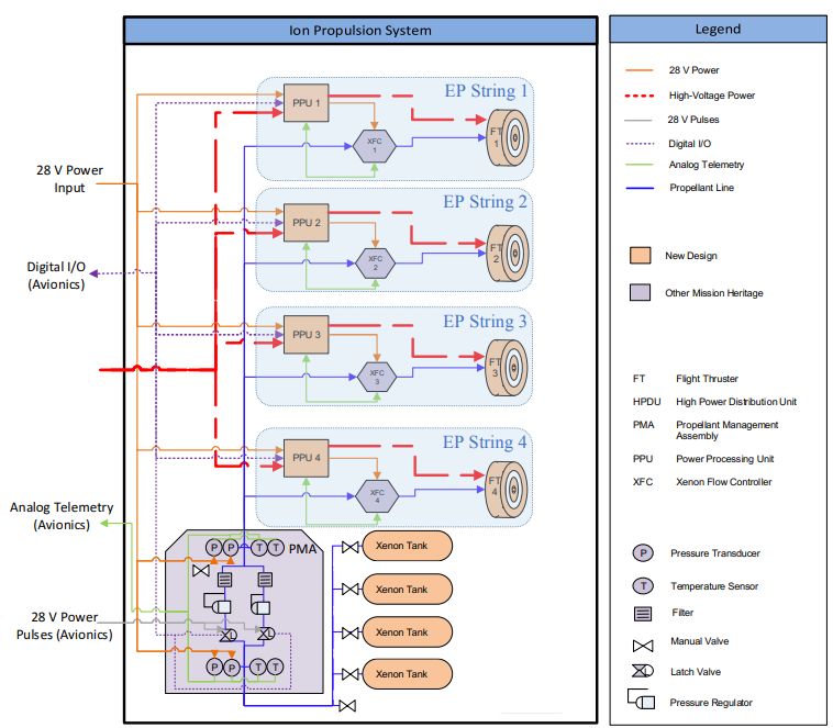
The AEPS is a solar electric propulsion system that uses xenon as its propellant, much like existing ion engines. Where it differs is in the power output, which should allow it to work as the primary propulsion method for large deep space and cargo missions. Much of the development and projections are covered in a 2017 presentation at the International Electric Propulsion Conference (IEPC).
Although the projected dates for much in this presentation (e.g. first flight of SLS Block 1 was in 2022, not 2018) are decidedly off, once the individual AEPS thrusters are validated, three strings will be mounted on the Power and Propulsion Element (PPE) that forms the core of the Lunar Gateway and is scheduled to be launched in November of 2025.
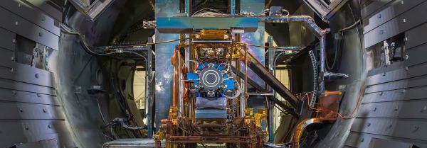
Top image: AEPS installed for testing at NASA Glenn. (Credit NASA)