Beware Of Tall Grass: Pokemon Go On The Gameboy Pocket

[Pepijn de Vos] was excited to interact with the world’s most popular augmented reality pedometer, Pokemon Go, and was extremely disappointed to find that his Blackberry couldn’t run it. Still, as far as he could tell from behind his wall of obsolete technology, Pokemon Go is all about walking distractedly, being suspicious, and occasionally catching a Pokemon. That should be possible.

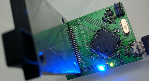
Not a stranger to hacking Pokemon on the Gameboy, [Pepijn] put together a plan. Using his TCPoke module, he took it a step further. Rather than just emulating the original gameboy trade signals over the internet, he hacked a Pokemon Red ROM with some custom Z80 assembly to add some features to the Cable Club in the game.

After some waiting for the delivery man to bring a flashable cartridge and along with some Arduino code, he could now translate the steps he took in the game to his steps in the real world. Well, mostly. He could pick the location where he would like to catch a Pokemon. The character stands there. Somewhere around 100m the game will trigger a random pokemon battle.

[Pepijn] is now no longer a social outcast, as you can see in the video after the break. On a simple trip to the grocery store he caught two Pokemon!

Continue reading “Beware Of Tall Grass: Pokemon Go On The Gameboy Pocket”

Pokemon Go Cheat Fools GPS With Software Defined Radio

Using Xcode to spoof GPS locations in Pokemon Go (like we saw this morning) isn’t that much of a hack, and frankly, it’s not even a legit GPS spoof. After all, it’s not like we’re using an SDR to spoof the physical GPS signal to cheat Pokemon Go.

To [Stefan Kiese], this isn’t much more than an exercise. He’s not even playing Pokemon Go. To squeeze a usable GPS signal out of his HackRF One, a $300 Software Defined Radio, [Stefan] uses an external precision clock. This makes up for the insufficient calibration of the HackRF’s internal clock, although he points out that this might also be fixed entirely in software.

Continue reading “Pokemon Go Cheat Fools GPS With Software Defined Radio”

Pokemon Go GPS Cheat (If You Don’t Fear Getting Banned)

Pokemon Go inherits a certain vulnerability to GPS location spoofing from it’s predecessor Ingress, but also the progress that has been made in spoof detection. Since taking advantage of a game’s underlying mechanisms is part of the winner’s game, why not hook up your smartphone to Xcode and see if you can beat Niantic this time? [Dave Conroy] shows you how to play back waypoints and activate your Pokemon Go warp drive.

Continue reading “Pokemon Go GPS Cheat (If You Don’t Fear Getting Banned)”

Analog Guts Display GPS Velocity In This Hybrid Speedometer

A digital dash is cool and all, but analog gauges have lasting appeal. There’s something about the simplicity of a purely mechanical gauge connected directly to a vehicle’s transmission. Of course that’s not what’s hapenning here. Instead, this build is an analog display for GPS-acquired speed data.

The video below does a good job at explaining the basics of [Grant Stephens]’ build. The display itself is a gutted marine speedometer fitted with the movement from a motorcycle tachometer. The tach was designed to take a 4-volt peak-to-peak square wave input signal, the frequency of which is proportional to engine speed. To display road speed, [Grant] stuffed an ATTiny85 with a GPS module into the gauge and cooked up a script to convert the GPS velocity data into a square wave. There’s obviously some latency, and the gauge doesn’t appear to register low speeds very well, but all in all it seems to match up well to the stock speedo once you convert to metric.

There’s plenty of room for improvement, but we can see other applications where an analog representation of GPS data could be useful. And analog gauges are just plain fun to digitize – like these old meters and gauges used to display web-scraped weather data.

Continue reading “Analog Guts Display GPS Velocity In This Hybrid Speedometer”

GPS And SDR Combine Forces

Software-defined radio (or SDR) is a relatively new (to average tinkerers, at least) way of sending and receiving radio signals. The interest in SDR exploded recently with the realization that cheap USB TV tuner cards could be used to start exploring the frequency spectrum at an extremely reduced cost. One of the reasons that this is so advantageous is because of all of the options that a general-purpose computer opens up that go beyond transmitting and receiving, as [Chris] shows with his project that ties SDR together with GPS.

The goal of the project was to automatically tune a radio to the local police department’s frequency, regardless of location. To do this, a GPS receiver on a computer reports information about the current location. A JavaScript program feeds the location data to the SDR, which automatically tunes to the local emergency services frequencies. Of course, this relies on good data for what those frequencies are, but this is public information in most cases (at least in the US).

There are a lot of opportunities here for anyone with SDR. Maybe an emergency alert system that can tune to weather broadcasts if there’s a weather alert, or any of a number of other captivating projects. As for this project, [Chris] plans to use Google’s voice recognition software to transcribe the broadcasts as well. The world of SDR is at your fingertips to do anything you can imagine! And, if you’re looking to get started in it, be sure to check out the original post covering those USB TV tuner dongles.

Hackaday Prize Entry: Reverse GPS

Every time you watch a SpaceX livestream to see a roaring success or fireball on a barge (pick your poison), you probably see a few cubesats go up. Everytime you watch a Soyuz launch that is inexplicably on liveleak.com before anywhere else, you’re seeing a few cubesats go up. There are now hundreds of these 10 cm satellites in orbit, and SatNogs, the winner of the Hackaday Prize a two years ago, gives all these cubesats a global network of ground stations.

There is one significant problem with a global network of satellite tracking ground stations: you need to know the orbit of all these cubesats. This, as with all Low Earth Orbit deployments that do not have thrusters and rarely have attitude control, is a problem. These cubesats are tumbling through the rarefied atmosphere, leading to orbits that are unpredictable over several months.

[hornig] is working on a solution to the problem of tracking hundreds of cubesats that is, simply, reverse GPS. Instead of using multiple satellites to determine a position on Earth, this system is using multiple receiving stations on Earth’s surface to determine the orbit of a satellite.

The hardware for [hornig]’s Distributed Ground Station Network is as simple as you would expect. It’s just an RTL-SDR TV tuner USB dongle, a few antennas, a GPS receiver, and a Raspberry Pi connected to the Internet. This device needs to be simple; unlike SatNogs, where single base station in the middle of nowhere can still receive data from cubesats, this system needs multiple receivers all within the view of a satellite.

The modern system of GPS satellites is one of the greatest technological achievements of all time. Not only did the US need to put highly accurate clocks in orbit, the designers of the system needed to take into account relativistic effects. Doing GPS in reverse – determining the orbit of satellites on the ground – is likewise a very impressive project, and something that is certainly a contender for this year’s Hackaday Prize.

The HackadayPrize2016 is Sponsored by: