Rediscovering The Nile: The Ancient River That Was Once Overlooked By The Egyptian Pyramids

Although we usually imagine the conditions in Ancient Egypt to be much like the Egypt of today, back during the Holocene there was significantly more rain as a result of the African Humid Period (AHP). This translated in the river Nile stretching far beyond its current range, with many more branches. This knowledge led a team of researchers to test the hypothesis that the largest cluster of pyramids in the Nile Valley was sited along one of these now long since vanished branches. Their findings are described in an article published in Communications Earth & Environment, by [Eman Ghoneim] and colleagues.
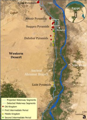
The Ahramat Branch and pyramids along its trajectory. (Credit: Eman Ghoneim et al., 2024)

The CliffsNotes version can be found in the accompanying press release by the University of North Carolina Wilmington. Effectively, the researchers postulated that a branch of the Nile existed along these grouping of pyramids, with their accompanying temples originally positioned alongside this branch. The trick was to prove that a river branch once existed in that area many thousands of years ago.

What complicates this is that the main course of the Nile has shifted over the centuries, and anthropogenic activity has obscured much what remained, making life for researchers exceedingly difficult. Ultimately a combination of soil core samples, geophysical evidence, and remote sensing (e.g. satellite imagery) helped to cement the evidence for the existence what they termed the Ahramat Nile Branch, with ‘ahramat’ meaning ‘pyramids’ in Arabic.

Synthetic Aperture Radar (SAR) and high-resolution radar elevation data provided evidence for the Nile once having traveled right past this string of pyramids, also identifying the modern Bahr el-Libeini canal as one of the last remnants of the Ahramat Branch before the river’s course across the floodplain shifted towards the East, probably due to tectonic activity. Further research using Ground Penetrating Radar (GPR) and Electromagnetic Tomography (EMT) along a 1.2 km section of the suspected former riverbed gave clear indications of a well-preserved river channel, with the expected silt and sediments.

Soil cores to a depth of 20 and 13 meters further confirmed this, showing not only the sediment, but also freshwater mussel shells at 6 meter depth. Shallow groundwater was indicated at these core sites, meaning that even today subsurface water still flows through this part of the floodplain.

These findings not only align with the string of pyramids and their causeways that would have provided direct access to the water’s edge, but also provided hints for a further discovery regarding the Bent Pyramid — as it’s commonly known — which is located deep inside the desert today. Although located far from the floodplain by about a kilometer, its approximately 700 meters long causeway terminates at what would have been a now extinct channel: the Dahshur Inlet, which might also have served the Red Pyramid and others, although evidence for this is shakier.

Altogether, these findings further illustrate an Ancient Egypt where the Old Kingdom was followed by a period of severe changes, with increasing drought caused by the end of the AHP, an eastwardly migrating floodplain and decreased flow in the Nile from its tributaries. By the time that European explorers laid eyes on the ancient wonders of the Ancient Egyptian pyramids, the civilization that had birthed them was no more, nor was the green and relatively lush environment that had once surrounded it.

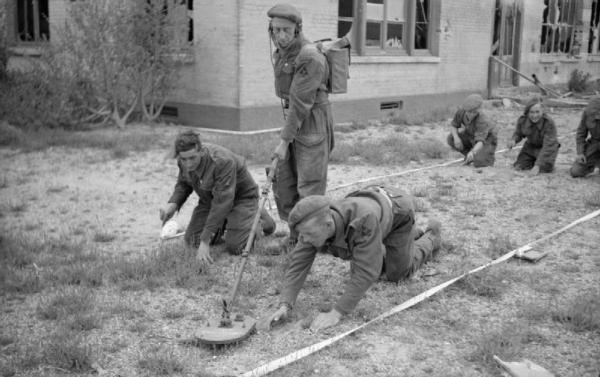
Sappers clearing the last mines from the beach front of a former French luxury hotel, now in use as a rest club for troops of 3rd Division, 15 July 1944.

The Long Tail Of War: Finding Unexploded Ordnance Before It Finds Us

Long after the enemy forces have laid down their arms, peace accords have been signed and victories celebrated, there is still a heavy toll to be paid. Most of this comes in the form of unexploded ordnance, including landmines and the severe pollution from heavy metals and other contaminants that can make large areas risky to lethal to enter. Perhaps the most extreme example of this lasting effect is the Zone Rouge (Red Zone) in France, which immediately after the First World War came to a close comprised 1,200 square kilometers.

Within this zone, contamination with heavy metals is so heavy that some areas do not support life, while unexploded shells – some containing lethal gases – and other unexploded ordnance is found throughout the soil. To this day much of the original area remains off-limits, though injuries from old, but still very potent ordnance are common around its borders. Clean-up of the Zone Rouge is expected to take hundreds of years. Sadly, this a pattern that is repeated throughout much of the world. While European nations stumble over ordnance from its two world wars, nations in Africa, Asia and elsewhere struggle with the legacy from much more recent conflicts.

Currently, in Europe’s most recent battlefield, more mines are being laid, booby traps set and unexploded shells and other ordnance scattered where people used to live. Clearing these areas, to make them safe for a return of their inhabitants has already begun in Ukraine, but just like elsewhere in the world, it is an arduous and highly dangerous process with all too often lethal outcomes.

Continue reading “The Long Tail Of War: Finding Unexploded Ordnance Before It Finds Us”

Navigating Self-Driving Cars By Looking At What’s Underneath The Road

When you put a human driver behind the wheel, they will use primarily their eyes to navigate. Both to stay on the road and to use any navigation aids, such as maps and digital navigation assistants. For self-driving cars, tackling the latter is relatively easy, as the system would use the same information in a similar way: when to to change lanes, and when to take a left or right. The former task is a lot harder, with situational awareness even a challenge for human drivers.

In order to maintain this awareness, self-driving and driver-assistance systems use a combination of cameras, LIDAR, and other sensors. These can track stationary and moving objects and keep track of the lines and edges of the road. This allows the car to precisely follow the road and, at least in theory, not run into obstacles or other vehicles. But if the weather gets bad enough, such as when the road is covered with snow, these systems can have trouble coping.

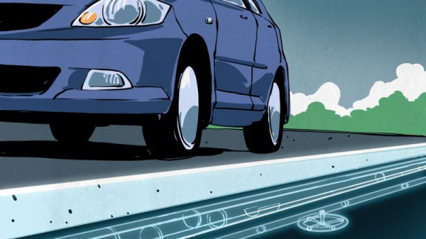
Looking for ways to improve the performance of autonomous driving systems in poor visibility, engineers are currently experimenting with ground-penetrating radar. While it’s likely to be awhile before we start to see this hardware on production vehicles, the concept already shows promise. It turns out that if you can’t see whats on the road ahead of you, looking underneath it might be the next best thing. Continue reading “Navigating Self-Driving Cars By Looking At What’s Underneath The Road”

Knowing What’s Below: Buried Utility Location

We humans have put an awful lot of effort into our infrastructure for the last few centuries, and even more effort into burying most of it. And with good reason — not only are above ground cables and pipes unsightly, they’re also vulnerable to damage from exposure to the elements. Some utilities, like natural gas and sanitary sewer lines, are also dangerous, or at least perceived to be so, and so end up buried. Out of sight, out of mind.

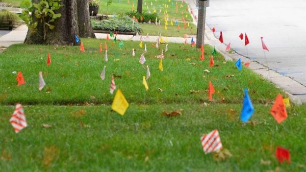
But humans love to dig, too, and it seems like no sooner is a paving project completed than some joker with a jackhammer is out there wrecking the pristine roadway. Before the construction starts, though, cryptic markings will appear on the pavement courtesy of your local buried utility locating service, who apply their rainbow markings to the ground so that nothing bad happens to the often fragile infrastructure below our feet.

Continue reading “Knowing What’s Below: Buried Utility Location”

Hackaday Prize Entry: Ground Penetrating Radar

This year’s Hackaday Prize is heating up, and right now there are quite a few projects in the works covering domains that are rarely, if ever, seen coming out of a garage or a workshop. One of the most interesting is [Glenn Powers]’ Open Ground Penetrating Radar. It’s exactly what the title says: an open-source radar system that can see into the Earth for less than $500.

While ground penetrating radar is great for archaeology and people searching for hoards buried in the middle of farmland, the biggest application is safety. You need only to Google “Florida sinkhole” to see the value of peering into the Earth.

[Glenn] is building his ground penetrating radar with a bare minimum of parts. A Baofeng VHF/UHF My First Radio™ serves as the signal generator, the controller is just an optoisolator, and the switch controller is a 7404 hex inverter. It literally can’t get simpler than that.

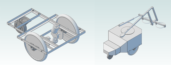
Of course these components can only be assembled into a simple radar, and the real value of a ground penetrating radar is the ability to map an area. For that, [Glenn] is bringing out a Pi and a GPS dongle to control the whole thing. Visualization is provided by none other than the US Navy. If it works for submarines, it should work for a metal cart, right?

It’s a great project, not only in the fact that it could help a whole bunch of people, but as a prime example of doing so much without tens of thousands of dollars in test equipment.


The 2015 Hackaday Prize is sponsored by: