Balloon To Fly During Solar Eclipse

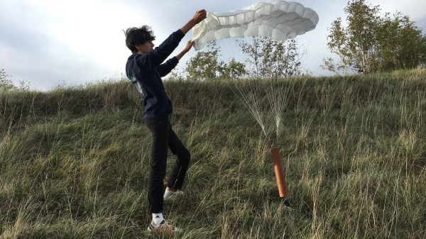
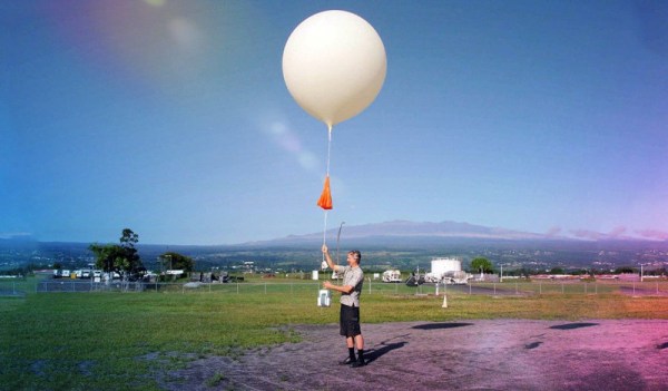
The Great American Eclipse was a solar eclipse that passed nearly the entire continental United States back in 2017. While it might sound like a once-in-a-lifetime event to experience a total solar eclipse, the stars have aligned to bring another total solar eclipse to North America although with a slightly different path stretching from the west coast of Mexico and ending off the cost of Newfoundland in Canada. Plenty of people near the path of totality have already made plans to view the event, but [Stephen] and a team of volunteers have done a little bit of extra preparation and plan to launch a high-altitude balloon during the event.

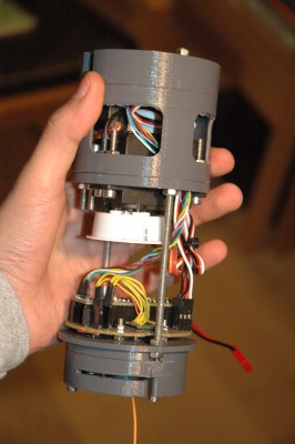
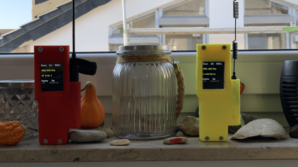
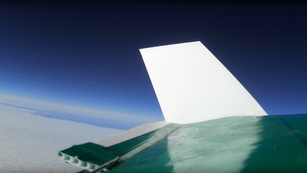
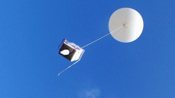
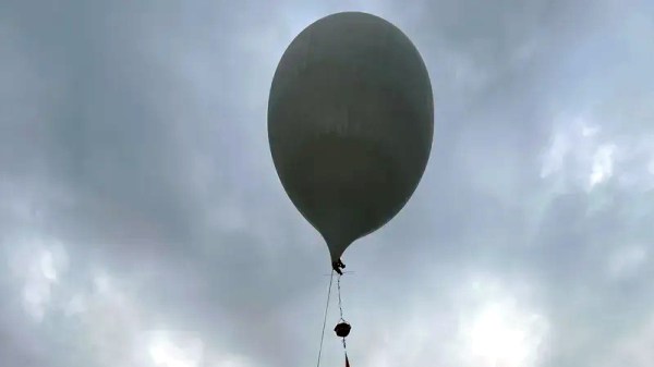
The unmanned balloon will primarily be carrying a solar telescope with the required systems onboard to stream its images live during its flight. The balloon will make its way to the stratosphere, hopefully above any clouds that are common in New Brunswick during the early spring, flying up to 30,000 meters before returning its payload safely to Earth. The telescope will return magnified images of the solar eclipse live to viewers on the ground and has been in development for over two years at this point. The team believes it to be the first time a non-governmental organization has imaged an eclipse by balloon.

For those who have never experienced a total solar eclipse before, it’s definitely something worth traveling for if you’re not already in its path. For this one, Canadians will need to find themselves in the Maritimes or Newfoundland or head south to the eastern half of the United States with the Americans, while anyone in Mexico needs to be in the central part of the mainland. Eclipses happen in places other than North America too, and are generally rare enough that you’ll hear about a total eclipse well in advance. There’s more to eclipses than watching the moon’s shadow pass by, though. NASA expects changes in the ionosphere and is asking ham radio operators for help for the 2024 eclipse.

Launching Paper Planes From Way, Waaaaaay Up

Every now and again we stumble across something a bit unexpected, and today that’s the fact that there have been quite a few efforts at launching paper planes from as close to space as possible. The current record for the highest paper plane launch is a whopping altitude of 35,043 meters.

That altitude is considerably short of what would be called “space”, but it’s still an awfully long way up and the air there is very thin compared to on the surface. Space is generally (but not universally) considered to be beyond 100 km above sea level, a human-chosen boundary known as the Kármán line. 35 km is a long ways into the stratosphere, but still within Earth’s atmosphere.

Even so, that doesn’t mean there haven’t been efforts to go considerably higher. There was a Japanese proposal to drop airplanes made from special heat-resistant paper from the International Space Station, roughly 400 km above Earth. Success would show that low-speed, low-friction atmospheric reentry is feasible — for pieces of paper, anyway. But one of the challenges is the fact that there is no practical way to track such objects on their way down, and therefore no way to determine where or when they would eventually land.

There have been many other high-altitude paper plane launches, but the current record of 35,043 meters was accomplished by David Green in the United Kingdom as part of a school project. Such altitudes are in the realm of things like weather balloons, and therefore certainly within the reach of hobbyists.

As for the airplanes themselves, the basic design pictured here probably won’t cut it, so why not brush up on designs with the Paper Airplane Design Database? Even if you don’t send them into the stratosphere (or higher), you might find something worth putting through a DIY wind tunnel to see how they perform.

GPS Guided Parachutes For High Altitude Balloons

Most amateur high altitude balloon payloads descend back to earth with a simple non-steerable parachute and can land hundreds of kilometers from the launch site in inaccessible areas. [Yohan Hadji] experienced this first-hand during a balloon launch conducted by his high school, which inspired him to R2Home, a GPS-guided parachute recovery system.

A Teensy runs the show, and controls a pair of sail winch servos pulling the brake lines

[Yohan]’s first challenge was to create a steerable parachute that can deploy reliably, so he started doing tests with a borrowed scale model paragliding wing. He quickly learned that a canopy aspect ratio of below two was needed for reliable deployment, so he started sewing his own canopies. Steering a parachute involves pulling on a pair of brake lines, one for each side of the parachute. A control stroke of about 20 cm was required, and [Yohan] found that RC sailboat winch servos work perfectly for this application. The entire system is designed to fit in a 7×40 cm tube, and the parachute is deployed with the help of a small drogue chute and a servo-operated release mechanism.

[Yohan] is working on a custom flight controller, built around a Teensy 4.1, GPS receiver, and digital compass. A possible alternative is Ardupilot, which we’ve seen used on several autonomous drones, gliders, and rovers. While this system might not be possible to return to the launch point, it could certainly close the gap, and land safely in a designated area.

So far [Yohan] has done a series of test drops from a drone at low altitude to test deployment and steering, using an RC controller. The project is open source, and the mechanical design files and control code is up on GitHub. As with most 16-year-olds, [Yohan]’s resources are limited, so feel free to drop him some financial help on the R2Home GoFundMe page. See the videos after the break for a development montage and project presentation. Continue reading “GPS Guided Parachutes For High Altitude Balloons”

A Tracker For Radio Sondes

Radiosondes – the telemetry packages carried aloft by sounding balloons for atmospheric weather data measurements – are regularly used by weather bureaus around the world to collect data, and there are quite a number of launches daily. Most of them are in Europe, but they also happen at many locations in North and South America, Japan, and Australia. The balloons burst when they reach a high enough altitude, the radiosonde falls back, and most often there is no effort made to recover them since they are deemed “expendable”. So it’s Finders Keepers, and rich pickings for any hacker who is fortunate enough to grab the fallen radiosondes. For successful recovery, you need to first be able to track those radiosondes, and that’s why leet guy [Robert Stefanowicz aka p1337] built his Weather ballon tracker (sic) project.

The hardware is all off-the-shelf, packaged in a pretty cool 3D printed package designed to make it look like the hand held radio that it is. At its heart is the ESP32 based TTGO T-BEAM V1.0 which has almost everything needed for this project. Add an OLED display, 18650 Li-Po cells, antenna and connectors and you can put it all together in an evening over your favourite beverage.

[DL9RDZ] wrote the software which runs on the T-Beam, available at the RDZ-Sonde repo on Github, that allows hunting these balloons. Setup is straightforward, and you need to fiddle with just a couple of well-explained config parameters. Once connected to your WiFi, config and settings can be accessed via convenient web URL’s and the single user action button on the TTGO offers quick access to different functional modes. At the moment, the software is written to decode signals from the widely used Vaisala RS41, Graw DFM06 and Graw DFM09 radiosondes. This LINK provides details for some of the popular radiosonde models.

Once you’re done building this piece of hunting gear, you’ll need some additional help finding out when and where the launches are taking place. If you’re in Europe, you luck out – there is a live radiosonde tracker map, thanks to the great work done by [Michał Lewiński – SQ6KXY]. If you live else where and know of similar resources, let us know in the comments. As a side note, Wikipedia tells us there are about 1300 launch sites worldwide and twice a day missions, so there’s quite a number of fallen pieces of hardware lying around just waiting to be picked up. At the very least, each will have a GPS module and temperature and humidity sensors that you can recover.

So, what do you do with the recovered radiosondes ? Here’s a tip on a “Fallen Radiosonde reborn as active L-band antenna“. And If you’d like to get the skinny on radiosondes, check out “Radiosondes: getting data from upstairs

Thanks for the tip, [Alex aka MD23F3].

Automated Radiosonde Tracking Via Open Source

Meteorological organisations across the world launch weather balloons on a regular basis as a part of their work in predicting whether or not it will rain on the weekend. Their payloads are called radiosondes, and these balloons deliver both telemetry and location data throughout their flightpath. Hobbyists around the globe have devoted time and effort to tracking and decoding these signals, and now it’s possible to do it all automatically, thanks to Radiosonde Auto RX.

The basis of the project is the RTL-SDR, everyone’s favourite low-cost software defined radio receiver. In this case, software is used to first hunt for potential radiosonde signals, before then decoding them and uploading the results to a variety of online services. Some of these are designed for simple tracking, while others are designed for live chase and recovery operations. Currently, the software only covers 3 varieties of radiosonde, but the team are eager to expand the project and have requested donations of other radiosondes for research purposes.

The team recently conducted a talk at linux.conf.au regarding the project, which goes into detail as to the decoding and tracking of the radiosonde data. If you’re eager to try it out, download the software, fetch your TV dongle and get cracking. You might also consider tracking cubesats while you’re at it. Video after the break.

via [crazyoperator], thanks to Slds Ernesto for the tip!

Continue reading “Automated Radiosonde Tracking Via Open Source”

Autonomous Spaceplane Travels To 10 Km, Lands Safely 200 Km Away

Space balloons, where one sends instrument packages to the edge of space on a weather balloon, are a low-cost way to scratch the space itch. But once you’ve logged the pressure and temperature and tracked your balloon, what’s the next challenge? How about releasing an autonomous glider and having it return itself to Earth safely?

That’s what [IzzyBrand] and his cohorts did, and we have to say we’re mightily impressed. The glider itself looks like nothing to write home about: in true Flite Test fashion, it’s just a flying wing made with foam core and Coroplast reinforced with duct tape. A pair of servo-controlled elevons lies on the trailing edge of the wings, while inside the fuselage are a Raspberry Pi and a Pixhawk flight controller along with a GPS receiver. Cameras point fore and aft, a pair of 5200 mAh batteries provide the juice, and handwarmers stuffed into the avionics bay prevent freezing.

After a long series of test releases from a quadcopter, flight day finally came. Winds aloft prevented a full 30-kilometer release, so the glider was set free at 10 kilometers. The glider then proceeded to a pre-programmed landing zone over 80 kilometers from the release point. At one point the winds were literally pushing the glider backward, but the little plane prevailed and eventually spiraled down to a perfect landing.

We’ve been covering space balloons for a while, but take a moment to consider the accomplishment presented here. On a shoestring budget, a team of amateurs hit a target the size of two soccer fields with an autonomous aircraft from a range of almost 200 kilometers. That’s why we’re impressed, and we can’t wait to see what they can do after a release from the edge of space.

Continue reading “Autonomous Spaceplane Travels To 10 Km, Lands Safely 200 Km Away”

Radiosondes: Getting Data From Upstairs

Ever since I first learned about radiosondes as a kid, I’ve been fascinated by them. To my young mind, the idea that weather bureaus around the world would routinely loft instrument-laden packages high into the atmosphere to measure temperature, pressure, and winds aloft seemed extravagant. And the idea that this telemetry package, having traveled halfway or more to space, could crash land in a field near my house so that I could recover it and take it apart, was an intoxicating thought.

I’ve spent a lot of time in the woods over the intervening years, but I’ve never seen a radiosonde in the wild. The closest I ever came was finding a balloon with a note saying it had been released by a bunch of schoolkids in Indiana. I was in Connecticut at the time, so that was pretty cool, but those shortsighted kids hadn’t put any electronics on their balloon, and they kind of left me hanging. So here’s a look at what radiosondes are, how they work, and what you can do to increase your chances of finding one.

Continue reading “Radiosondes: Getting Data From Upstairs”