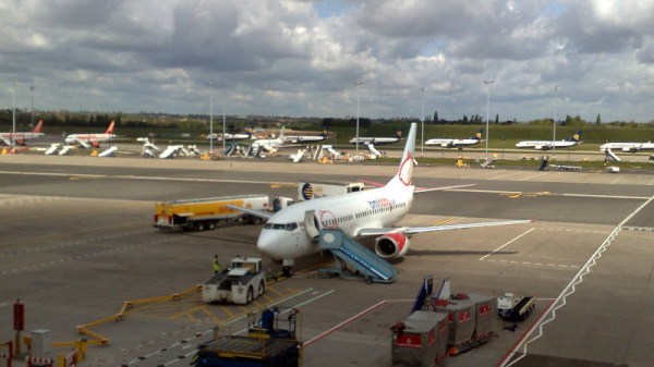
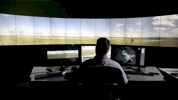
How Three Letters Brought Down UK Air Traffic Control

The UK bank holiday weekend at the end of August is a national holiday in which it sometimes seems the entire country ups sticks and makes for somewhere with a beach. This year though, many of them couldn’t, because the country’s NATS air traffic system went down and stranded many to grumble in the heat of a crowded terminal. At the time it was blamed on faulty flight data, but news now emerges that the data which brought down an entire country’s air traffic control may have not been faulty at all.

Armed with the official incident report and publicly available flight data, Internet sleuths theorize that the trouble was due to one particular flight: French Bee flight 731 from Los Angeles to Paris. The flight itself was unremarkable, but the data which sent the NATS computers into a tailspin came from two of its waypoints — Devil’s Lake Wisconsin and Deauville Normandy — having the same DVL identifier. Given the vast distance between the two points, the system believed it was looking at a faulty route, and refused to process it. A backup system automatically stepped in to try and reconcile the data, but it made the same determination as the primary software, so the whole system apparently ground to a halt.

It’s important to note that there was nothing wrong with the flight plan entered in by the French Bee pilots, and that early stories blaming faulty data were themselves at fault. However we are guessing that air traffic software developers worldwide are currently scrambling to check their code for this particular bug. We’re fortunate indeed that safety wasn’t compromised and only inconvenience was the major outcome.

Air traffic control doesn’t feature here too often, but we’ve previously looked at a much earlier system.

Header image: John Evans, CC BY-SA 2.0.

It’s A Bird! It’s A Plane! It’s… A Live Air Traffic Plane Spotting Simulation

Plane spotting has been a hobby of aviation enthusiasts for generations. Hanging out by the airport, watching aircraft come and go, maybe even listening to Air Traffic Control on a scanner from your local Radio Shack. Yep- we’ve been there, and it can be a lot of fun! But how can those of us who don’t live near a major controlled airport keep up on the action? As demonstrated by the [Information Zulu] YouTube channel’s Live Stream, seen below the break, the action may be closer than you think!

Aircraft on approach to LAX- Virtually

By using publicly available information, software, and some ingenuity, [Information Zulu] has created a live simulation of Los Angeles International Airport (LAX) for your simulated plane spotting pleasure. Aircraft positional data is gained through an ADSB receiver and piped into a the flight simulator software with a Traffic Injection Addon, and the simulator itself is used to properly place aircraft, set the weather, and even the correct aircraft types and liveries. Setting off the illusion of a real plane spotting adventure is the live Air Traffic Control radio chatter!

We love the creativity that went into not just making all of the software available, but in combining it into a cohesive product that can be viewed 24/7 on YouTube that, if you squint just right, could be mistaken for a view of the real thing.

If you’re not familiar with ADSB and how it’s used to track aircraft in such a way that anybody can receive it with the right equipment, check out this beginner’s course on ADSB from a few years back!

Continue reading “It’s A Bird! It’s A Plane! It’s… A Live Air Traffic Plane Spotting Simulation”

Wind Farms In The Night: On-Demand Warning Lights Are Coming

There appears to be no shortage of reasons to hate on wind farms. That’s especially the case if you live close by one, and as studies have shown, their general acceptance indeed grows with their distance. Whatever your favorite flavor of renewable energy might be, that’s at least something it has in common with nuclear or fossil power plants: not in my back yard. The difference is of course that it requires a lot more wind turbines to achieve the same output, therefore affecting a lot more back yards in total — in constantly increasing numbers globally.

Personally, as someone who encounters them occasionally from the distance, I find wind turbines mostly to be an eyesore, particularly in scenic mountainous landscapes. They can add a futuristic vibe to some otherwise boring flatlands. In other words, I can not judge the claims actual residents have on their impact on humans or the environment. So let’s leave opinions and emotions out of it and look at the facts and tech of one issue in particular: light pollution.

This might not be the first issue that comes to mind when thinking about wind farms. But wind turbines are tall enough to require warning lights for air traffic safety, and can be seen for miles, blinking away in the night sky. From a pure efficiency standpoint, this doesn’t seem reasonable, considering how often an aircraft is actually passing by on average. Most of the time, those lights simply blink for nothing, lighting up the countryside. Can we change this?

Continue reading “Wind Farms In The Night: On-Demand Warning Lights Are Coming”

Wing Opens The Skies For Drones With UTM

Yesterday Alphabet (formerly known as Google) announced that their Wing project is launching delivery services per drone in Finland, specifically in a part of Helsinki. This comes more than a month after starting a similar pilot program in North Canberra, Australia. The drone design Wing has opted for consists not of the traditional quadcopter design, but a hybrid plane/helicopter design, with two big propellers for forward motion, along with a dozen small propellers on the top of the dual body design, presumably to give it maximum range while still allowing the craft to hover.

With a weight of 5 kg and a wingspan of about a meter, Wing’s drones are capable of lifting and carrying a payload of about 1.5 kg. This puts it into a category of drones far beyond of what hobbyists tend to fly on a regular basis, and worse, it involves Beyond Visual Line Of Sight (BVLOS for short) flying, which is frowned upon by the FAA and similar regulatory bodies. What Google/Alphabet figures that can enable them to make this kind of service a commercial reality is called Unmanned aircraft system Traffic Management (UTM).

UTM is essentially complementary to the existing air traffic control systems, allowing drones to integrate into these flows of manned airplanes without endangering either. Over the past years, it’s been part of NASA’s duty to develop the systems and infrastructure that would be required to make UTM a reality. Working together with the FAA and companies such as Amazon and Alphabet, the hope is that before long it’ll be as normal to send a drone into the skies for deliveries and more as it is today to have passenger and cargo planes with human pilots take to the skies.

Pushing Tin Remotely: The Start Of Flight Control In The Cloud

In a 1999 movie (Pushing Tin), a flight controller is a passenger on a plane and tells the flight attendant that he needs to speak to the person controlling the plane. The flight attendant tells him the pilot is very busy to which the controller responds, “…you really think the pilot is controlling this plane? That would really scare me.” We wonder what that fictional character would think flying into Loveland Colorado. Their Colorado Remote Tower Project. While there’s still a human flight controller, they aren’t physically located at the airport and rely on remote cameras and radar so the controller can be located elsewhere.

The subject airport is the Northern Colorado Regional Airport and is the state’s busiest airport that has no tower. While the concept — generically known as Remote and Virtual Tower or RVT — dates back to 2002, its adoption is only now starting to pick up steam. An airport in Sweden was the first to go live for normal use in April of 2015, but the Colorado installation is the first approved in the United States. If the official site is a little too dry for you, there’s a CBS report with a video that gives you a quick overview of what’s happening. Or dive in with the demonstration video you can see below.

Continue reading “Pushing Tin Remotely: The Start Of Flight Control In The Cloud”

Aireon Hitchhikes On Iridium To Track Airplanes

SpaceX just concluded 2017 by launching 10 Iridium NEXT satellites. A footnote on the launch was the “hosted payload” on board each of the satellites: a small box of equipment from Aireon. They will track every aircraft around the world in real-time, something that has been technically possible but nobody claimed they could do it economically until now.

Challenge one: avoid adding cost to aircraft. Instead of using expensive satcom or adding dedicated gear, Aireon listen to ADS-B equipment already installed as part of international air traffic control modernization. But since ADS-B was designed for aircraft-to-aircraft and aircraft-to-ground, Aireon had some challenges to overcome. Like the fact ADS-B antenna is commonly mounted on the belly of an aircraft blocking direct path to satellite.

Challenge two: hear ADS-B everywhere and do it for less. Today we can track aircraft when they are flying over land, but out in the middle of the ocean, there are no receivers in range except possibly other aircraft. Aireon needed a lot of low-orbit satellites to ensure you are in range no matter where you are. Piggybacking on Iridium gives them coverage at a fraction of the cost of building their own satellites.

Continue reading “Aireon Hitchhikes On Iridium To Track Airplanes”

Let Skynet Become Self-Aware!

Not so long ago, it was hard to fly. Forget actual manned aircraft and pilots licenses; even flying model aircraft required hours of practice, often under the tutelage of a master at a flying field. But along with that training came an education in the rules of safe flight, including flying at a designated airfield and watching out for obstacles.

We accidentally messed that up. We in the drone industry made aircraft super easy to fly — perhaps too easy to fly. Thanks to smart autopilots and GPS, you can open a box, download an app and press “take off”. The copter will dutifully rise into the air and wait there for further instructions — no skill required. And it will do this even if you happen to be in an NFL football stadium in the middle of a big game. Or near an airport. Or in the midst of a forest fire.

The problem is that along with taking training out of the process of flying a drone, we inadvertently also took out the education process of learning about safe and responsible flight. Sure, we drone manufacturers include all sorts of warning and advisories in our instructions manual (which people don’t read) and our apps (which they swipe past), and companies such as DJI and my own 3DR include basic “geofencing” restrictions to try to keep operators below 400 feet and within “visual line of sight”. But it’s not enough.

Every day there are more reports of drone operators getting past these restrictions and flying near jetliners, crashing into stadiums, and interfering with first responders. So far it hasn’t ended in tragedy, but the way things are going it eventually will. And in the meantime, it’s making drones increasingly controversial and even feared. I call this epidemic of (mostly inadvertent) bad behavior “mass jackassery”. As drones go mass market, the odds of people doing dumb things with them reach the singularity of certainty.

We’ve got to do something about this before governments do it for us, with restrictions that catch the many good uses of drones in the crossfire. The reality is that most drone operators who get in trouble aren’t malicious and may not even know that what they’re doing is irresponsible or even illegal. Who can blame them? It’s devilishly hard to understand the patchwork quilt of federal, state and local regulations and guidelines, which change by the day and even the hour based on “airspace deconfliction” rules and FAA alerts written for licensed pilots and air traffic control. Many drone owners don’t even know that such rules exist.

Drones Themselves Should Know Rules of Each Area

Fortunately, they don’t have to. Our drones can be even smarter — smart enough to know where they should and shouldn’t fly. Because modern drones are connected to phones, they’re also connected to the cloud. Every time you open their app, that app can check online to find appropriate rules for flight where you are, right then and there.

Here’s how it works. The app sends four data fields to a cloud service: Who (operator identifier), What (aircraft identifier), Where (GPS and altitude position) and When (either right now or a scheduled time in the case of autonomous missions). The cloud service then returns a “red light” (flight not allowed), a “green light” (flight allowed, with basic restrictions such as a 400 feet altitude ceiling), or “yellow light” (additional restrictions or warnings, which can be explained to the operator in context and at the point of use).

image01

Right now industry groups such as the Dronecode Foundation, the Small UAV Coalition (I help lead both of them, but this essay just reflects my own personal views) and individual manufacturers such as 3DR and DJI are working on these “safe flight” standards and APIs. Meanwhile, a number of companies such as Airmap and Skyward are building the cloud services to provide the up-to-date third-party data layer that any manufacturer can use. It will start with static no-fly zone data such as proximity to airports, US national parks and other banned airspace such as Washington DC. But it will quickly add dynamic data, too, such as forest fires, public events, and proximity to other aircraft.

(For more on this, you can read a white paper from one of the Dronecode working groups here and higher level description here.)

There’s Always a Catch

Of course, this system isn’t perfect. It’s only as good as the data it uses, which is still pretty patchy worldwide, and the ways that the manufacturers implement those restrictions. Some drone makers may choose to treat any area five miles from an airport as a hard ban and prohibit all flight in that zone, even at the cost of furious customers who had no idea they were five miles from an airport when they bought that toy at Wal-mart (nor do they think it should matter, since it’s just a “toy”). Other manufacturers may choose to make a more graduated restriction for the sake of user friendliness, adding a level of nuance that is not in the FAA regulation. They might ban, say, flight one mile from an airport, but only limit flight beyond that to something like 150ft of altitude (essentially backyard-level flying).

That’s a reasonable first step. But the ultimate safe flight system would go a lot further. It would essentially extend the international air traffic control system to millions of aircraft (there are already a million consumer drones in the air) flown by everything from children to Amazon. The only way to do that is to let the drones regulate themselves (yes, let Skynet become self-aware).

Peer-to-peer Air Traffic Control

There’s a precedent for such peer-to-peer air traffic control: WiFI. Back in the 1980s, the FCC released spectrum in the 2.4 Ghz band for unlicensed use. A decade later, the first 802.11 standards for Wifi were released, which was based on some principles that have application to drones, too.

  1. The airspace used is not otherwise occupied by commercial operators
  2. The potential for harm is low (in the case of WiFi, low transmission power. In the case of drones, low kinetic energy due to the weight restrictions of the “micro” category)
  3. The technology has the capability to self-”deconflict” the airspace by observing what else is using it and picking a channel/path that avoids collisions.

That “open spectrum” sandbox that the FCC created also created a massive new industry around WiFi. It put wireless in the hands of everyone and routed around the previous monopoly owners of the spectrum, cellphone carriers and media companies. The rest was history.

Quadcopter ThumbWe can do the same thing with drones. Let’s create an innovation “sandbox” with de minimus regulatory barriers for small UAVs flying within very constrained environments. The parameters of the sandbox could be almost anything, as long as they’re clear, but it should be kinetic energy and range based (a limit of 2kg and 20m/s at 100m altitude and 1,000m range within visual line of sight would be a good starting point).

As in the case of open spectrum, in relatively low risk applications, such as micro-drones, technology can be allowed to “self-deconflict the airspace” without the need for monopoly exclusions such as exclusive licences or regulatory permits. How? By letting the drones report their position using the same cellphone networks they used to get permission to fly in the first place. The FAA already has a standard for this, called ADS-B, which is based on transponders in each aircraft reporting their position. But those transponders are expensive and unnecessary for small drones, which already know their position and are connected to the cloud. Instead, they can use “virtual ADS-B” to report their position via their cell network connections, and that data can be injected into the same cloud data services they used to check if their flight was safe in the first place.

Once this works, we’ll have a revolution. What WiFi did the telecoms industry, autonomous, cloud-connected drones can do to the aerospace industry. We can occupy the skies, and do it safely. Technology can solve the problems it creates.


About the Author

judge-thumb-AndersonChris Anderson (@Chr1sa) is the CEO of 3D Robotics and founder of DIY Drones. From 2001 through 2012 he was the Editor in Chief of Wired Magazine. Before Wired he was with The Economist for seven years in London, Hong Kong and New York.

The author of the New York Times bestselling books The Long Tail and Free as well as the Makers: The New Industrial Revolution.

His background is in science, starting with studying physics and doing research at Los Alamos and culminating in six years at the two leading scientific journals, Nature and Science.

In his self-described misspent youth [Chris] was a bit player in the DC punk scene and amusingly, a band called REM. You can read more about that here.

Awards include: Editor of the Year by Ad Age (2005). Named to the “Time 100,” the newsmagazine’s list of the 100 most influential people in the world (2007). Loeb Award for Business Book of the Year (2007). Wired named Magazine of the Decade by AdWeek for his tenure (2009). Time Magazine’s Tech 40 — The Most Influential Minds In Technology (2013). Foreign Policy Magazine’s Top 100 Global Thinkers (2013).