Over on his secondary YouTube channel, [Jeff Geerling] recently demoed the new Mitxela Precision Clock Mk IV.
This clock uses GPS to get the current time, but also your location so it can figure out what time zone you’re in and which daylight savings time might apply. On the back a blinking diode announces the arrival of each second. A temperature-compensated crystal oscillator (TCXO) is employed for accurate time-keeping.
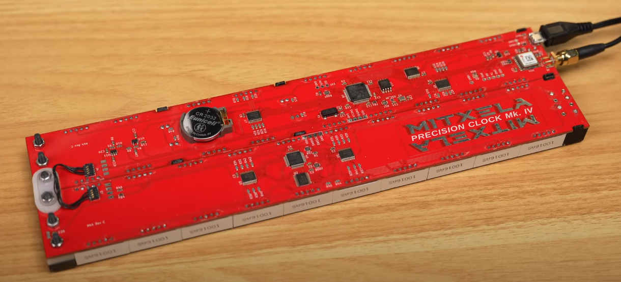 The clock can be folded in half, thereby doubling as a clapperboard for movie makers. The dimming system is analog, not pulse width modulation (PWM), which means no visible flashing artifacts when recording. It is highly configurable and has USB connectivity. And it has not one but two ARM microcontrollers, an ARM STM32L476, and an ARM STM32L010. If you’re interested, you can pick one up for yourself from [Mitxela]’s shop.
Toward the end of his video [Jeff] does some navel gazing, thinking about what might be required if future versions of the clock wanted to get down into precision at the nanosecond level. Do you arrange it so the light arrives at the viewer’s eyeball at the right time? Or do you update it on the clock at the right time and let the viewer know about it after a minuscule delay? Philosophical preponderances for another day!
We should add that we’ve seen plenty of cool stuff from [Mitxela] before, including the Euroknob and these soldering tweezers.
Continue reading “A Close Look At The Mitxela Precision Clock Mk IV”