[SignalsEverywhere] has a lot of satellite antennas and he’s willing to show them off — inside and out — in his latest video that you can see below. Using software-defined radio techniques, you can use these antennas to pull off weather satellite images and other space signals.
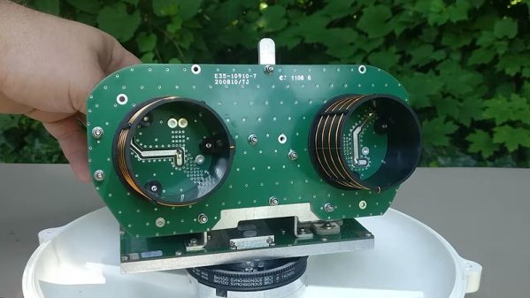
 A lot of these antennas are actually made for some commercial purpose like keeping ships connected to Inmarsat. In fact, the shipborne antenna has a nice motorized system for pointing the antenna that [SignalsEverywhere] is hoping to modify for his own purposes.
With what appears to be standard NEMA 17 steppers onboard, it should be relatively easy to supplant the original controller with an Arduino and CNC shield. Though considering the resale value these particular units seem to have on eBay, we might be inclined to just roll our own positioner.
The QHF QFH antenna is another interesting teardown. The antenna makes a helix shape and looks like it would be interesting to build from scratch. There isn’t a lot of details about the antenna designs, but it is interesting to see the variety and range of antennas and how they appear internally.
L band is from 1 GHz to 2 GHz, so signals and antennas get very strange at these frequencies. The wavelength of a 2GHz signal is only 15cm, so small antennas can work quite well and are often as much mechanical designs as electrical. The L band contains everything from GPS to phone calls to ADS-B.
We’ve seen radiosonde antennas reborn before. Dish antenna repurposing is also popular.