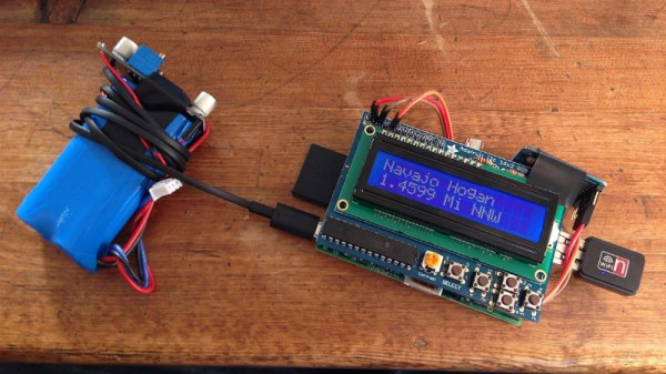
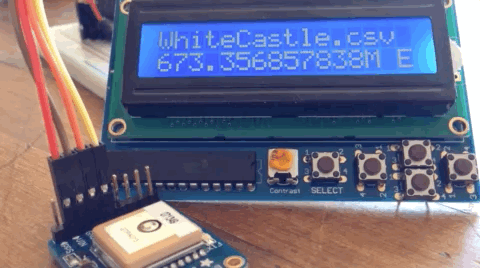
Jeremy Hong: Weaponizing The Radio Spectrum

Jeremy Hong knows a secret or two about things you shouldn’t do with radio frequency (RF), but he’s not sharing.

That seems an odd foundation upon which to build one’s 2018 Hackaday Superconference talk, but it’s for good reason. Jeremy knows how to do things like build GPS and radar jammers, which are federal crimes. Even he hasn’t put his knowledge to practical use, having built only devices that never actually emitted any RF.

So what does one talk about when circumspection is the order of the day? As it turns out, quite a lot. Jeremy focused on how the military leverages the power of radio frequency jamming to turn the tables on enemies, and how civilian police forces are fielding electronic countermeasures as well. It’s interesting stuff, and Jeremy proved to be an engaging guide on a whirlwind tour into the world of electronic warfare.
Continue reading “Jeremy Hong: Weaponizing The Radio Spectrum”

Meat-Seeking Raspberry Pi Leads You To Flavortown

[Patrick McDavid] and his wife had a legitimate work-related reason for writing some Python code that would pull the exact latitude and longitude of the individual locations within a national retain chain from Google’s Geocoding API. But don’t worry about that part of the story. What’s important now is that this simple concept was then expanded into a pocket-sized device that will lead the holder to the nearest White Castle or Five Guys location.

The device, which [Patrick] lovingly referrers to as the “Cheeseburger Compass”, uses a Raspberry Pi 3, an Adafruit 16×2 LCD with keypad, a GPS module, and the requisite battery and charger circuit to make it mobile. With the coordinates for the various places one can obtain glorious artery clogging meat circles loaded up, the device will give the user the cardinal direction and current distance from the nearest location of the currently selected chain.

[Patrick] has published the source code for this meat-seeking gadget on GitHub, but notes that most of it is just piecing together existing libraries and tools. As with many Python projects, it turns out there’s already a popular library to do whatever it is you were trying to do manually, so his early attempts at calculating distances and bearings were ultimately replaced with turn-key solutions. Though he did come up with a quick piece of code that would convert a compass heading in degrees to a cardinal direction that he couldn’t find a better solution for. Maybe he should make it a library…

Sadly the original Cheeseburger Compass got destroyed from being carried around so much, but at least it died doing what it loved. [Patrick] says a second version of the device would likely switch over to a microcontroller rather than the full Raspberry Pi experience, as it would make the device much smaller and greatly improve on the roughly two hour battery life.

This project reminds us of the various geocache devices we’ve covered in the past, but with the notable addition of hot sizzling meat. Talk about improving on a good thing.

Tractor Drives Itself, Thanks To ESP32 And Open Source

[Coffeetrac]’s ESP32-based Autosteer controller board, complete with OLD OLED display for debugging and easy status reference.
Modern agricultural equipment has come a long way, embracing all kinds of smart features and electronic controls. While some manufacturers would prefer to be the sole gatekeepers of the access to these advanced features, that hasn’t stopped curious and enterprising folks from working on DIY solutions. One such example is this self-steering tractor demo by [Coffeetrac], which demonstrates having a computer plot and guide a tractor through an optimal coverage pattern.

A few different pieces needed to come together to make this all work. At the heart of it all is [Coffeetrac]’s ESP32-based Autosteer controller, which is the hardware that interfaces to the tractor and allows for steering and reading sensors electronically. AgOpenGPS is the software that reads GPS data, interfaces to the Autosteer controller, and tells equipment what to do; it can be thought of as a mission planner.

[Coffeetrac] put it all together with everything controlled by a tablet mounted in the tractor’s cab. The video is embedded below, complete with a “cockpit view” via webcam right alongside the plotted course and sensor data.

Continue reading “Tractor Drives Itself, Thanks To ESP32 And Open Source”

Faux Walkie-Talkie For Comedy Walking Tour Is A Rapid Prototyping Win

Chances are good that a fair number of us have been roped into “one of those” projects before. You know the type: vague specs, limited budget, and of course they need it yesterday. But you know 3D-printers and Raspberduinos and whatnot; surely you can wizard something together quickly. Pretty please?

He might not have been quite that constrained, but when [Sean Hodgins] got tapped to help a friend out with an unusual project, rapid prototyping skills helped him create this GPS-enabled faux-walkie talkie audio player. It’s an unusual device with an unusual purpose: a comedic walking tour of Vancouver “haunted houses” where his friend’s funny ghost stories are prompted by location. The hardware to support this is based around [Sean]’s useful HCC module, an Arduino-compatible development board. With a GPS module for localization and a VS1053 codec, SD card reader, and a small power amp for the audio end, the device can recognize when the user is within 50 meters of a location and play the right audio clip. The housing is a 3D-printed replica of an old toy walkie-talkie, complete with non-functional rubber ducky antenna.

[Sean]’s build looks great and does the job, although we don’t get to hear any of the funny stuff in the video below; guess we’ll have to head up to BC for that. That it only took two weeks start to finish is impressive, but watch out – once they know you’re a wizard, they’ll keep coming back. Continue reading “Faux Walkie-Talkie For Comedy Walking Tour Is A Rapid Prototyping Win”

Epic Clock Clocks The Unix Epoch

Admit it: when you first heard of the concept of the Unix Epoch, you sat down with a calculator to see when exactly 2³¹-1 seconds would be from midnight UTC on January 1, 1970. Personally, I did that math right around the time my company hired contractors to put “Y2K Suspect” stickers on every piece of equipment that looked like it might have a computer in it, so the fact that the big day would come sometime in 2038 was both comforting and terrifying.

[Forklift] is similarly entranced by the idea of the Unix Epoch and built a clock to display it, at least for the next 20 years or so. Accommodating the eventual maximum value of 2,147,483,647, plus the more practical ISO-8601 format, required a few more digits than the usual clock – sixteen to be exact. The blue seven-segment displays make an impression in the sleek wooden case, about which there is sadly no detail in the build log. But the internals are well documented, and include a GPS module and an RTC. The clock parses the NMEA time string from the satellites and syncs the RTC. There’s a brief video below of the clock in action.

We really like the look of [Forklift]’s clock, and watching the seconds count up to the eventual overflow seems like a fun way to spend the next two decades. It’s not the first Epoch clock we’ve featured, of course, but it’s pretty slick.

Continue reading “Epic Clock Clocks The Unix Epoch”

Where’s The Cat? Locating Your Moggy Without Eating Batteries

Where the Hackaday Cat goes when she steps over the threshold into the wider world is a mystery, she reveals her whereabouts strictly on her terms and would we suspect be very cagey were we able to ask her about it. [Andy C] however has a need to know where his cat is spending her time, so he’s made a GPS collar for a bit of feline spying.

There are commercial GPS collars for pets, but they all share the flaw of extremely limited battery life. His challenge then was to create a collar that delivered the required pinpoint fix alongside a battery life measured in months. The solution was a combination of a low-power miniature GPS receiver and a low-power PC microcontroller hooked up to an FSK radio whose frequency he doesn’t give but which we suspect is probably the usual 433 MHz. The collar remains in low power mode until it receives a call on the FSK, at which point it wakes up, gets a GPS fix, transmits it, and returns to sleep.

The summary links to a series of posts which provide an extremely detailed look at all aspects of the project, and go well beyond mere GPS trackers for a cat. If you have an interest in low power devices or antenna matching for example, you’ll find a lot of interesting stuff in these pages. Of course, if all you need is a GPS tracker though, you may prefer a simpler option.

Raspberry Pi On The Go Powers Car System

Most new cars have GPS, rear cameras, and all the other wonders an on-board system can bring. But what if you have an old car? [Fabrice Aneche] has a 2011 vehicle, and wanted a rearview camera. He started with a touch screen, a Raspberry Pi 3, and a camera. But you know how these projects take on a life of their own. So far, the project has two entries in his blog.

It wasn’t long before he couldn’t resist the urge to add a GPS. But that’s no fun without maps. Plus you need turn-by-turn directions. [Fabrice] did a lot of the user interface using Qt5 and QML. He started out running it with X11 but that was slow. It turns out though that Qt5 can drive the Pi’s video directly without using X11, so that’s what he wound up doing. The code that isn’t in QML — mainly dealing with the GPS location — is written in Go, while the code for MOCS (My Own Car System) is on GitHub.

Continue reading “Raspberry Pi On The Go Powers Car System”